BEST MALLEE & LAKE TYRRELL PHOTO SPOTS
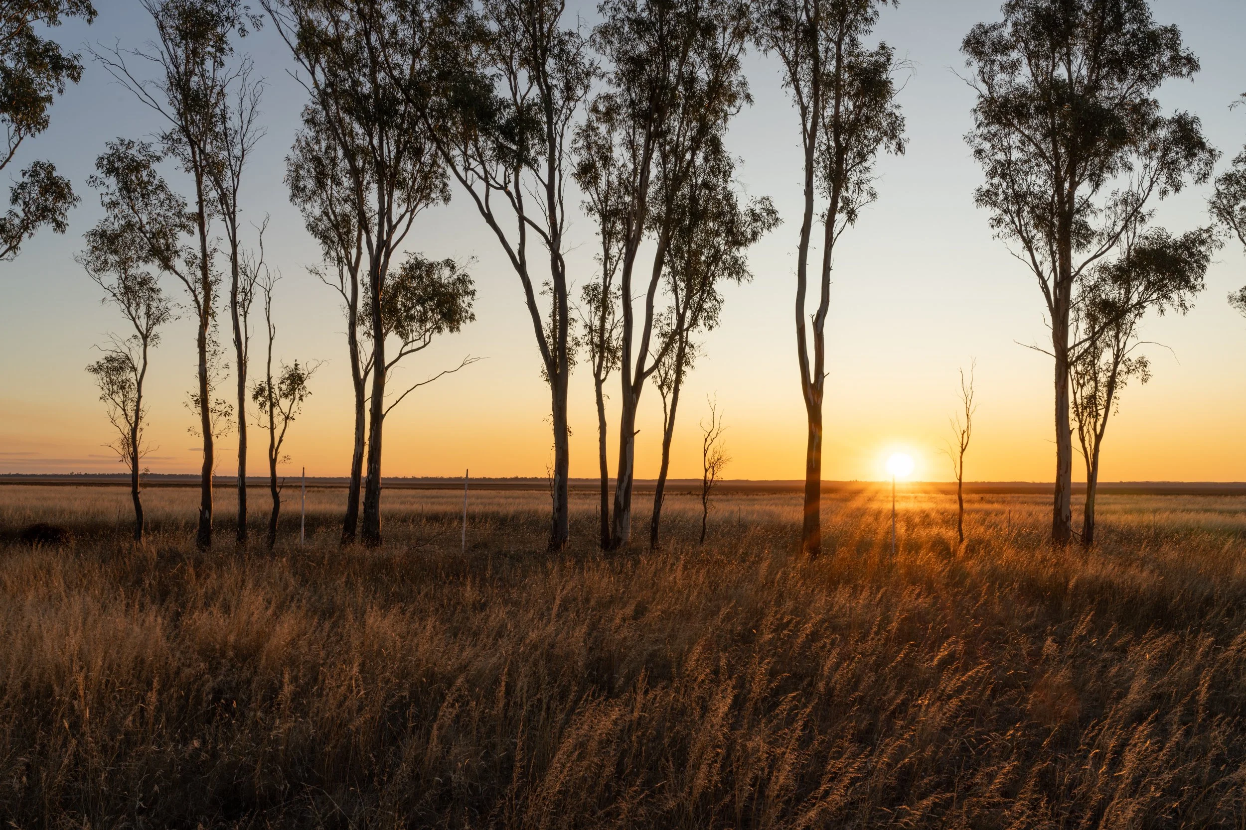
I first discovered the Mallee like many suburban photographers – on the Silo Art trail in 2018, then Lake Tyrrell in 2020. Unlike anywhere else in Victoria, the Mallee is vast and open, stretching across the state’s north-west into New South Wales and South Australia. The southern half is the Wimmera Mallee, the north simply the Mallee.
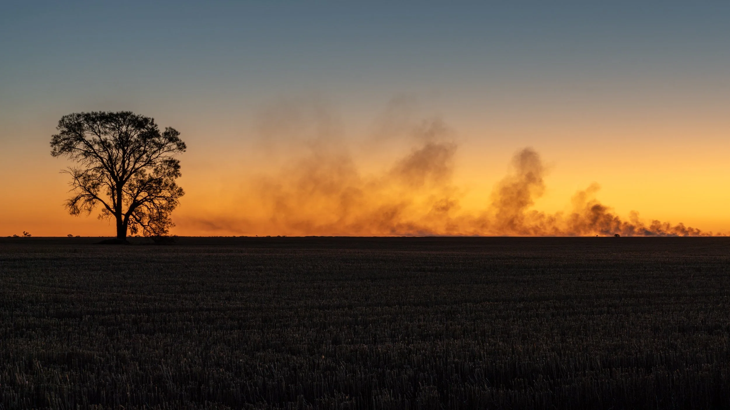
It’s a landscape that quietly pulls you in. Dead-straight roads disappear to the horizon, farms run endlessly, and tiny towns – some crumbling, some thriving – punctuate the emptiness. I love choosing a route, loading an audiobook, and just drifting, scanning the land for whatever appears: abandoned halls, lonely fences, desert sand and saltbush, endless fields lit by sunrise or sunset, solar farms beside old rail lines, rusting or brightly painted silos, mirror-still lakes, dead trees, grand old hotels and locals with stories to share.
The Mallee doesn’t offer mountains or waterfalls, but it has a rare charm and a unique beauty. For photographers, it’s a place where almost anything can become a compelling image.
Below I’ll touch on a few of the big drawcards, then share some of my favourite Mallee scenes – and if I’ve missed any, let me know.
All images are available for print purchase, or licensing - please get in touch to start a conversation.
The Mallee is so vast I'm not going to list all the spots I've visited, however on this map, B is Lake Tyrrell, C is Lulla, D is Ouyen, E is Lake Hindmarsh. After Lake Hindmarsh you could thred your way back to Melbourne through towns like Warracknabeal, St Arnaud, Ararat, Bendigo or Ballarat. You could also spend a few days in the Grampians, I have a separate guide for the Grampians here or in the Best Victorian Photo Spots menu above.
The drive from Melbourne to Sea Lake is 4 hours with no stops. Sea Lake/Lulla/Ouyen is 1.5 hours with no breaks, Ouyen to Lake Hindmarsh 2 hours, and then Lake Hindmarsh back to Melbourne 4.5 hours.
The Silo Art Trail
Point Nepean Rd, Blairgowrie VIC 3943
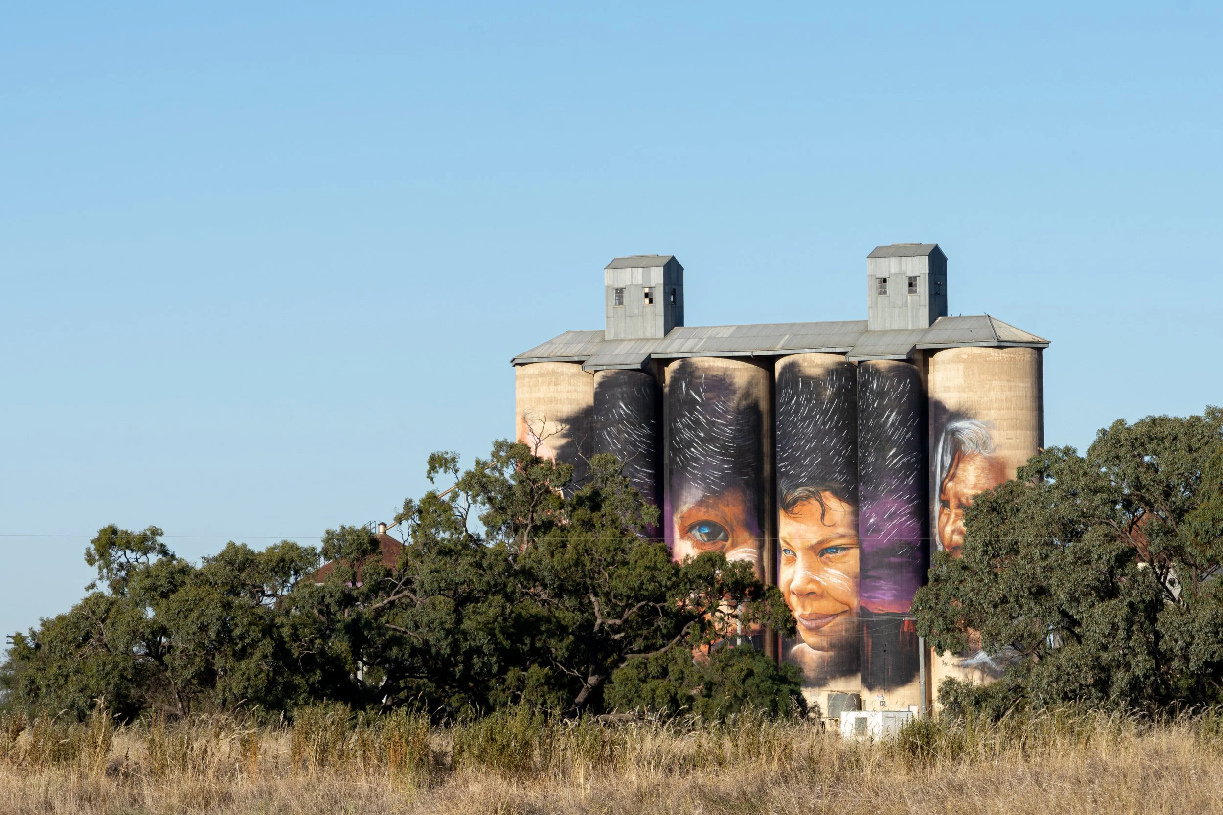
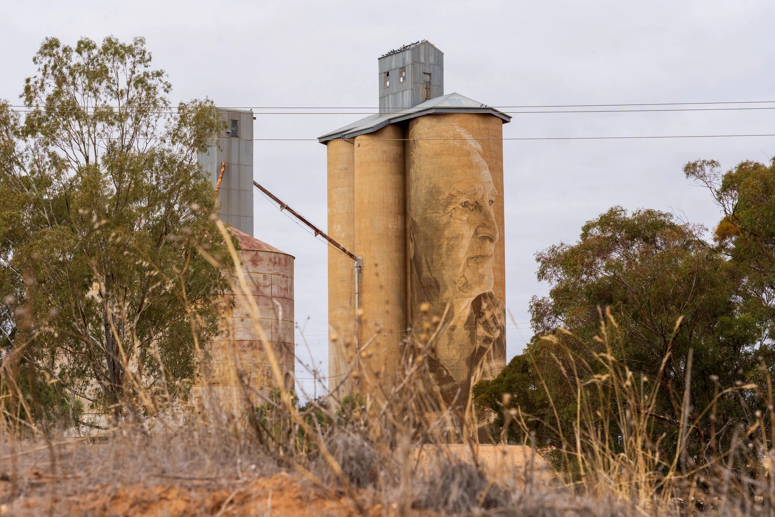
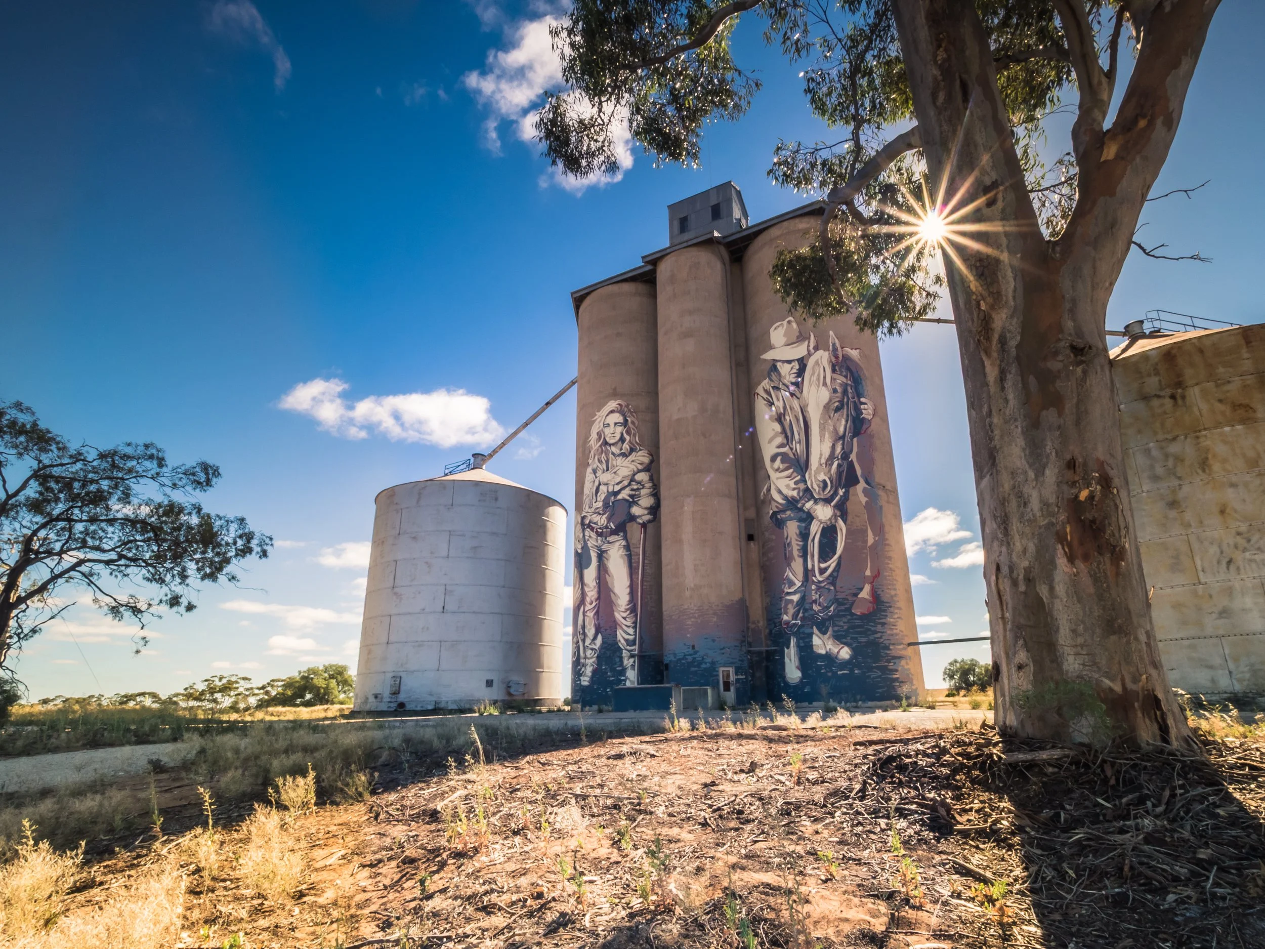
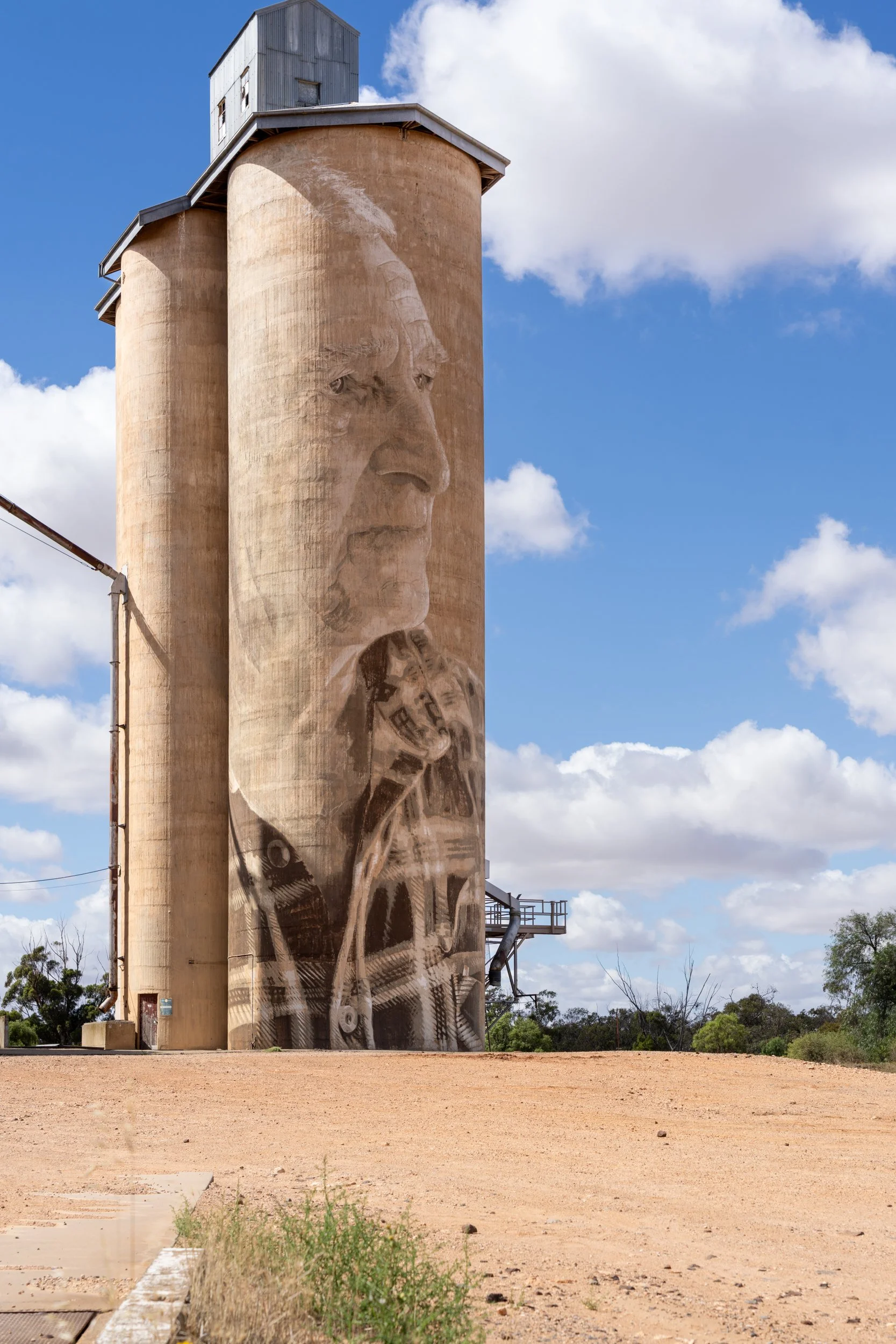
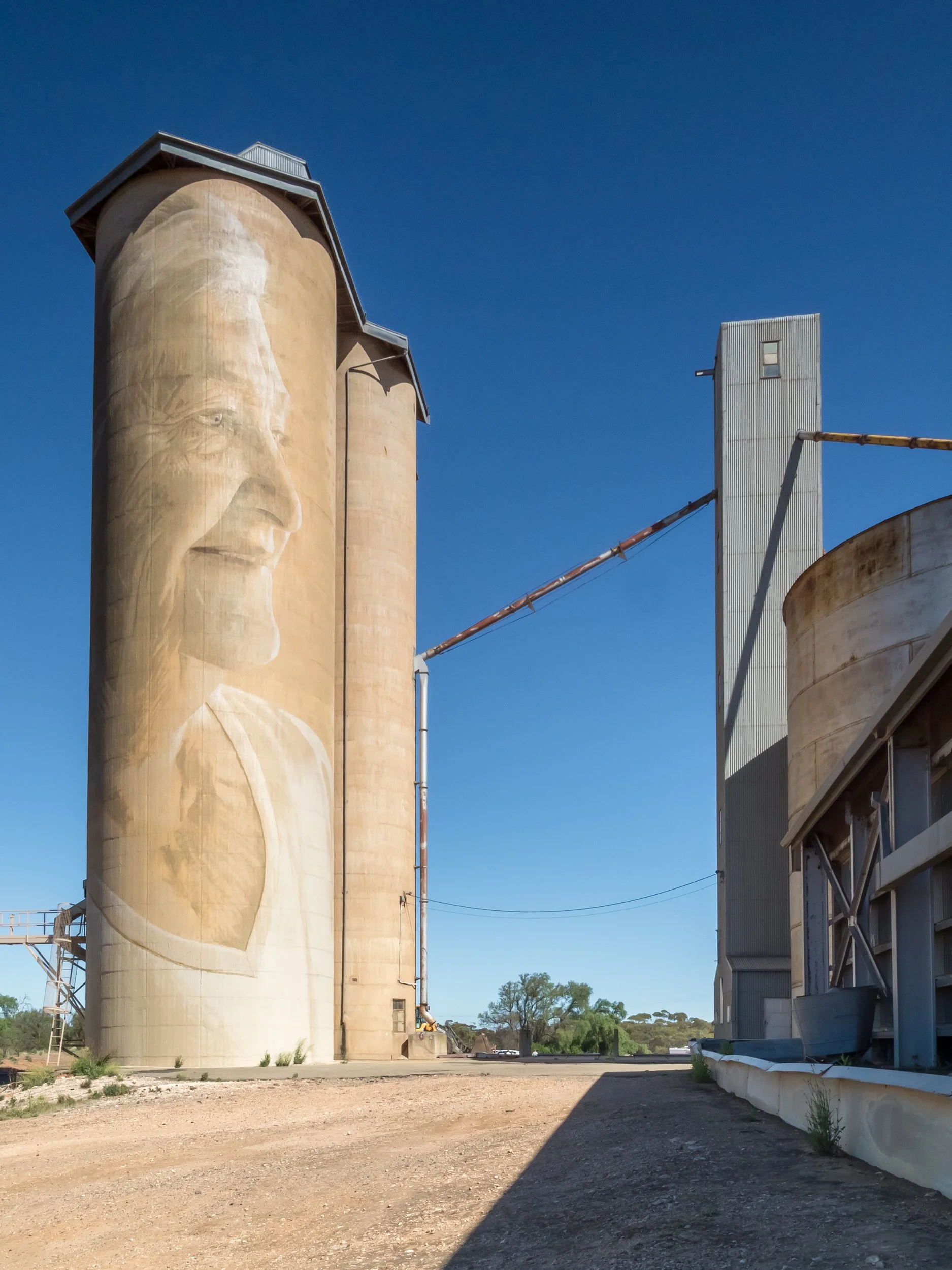
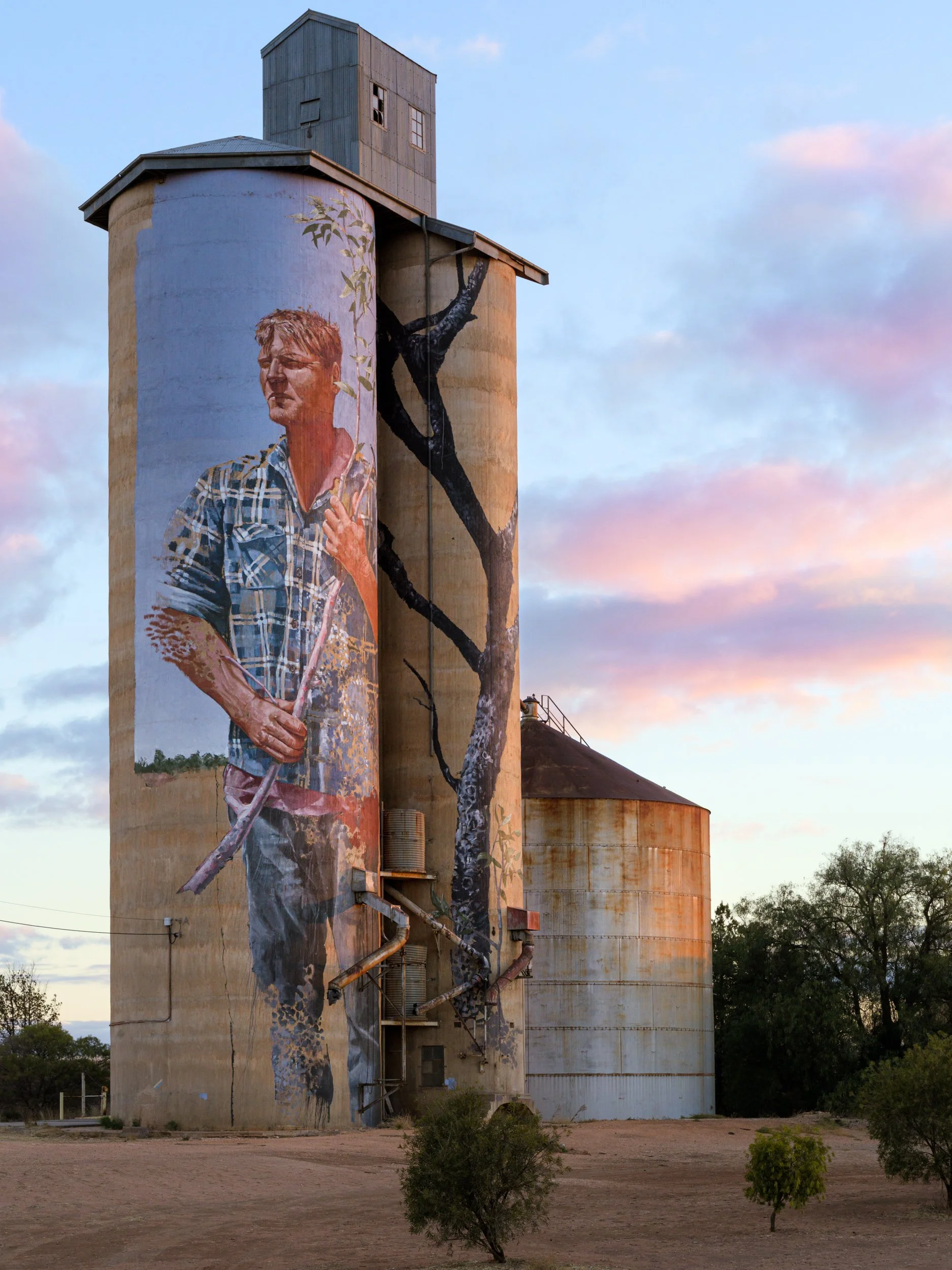
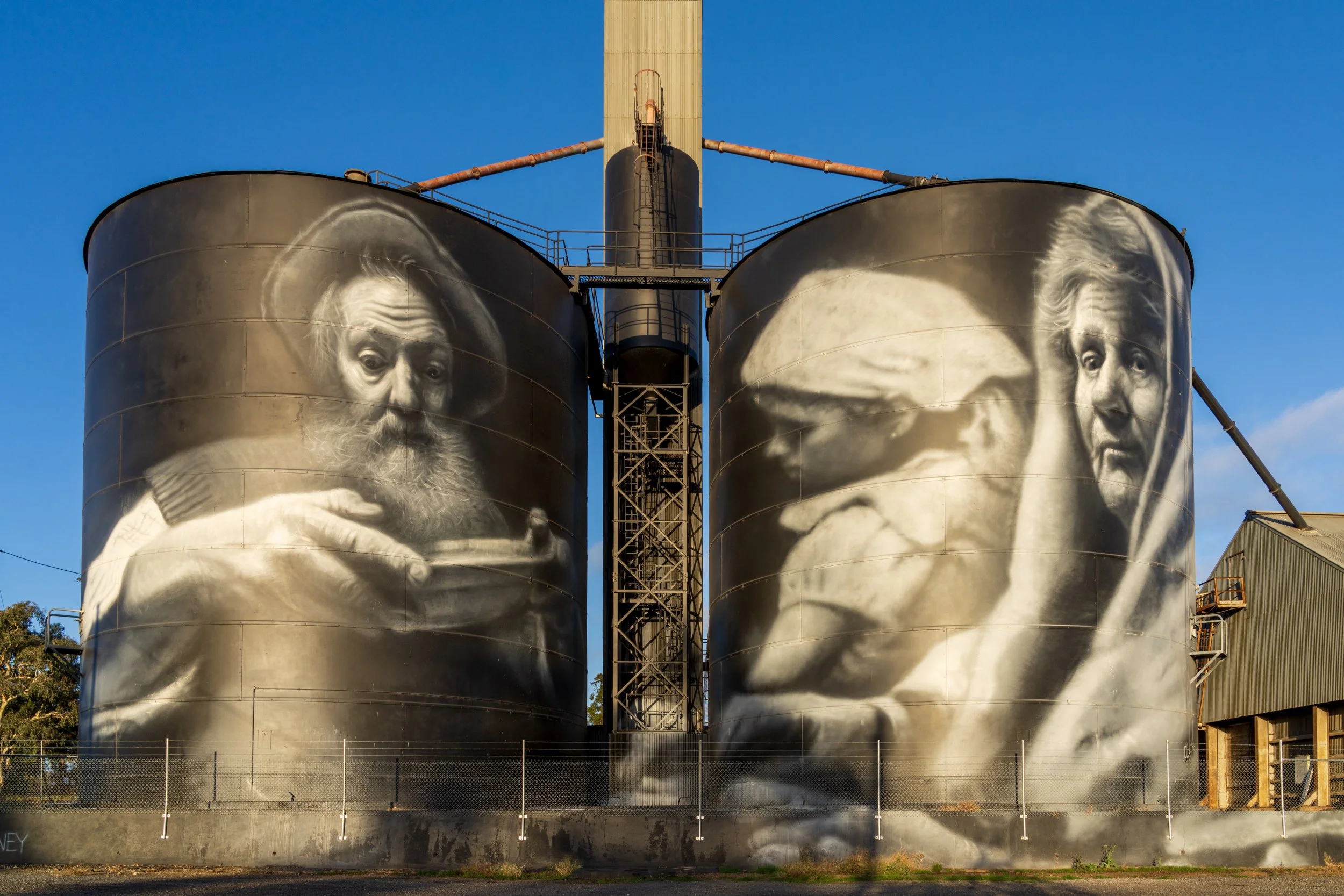
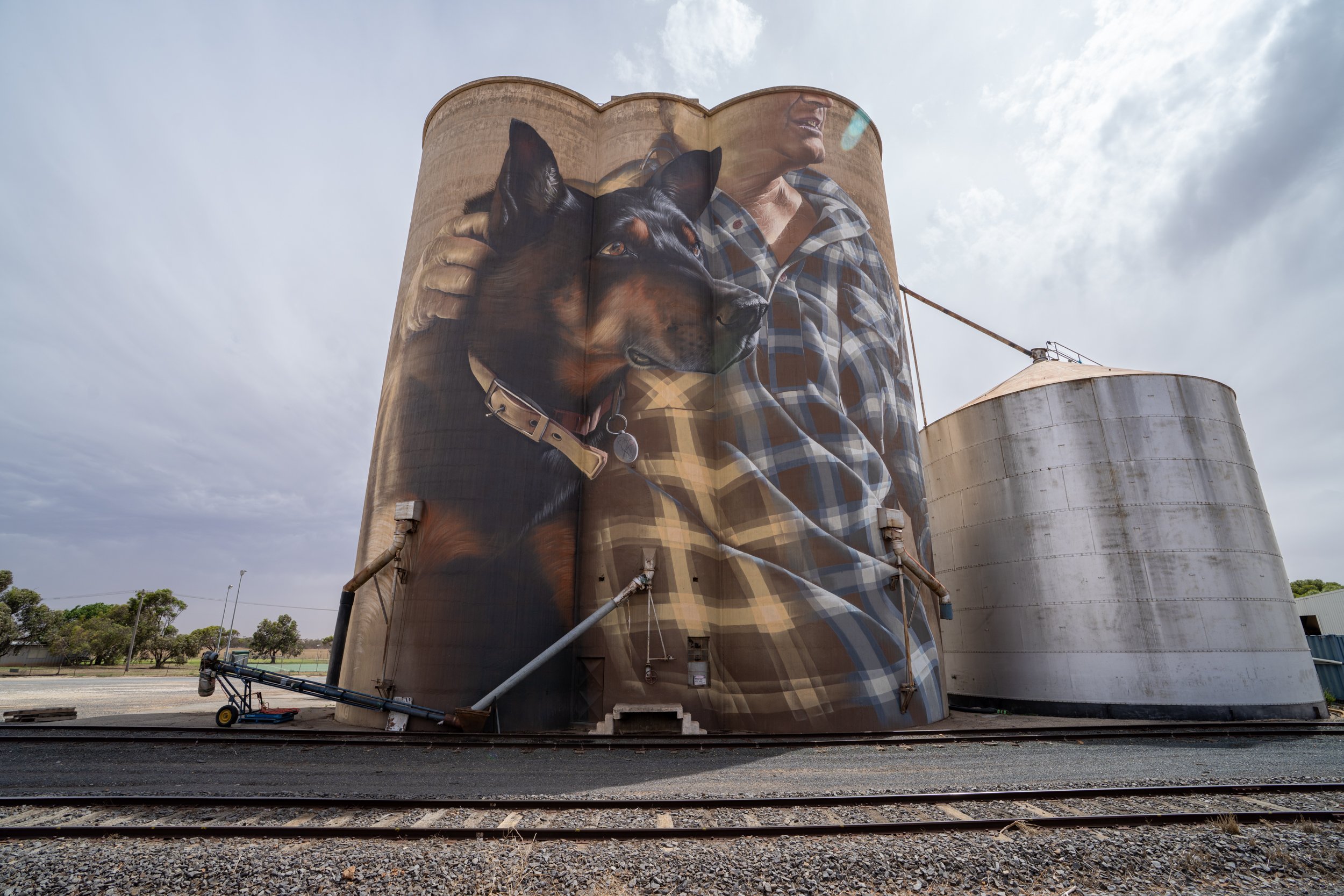
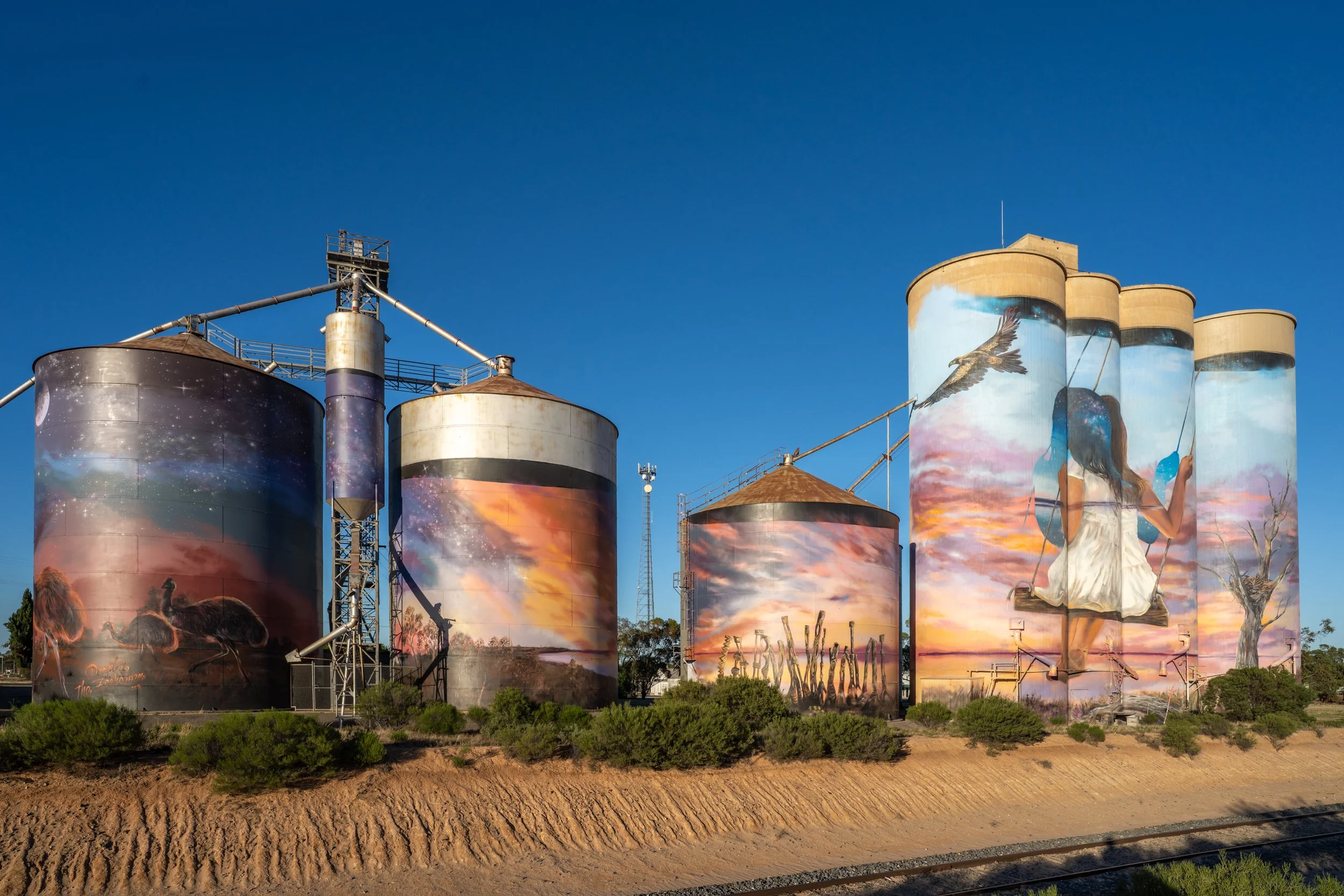
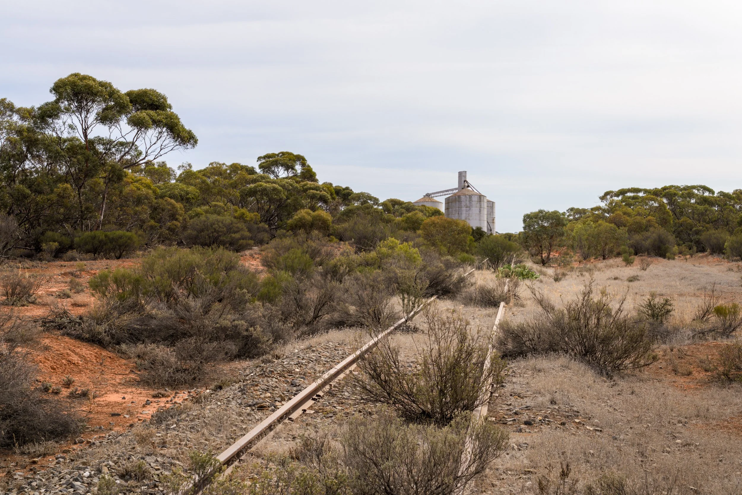
The Silo Art Trail has become a fantastic draw card for tourists out to the regions. The landscape is dotted with concrete grain silos, most of which are now no longer in use
They are spaced out on railway lines that used to transport all the grain out to our ports and cities. A number of these have been painted with huge murals by various artists, and are absolutely stunning to see. The route below is from 2018 and covers the most well known silos, however more and more are painted each year, and are spreading into different parts of the Mallee, and other regions in Vic and across Australia. The Australian Silo Art Trail website is a wonderful resource to see all the silos, water towers, street art and proposed new silo art locations around Australia.
The first silo is around 1 hour past the town of Ararat in Victoria's west (2.5 hour drive from Melbourne), the trail then takes around 2 hours to complete. That makes it a 5.5 hour trip from Melbourne to the end of the trail. Being a photographer, naturally I wanted to be there for sunrise, so I drove to Ararat on New Year's Eve and stayed the night.
If you want to stay overnight, I've slept at the Ararat Southern Cross Motor Inn and also at the Commercial Hotel in Rupanyup (Aug 2021 has been sold, new owners not yet taking bookings). Both are comfortable options that can serve as your gateway to the region.
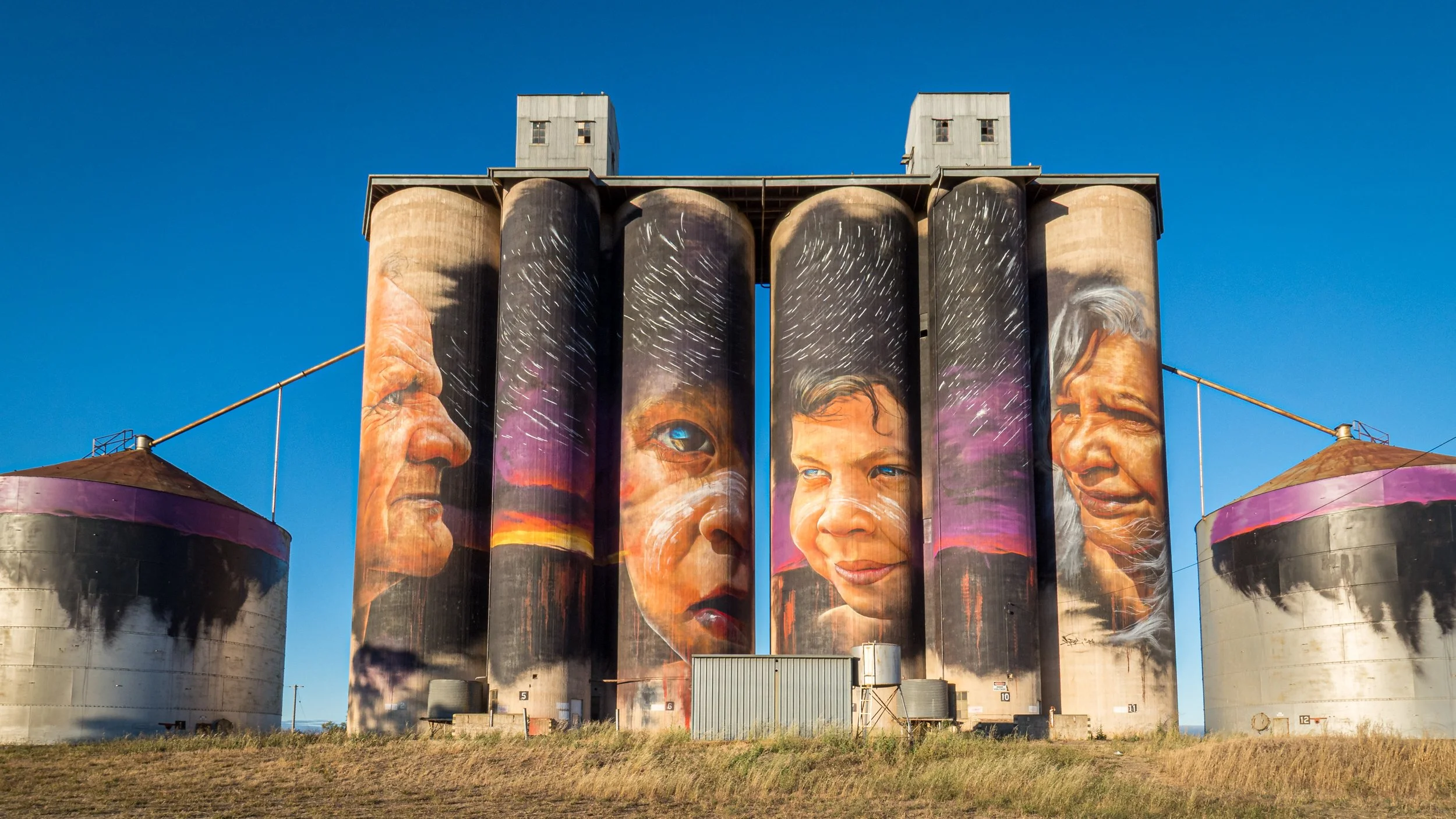
My image of the Brim Silo below was featured on Victorian Premiere Daniel Andrew's 2020 Christmas Card. I tend to be to the left of centre, so for me this was really quite exciting.
Sheep Hills, Adnate, 2016
Lascelles, Rone, 2017

Rupanyup, Julia Volchkova, 2017
Sheep Hills, Adnate, 2016
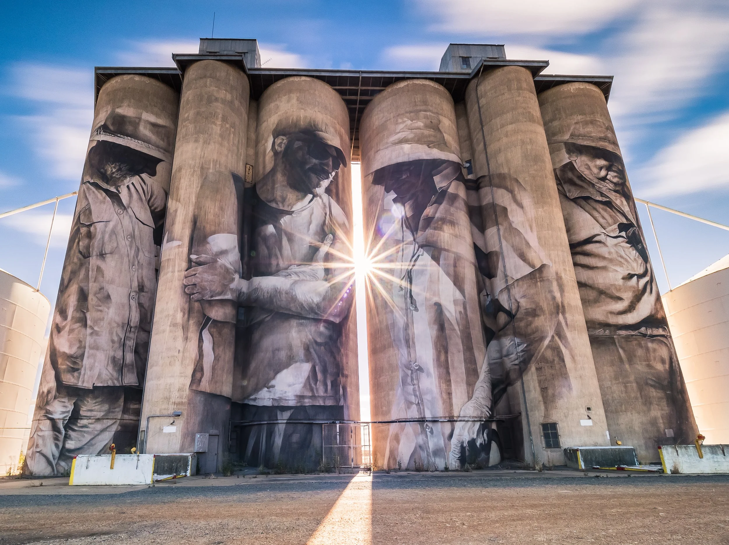
Brim, Guido Van Helten, 2016
Rosebery, Kaff-eine, 2017
Lascelles, Rone, 2017
Lascelles, Rone, 2017
Patchewollock, Fintan Magee, 2016
St Arnaud, Kyle Torney, 2020
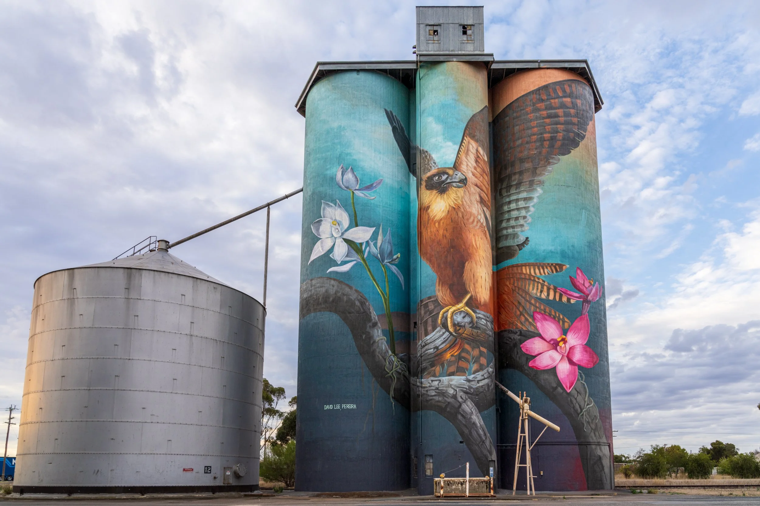
Kaniva, David Lee Pereira, 2020
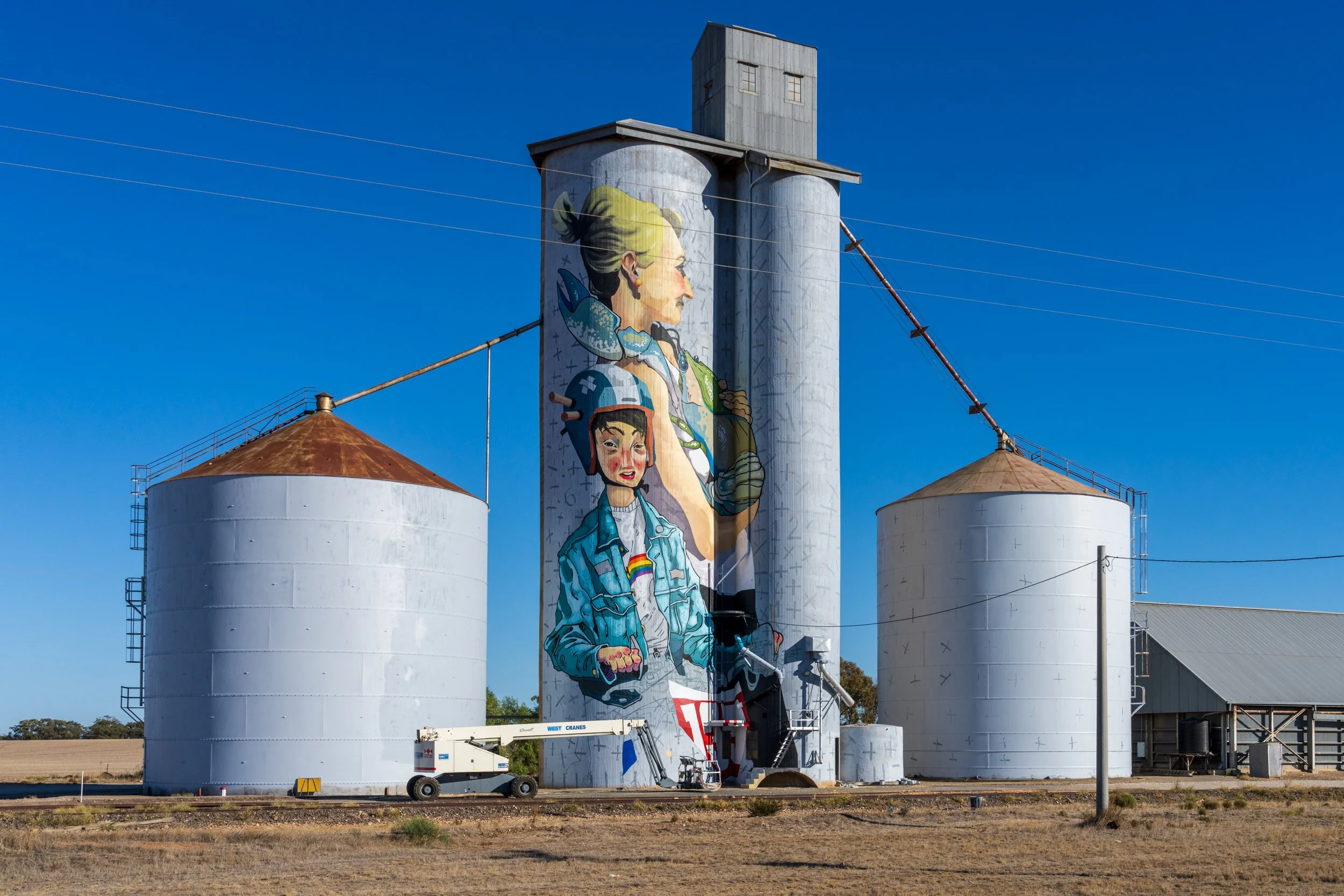
Albacutya, Kitt Bennett, 2021
Nullawil, Smug, 2019
Sea Lake, Drapl & The Zookeeper, 2019
Dramatic Mallee Photo Spots
These are some of the more dramatic spots where I've taken photographed around the Mallee. There are many others I still want to visit, so I'll most likely add to the list as I go!
I would love any recommendations!!
Where to Stay?
Ouyen
Ouyen is a good sized town that is a great spot to base yourself for a few days if you are planning on exploring north of Sea Lake. I've slept here a couple of times when I've driven up to photograph at Lulla. There are heaps of tiny little towns and spots around to drive to. It's also one of the last bigger towns until you get up to Mildura, so it's a good halfway point to sleep. There's slim pickings between here and Mildura. I've stayed at the Hilltop Motel a few times while I've been exploring the area. There's also great bistro meals at the Victoria Hotel only a couple of minutes drive from the motel. The hotel also has some accommodation available.
Some of the points of interest around these towns, apart from Lulla and Lake Tyrrell, are the little towns like Tempy and Speed, the end of the old railway at Kulwin, the Murray-Sunset (pink lakes) and Big Desert national parks to the west. There's also a huge stretch of solar farms to the north, running along the west side of the railway to the west side of the highway.
Sea Lake
Sea Lake is the town just to the south of Lake Tyrrell, and has a number of motel options. There's a good representation of stores including cafes, supermarket, chemist and a wonderful photography gallery/cafe Skymirror. Skymirror also has some accommodation available, and a fabulous array of photography on rotation in their gallery space. It's well worth a visit to grab a coffee (best for miles) and appreciate some fantastic work on display (and maybe buy a print to take home!). I’ve stayed at the Sea Lake Motel and the Royal Hotel Sea Lake in the centre of town. I enjoyed both of them!
Culgoa
If all the accommodation in Sea Lake is taken, Culgoa is only a 30 minute drive away where you can stay at the Kaneira Hotel. This is a good value country hotel, that serves good meals, cold beer and a comfy bed. I've stayed here twice and would happily stay again! It's a very small little town, but I had a great time walking the main street at sunrise and capturing some of the rural scenes.
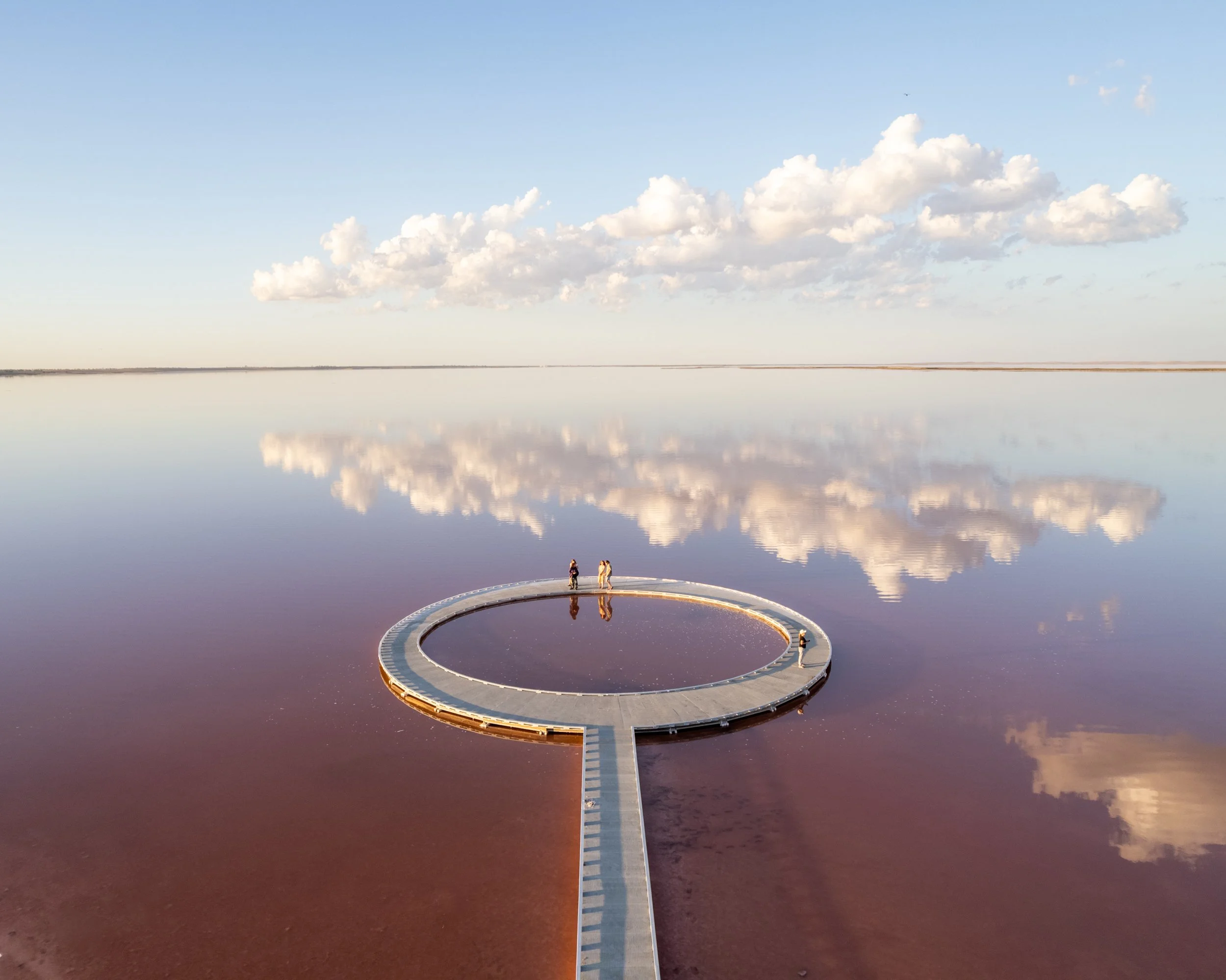
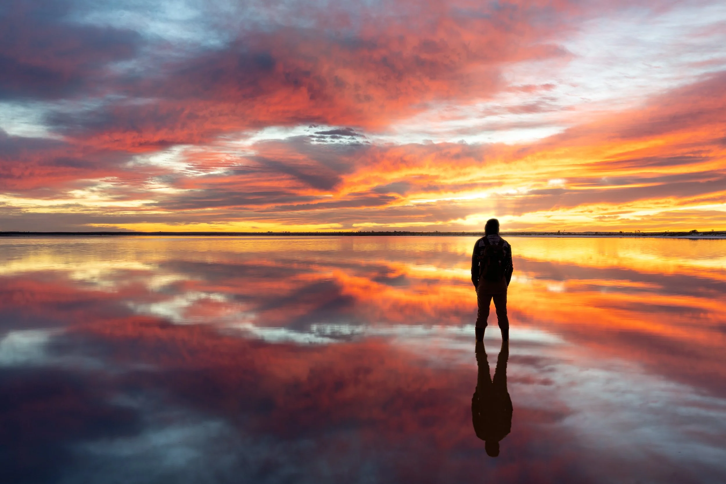
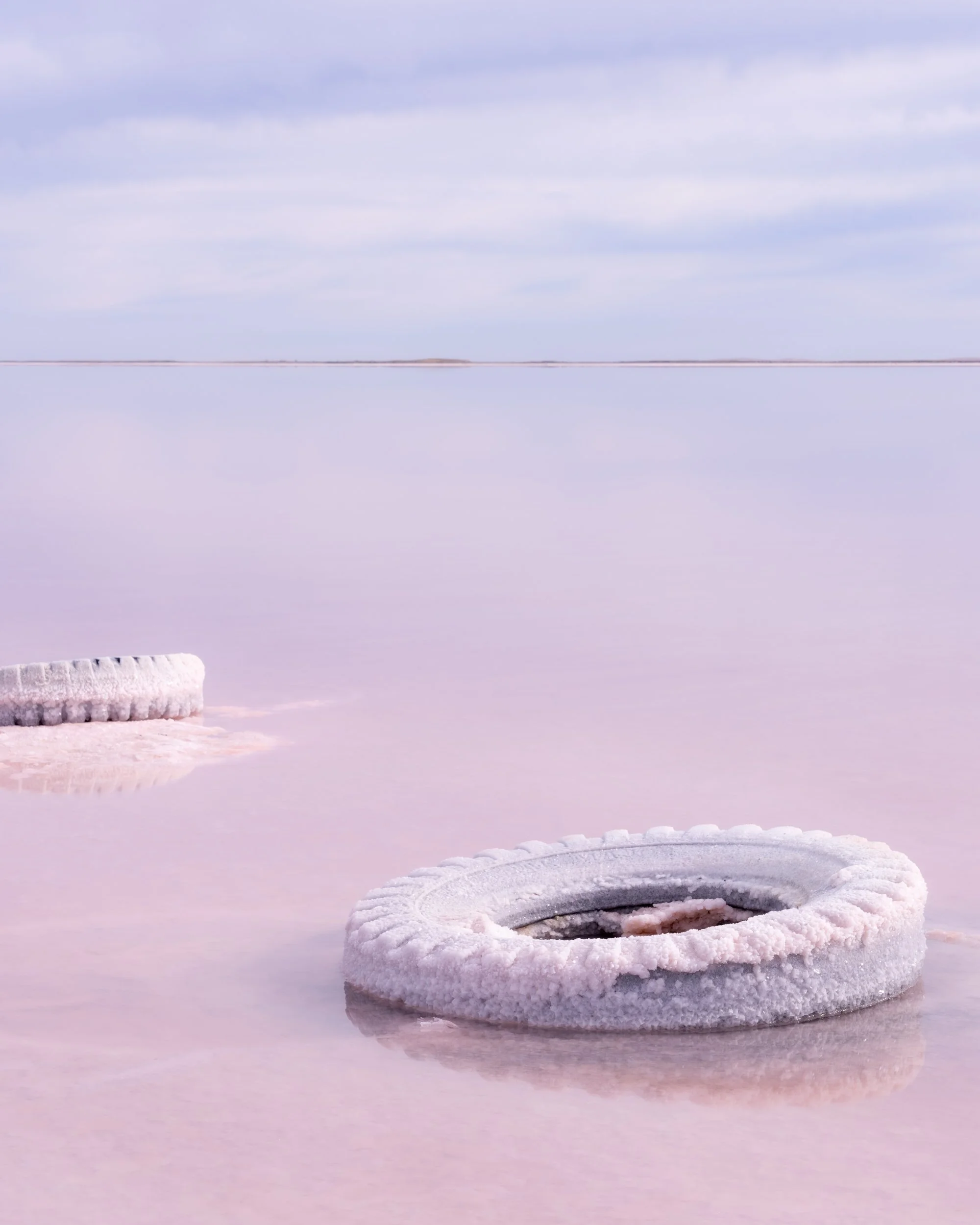
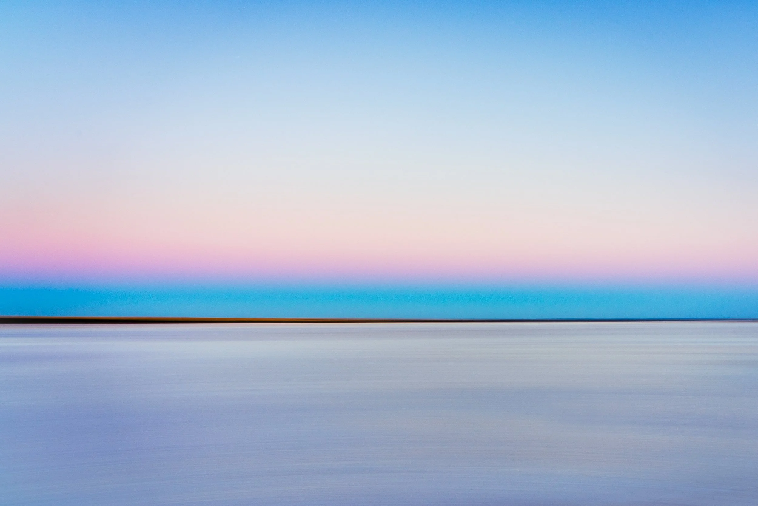
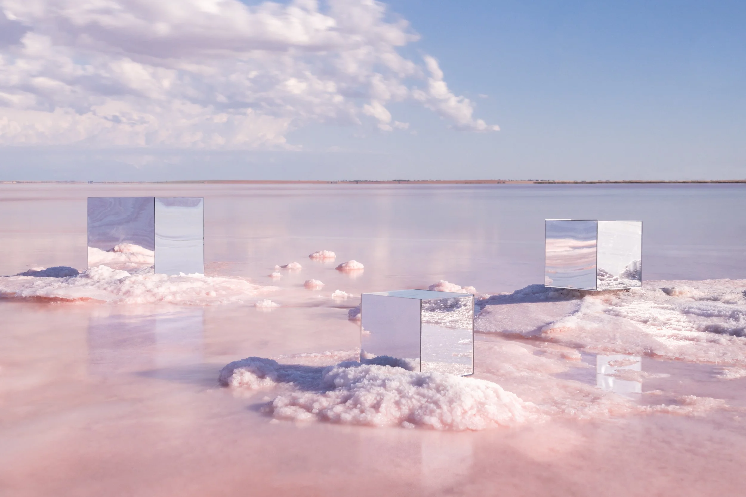
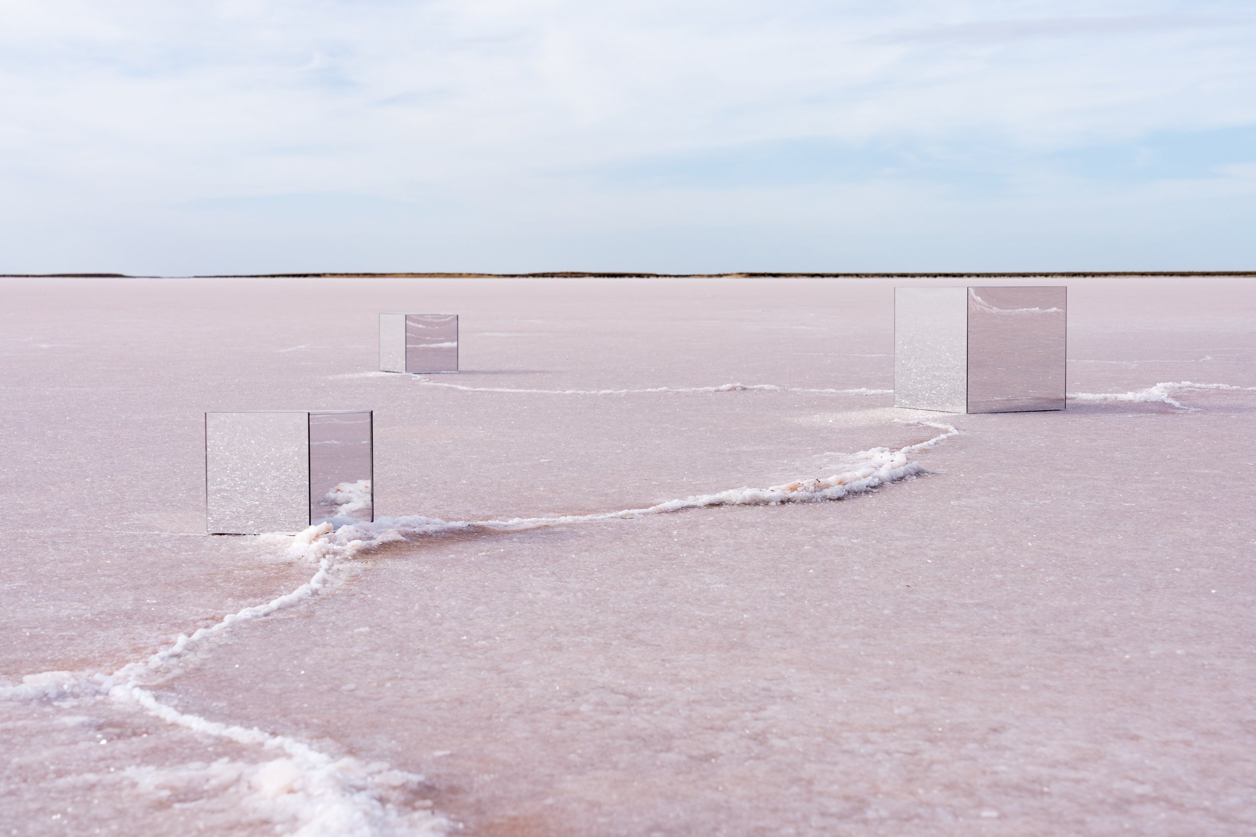
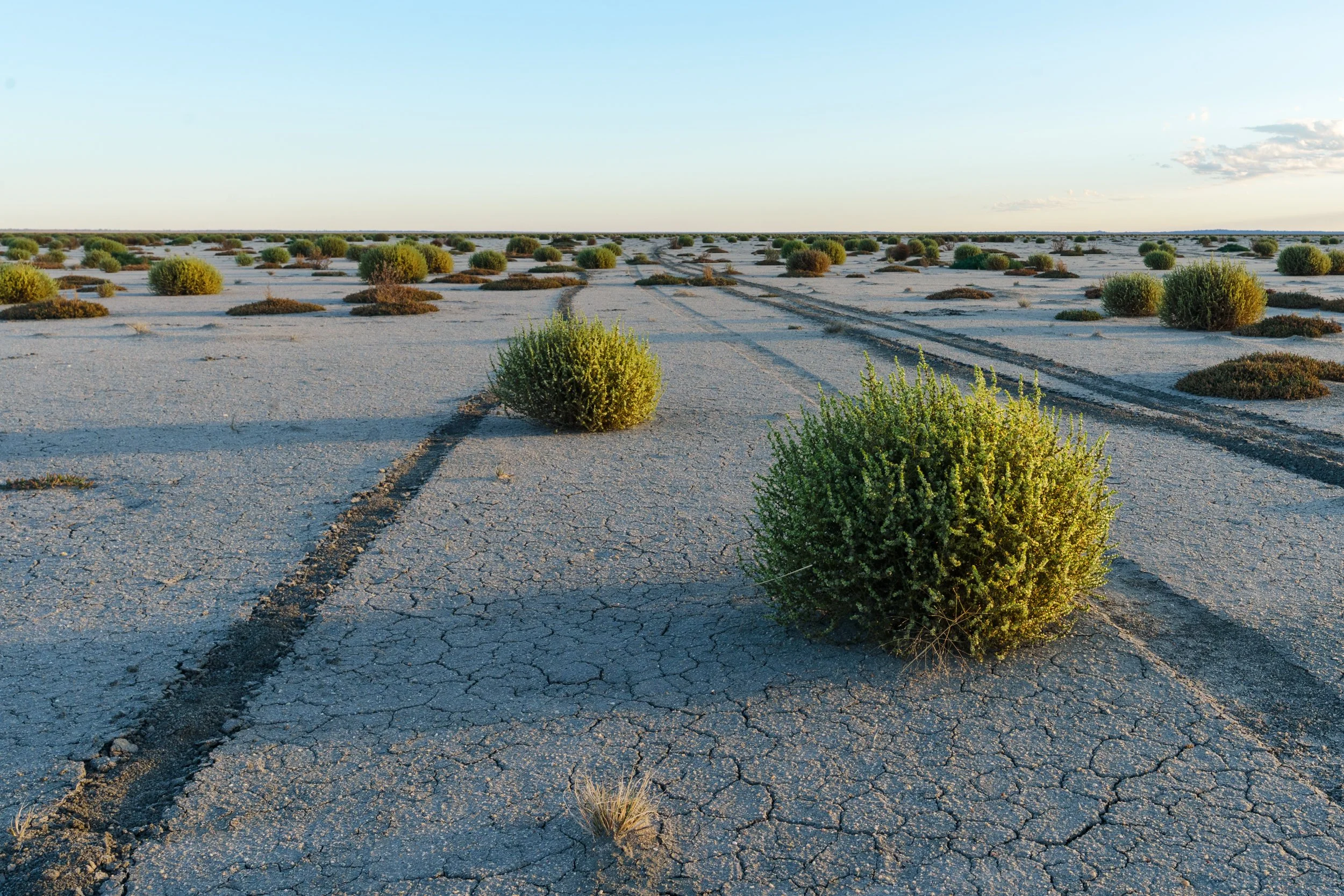
Lake Tyrrell
This is the home of Lake Tyrrell, a shallow salt lake that in the right conditions forms a perfect mirror.
From Visit Victoria: The 120,000 year old lake is regarded as one of the best places in Australia for star navigation, with the dark and endless skies providing the perfect environment to view the dazzling spectacles of the southern hemispheres constellations. The unique salty formation on the lake bed has also become a mecca for international visitors looking to capture that once in a lifetime photo opportunity, over the shallow lake's refective surface.
If it's your first time, you can get in touch with Julie at Sea Lake Tyrrell Tours to have a chat about your plans for your visit. A tour with Julie is an excellent way to introduce yourself to the lake. See the section above about some great places to stay, and the must visit Skymirror gallery/cafe & accommodation.


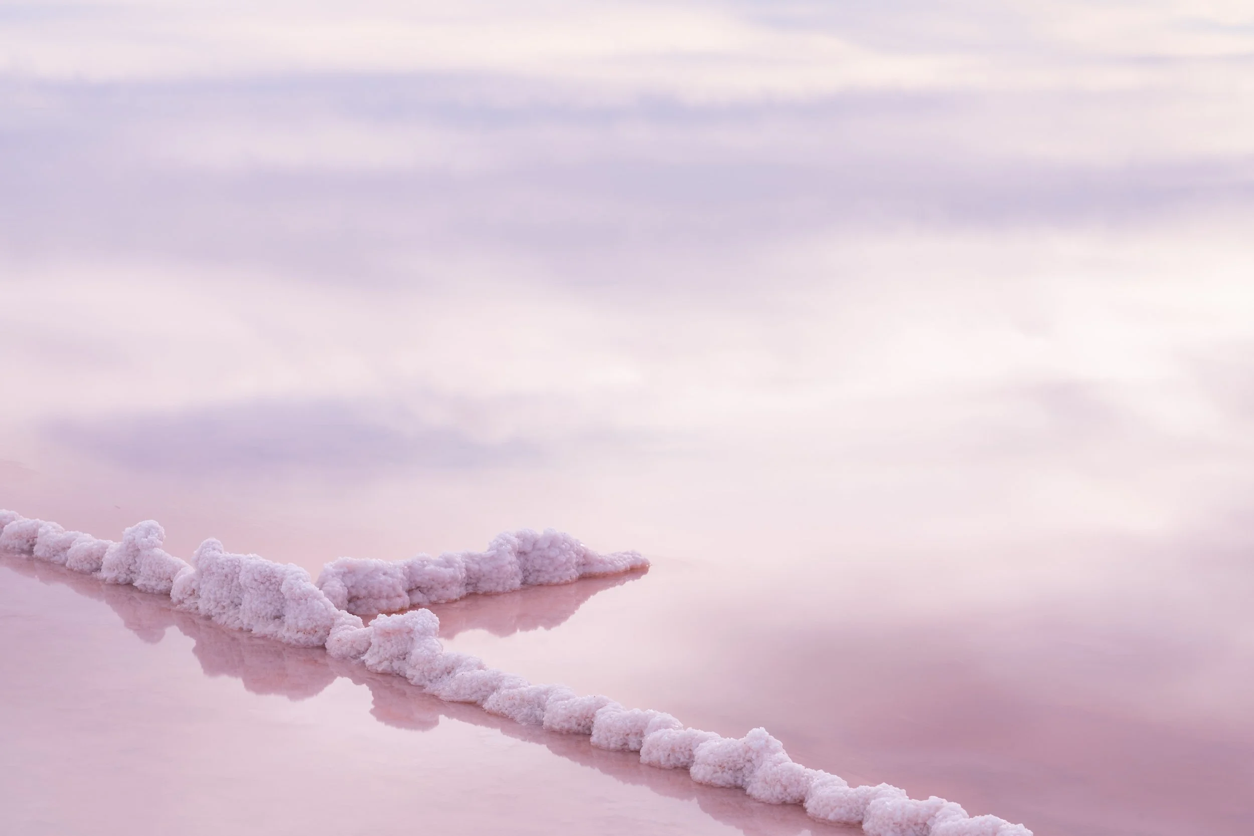

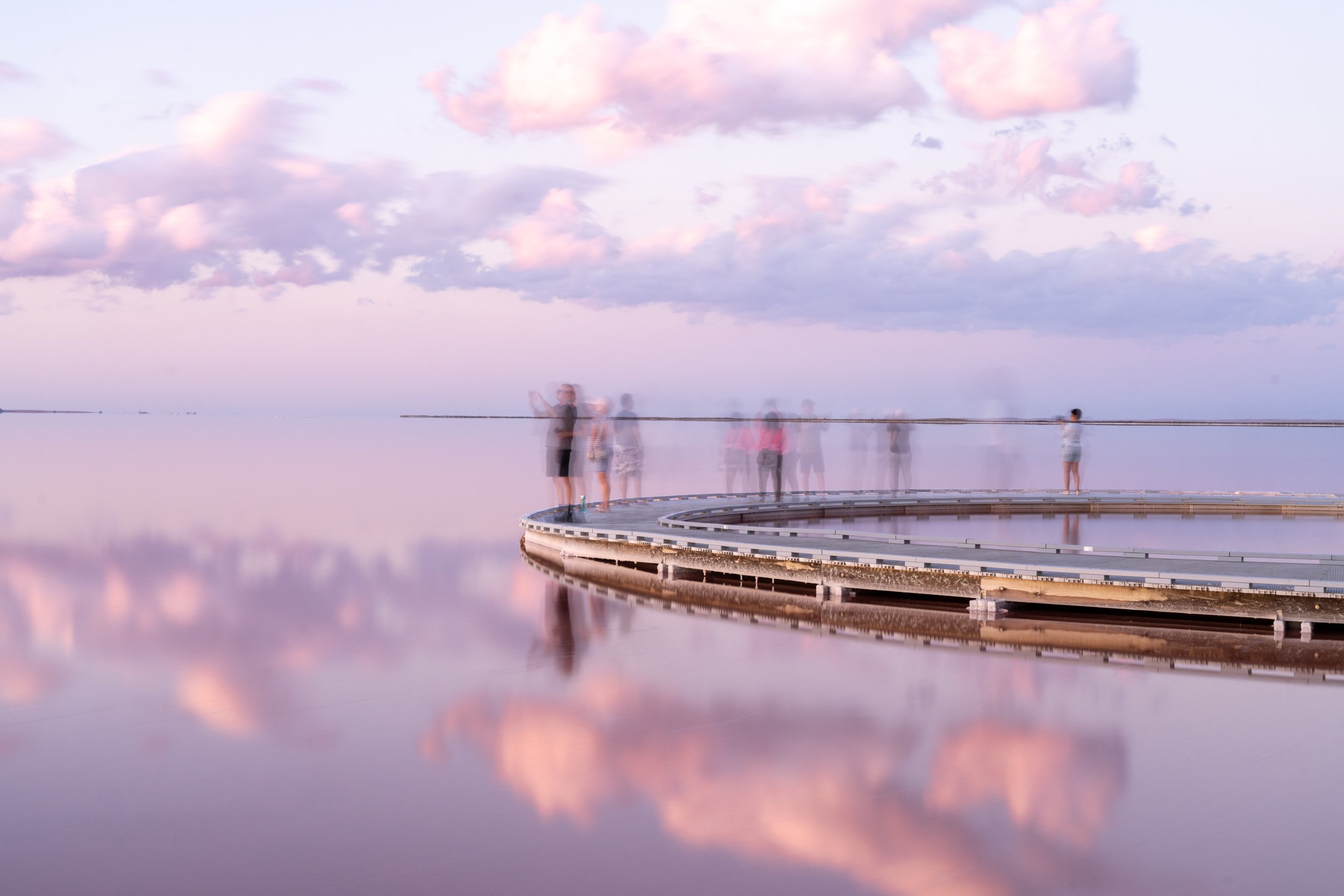

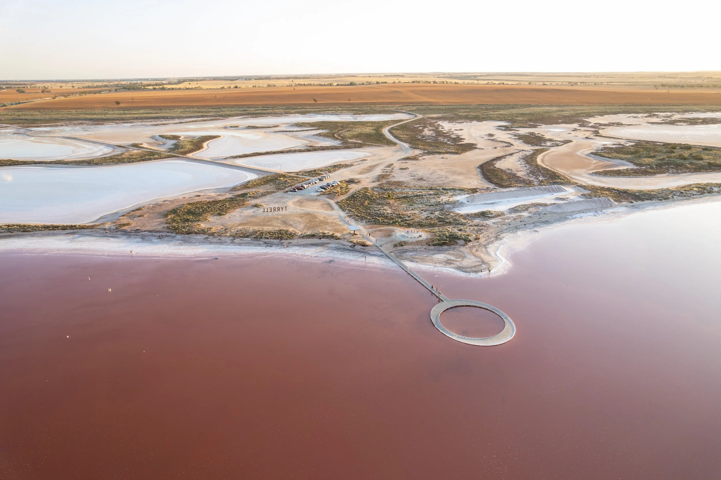
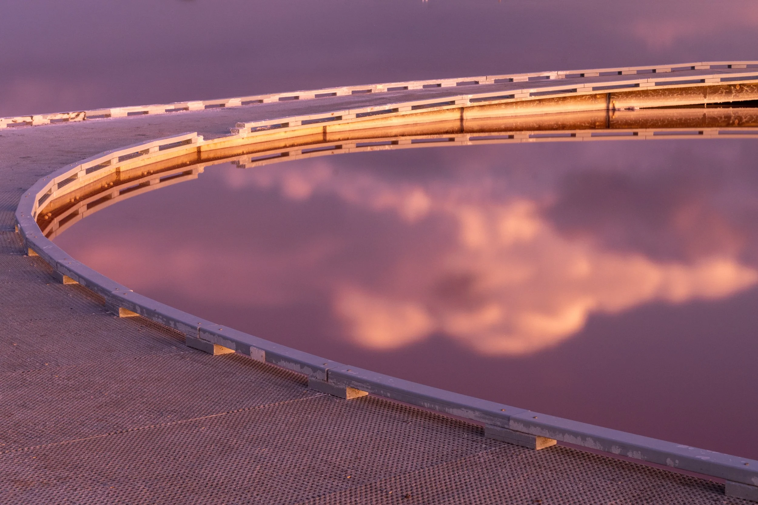
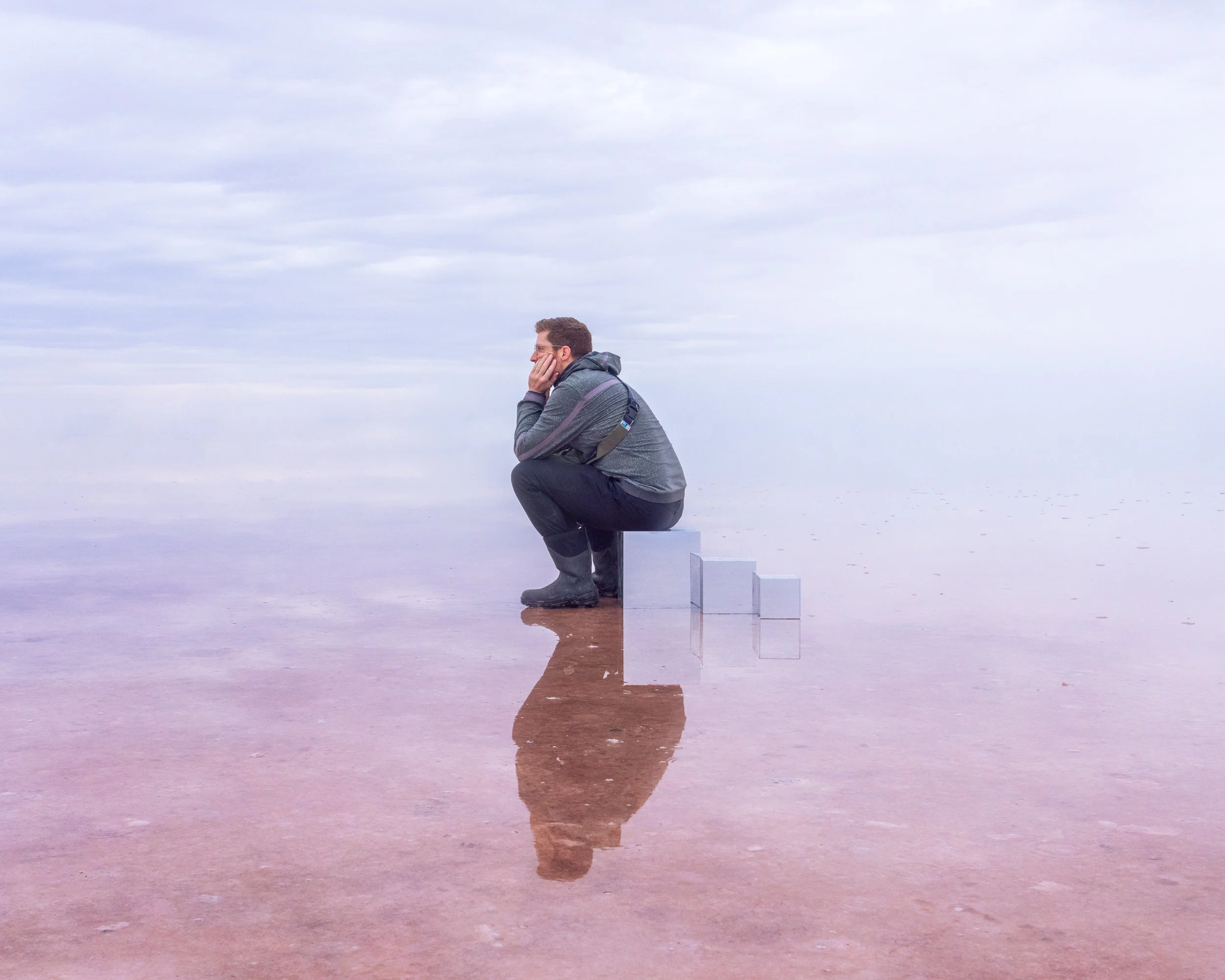
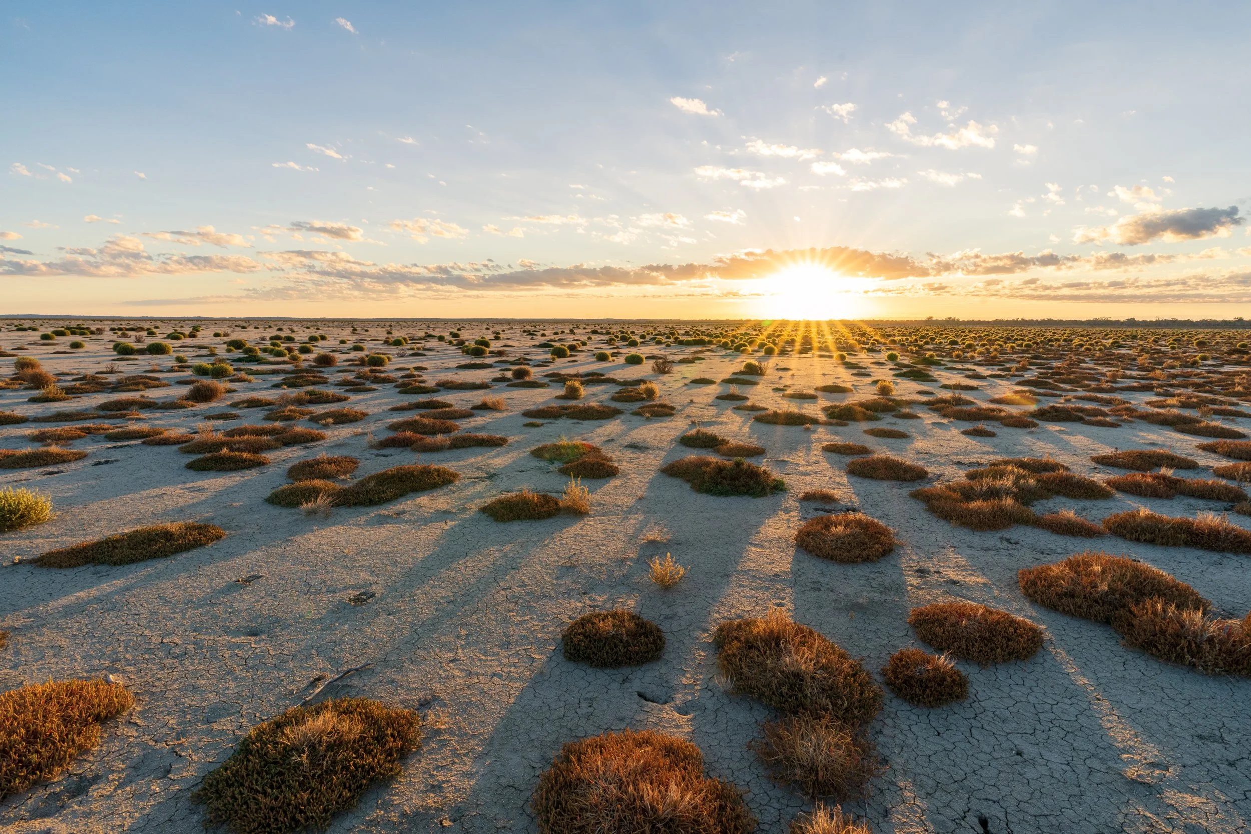
Incredible for art, portraits, and landscapes when there are incredible skies. The lake has become quite famous around the world, and is now as much of a draw card than the Silo Art Trail. The lake is HUGE, but there is fantastic tourist infrastructure, with board walks, viewing platforms, car parks and bathroom facilities. All of these are at the southern end of the lake nearest Sea Lake. For a smooth mirror surface, it's best to visit in late October, early November when there is more water in the lake, on a day with next to no wind (will ripple the surface). The lake when full is generally only 10 or so cm deep (in most places!) so you can walk out pretty confidently in a good pair of gumboots.
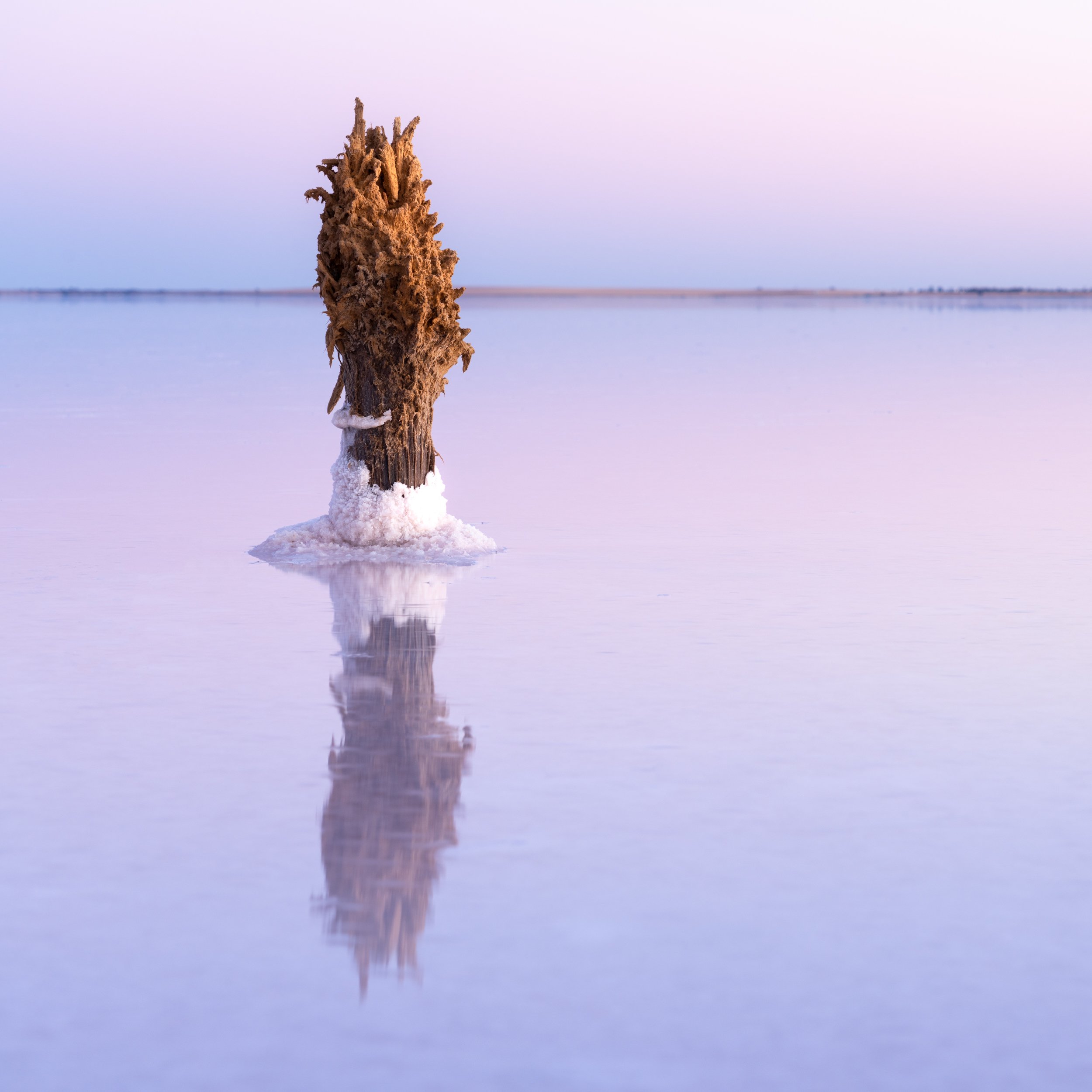
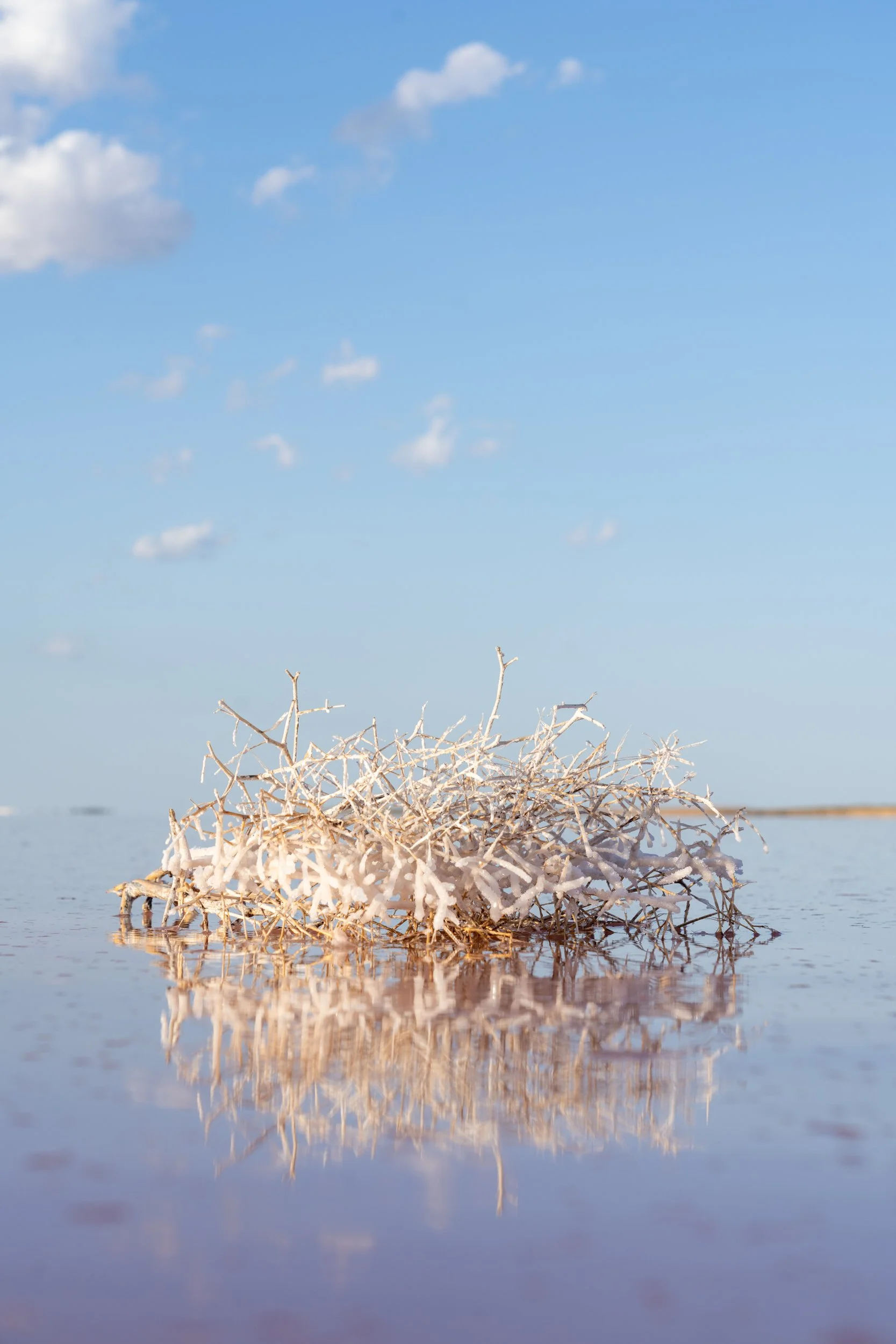
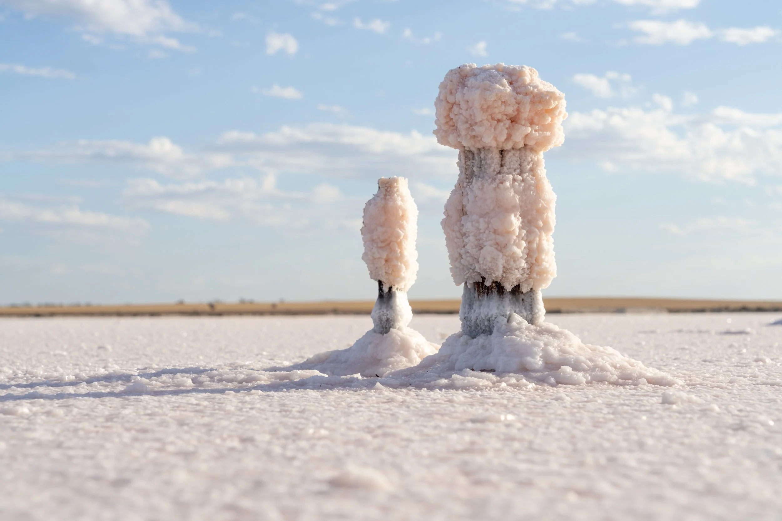
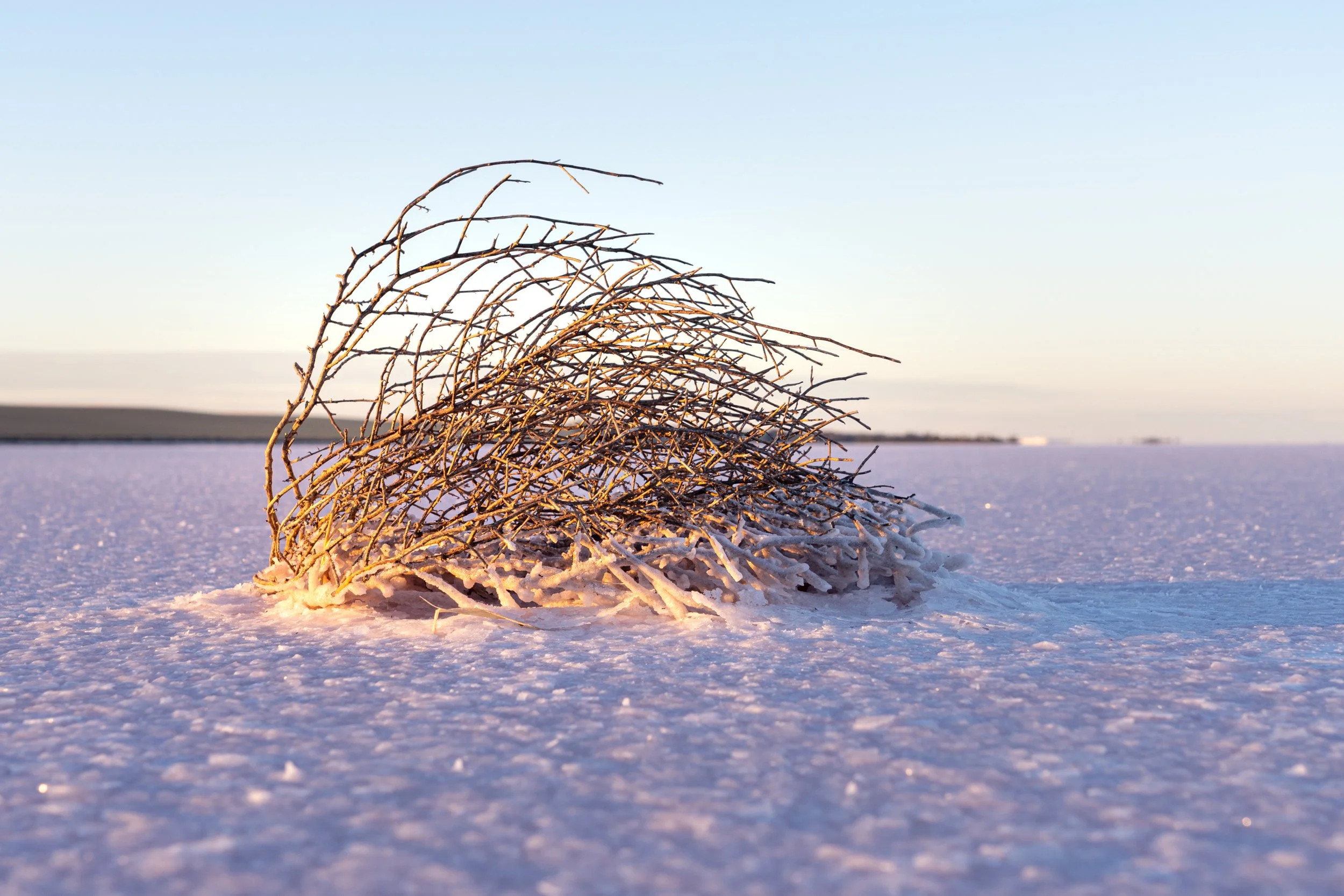
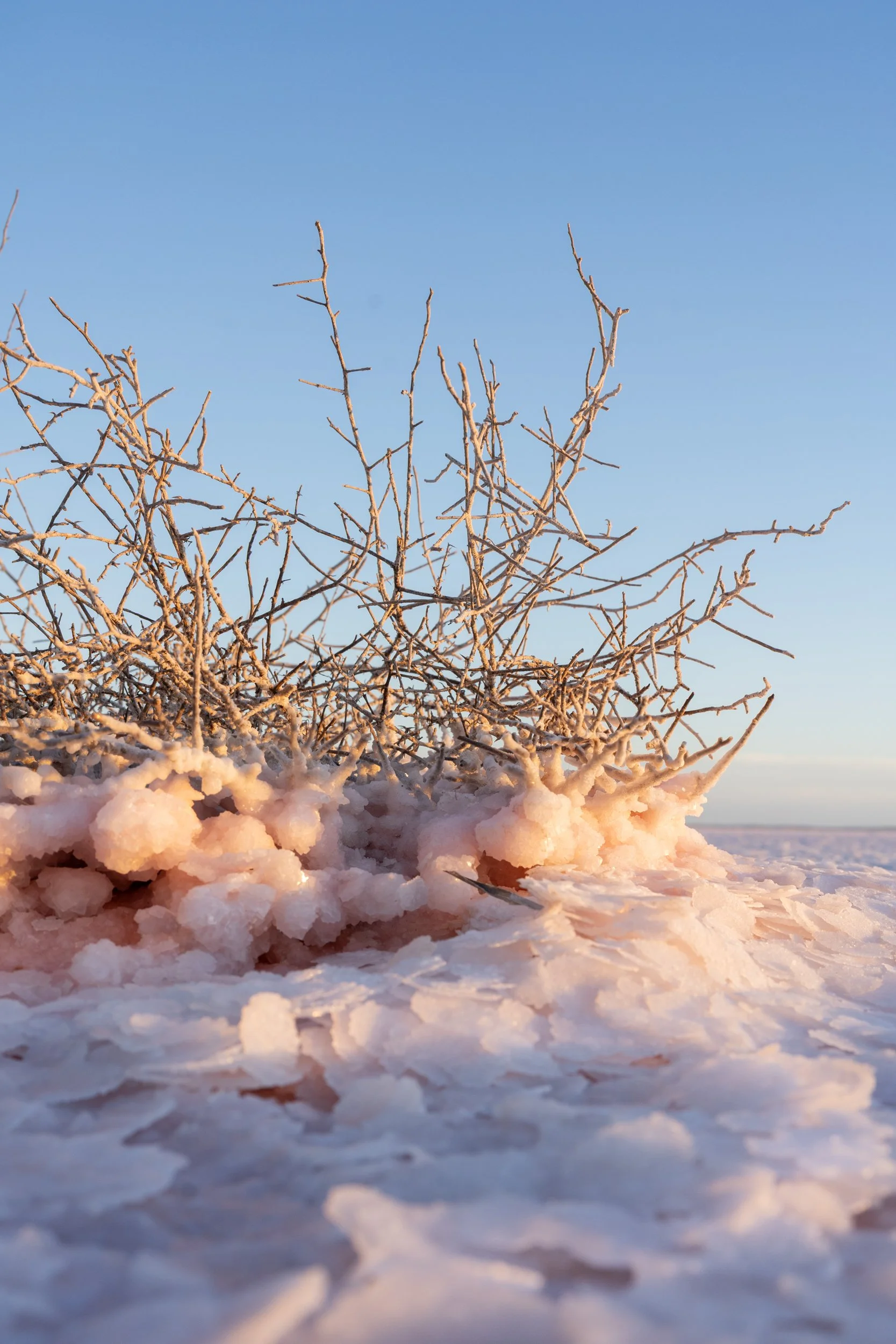
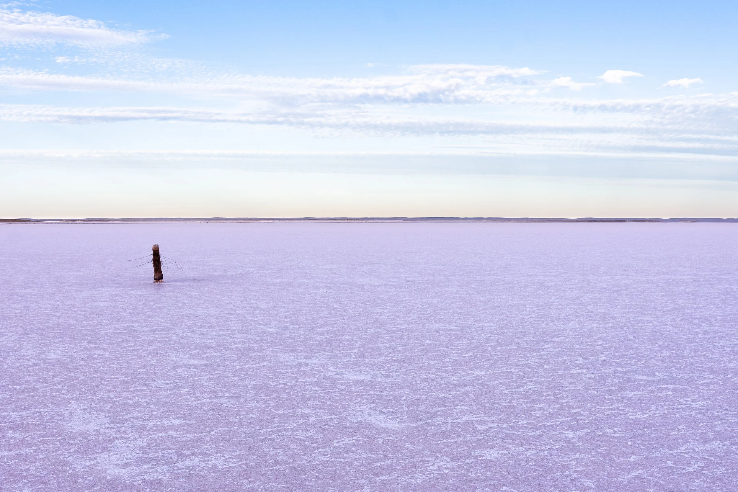
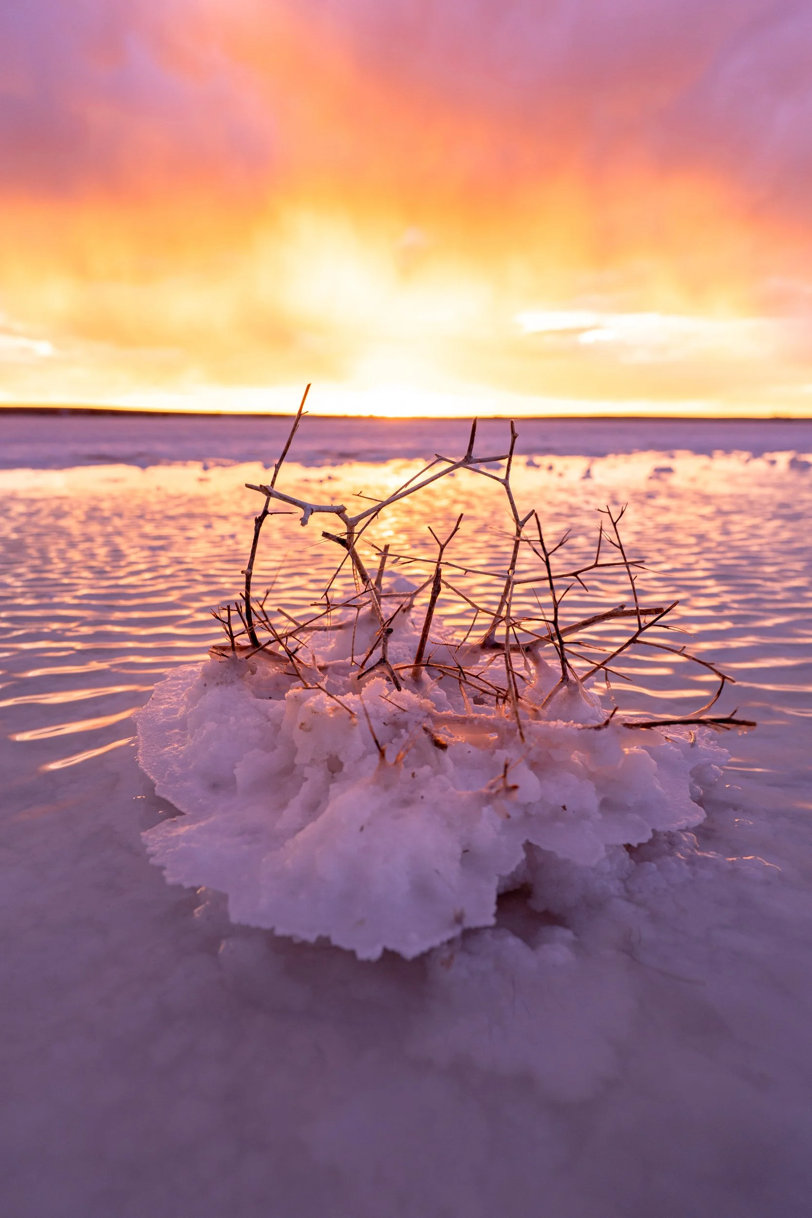
In those warmer months there's more of a chance of the water turning pink from algae blooms than the cooler months. During hot months, the lake will mostly be dry, if you're lucky with small patches of water that you may still be able to use to create those mirrored shots. The dry lake is still incredible for photography, stretching as far as the eye can see. You can find rusty industrial objects around the shore line, fence posts and blown bushes crusted in salt further out into the lake.
Let your imagination run wild, this is a photographer's playground. Be careful with your gear here. Incredibly salty water and electronics do not play well together. I was alternating between running around with excitement and being paranoid about getting salt water in my gear. Also, if you are going to be spending a lot of time here, gumboots would be a really good idea, and be prepared for your hands to get a bit chapped from all the salt.
Sunrise
The sun rises from the east, when you are at the new viewing platform, that's to the right. The time I was there the lake around the platform was dry, so we walked 5 minutes or so towards the east where there is an old fence line covered in salt crystals. There were a few large pools of water here that made for great compositions. Also the sun rising just over the horizon illuminated some of the salt formations, making for some great detailed and close up shots
Sunset
The sun sets somewhere to the left and behind the viewing platform, so for sunsets you are best to walk our into the lake and shoot back towards the platform to capture the colours of the sky. I was rather lucky on my visit! There had been a dust storm that day, and storms brewing, but the clouds were high with a gap on the horizon. All the sediment and moisture in the air set the sky on fire - perfect! In the images below, you can see the water is quite choppy, and not the mirrored image you can see in the image above. It was quite a windy day, so I lost the mirror effect (and I left my filters at home so couldn't simulate it). Nevertheless, work with what you have!
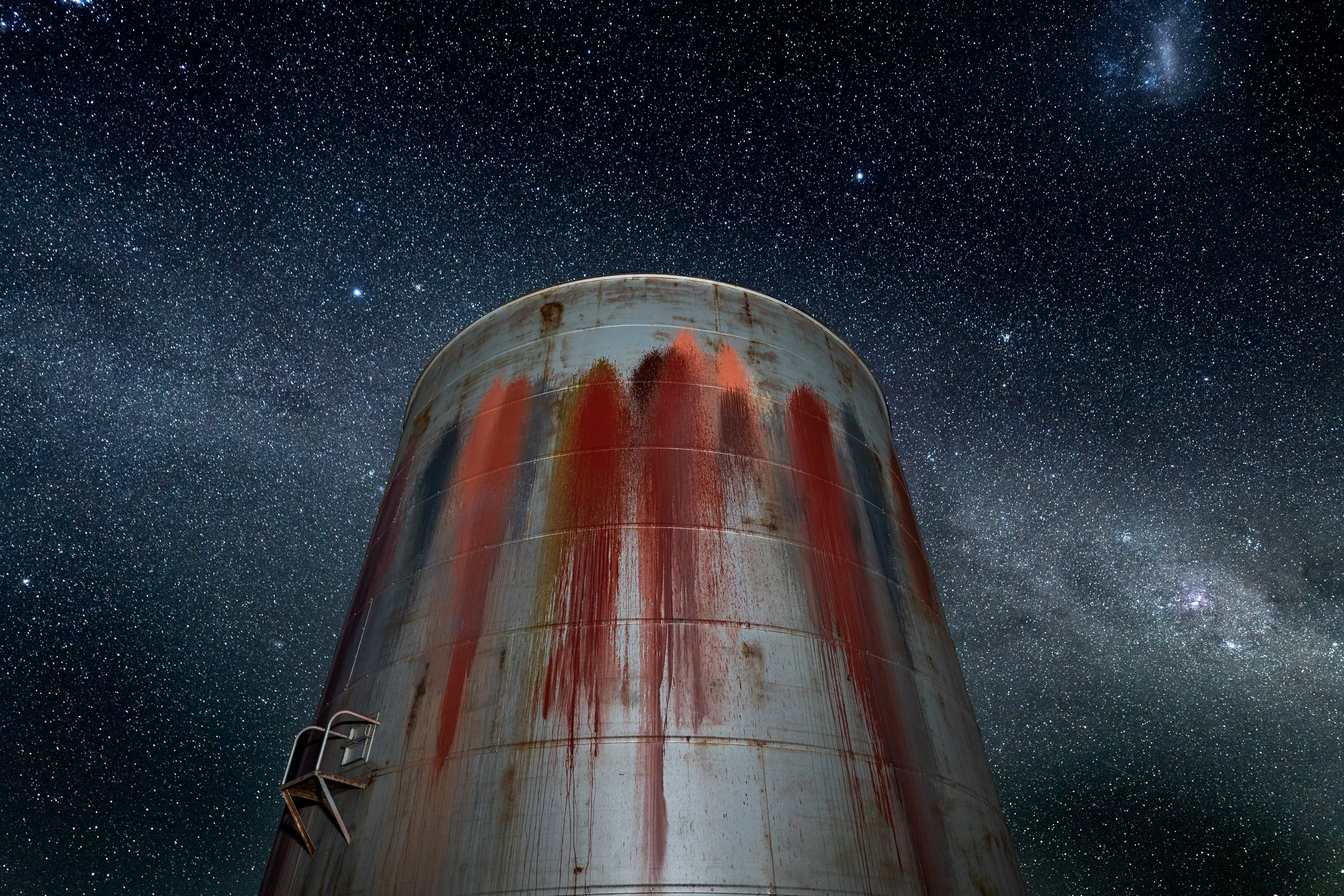
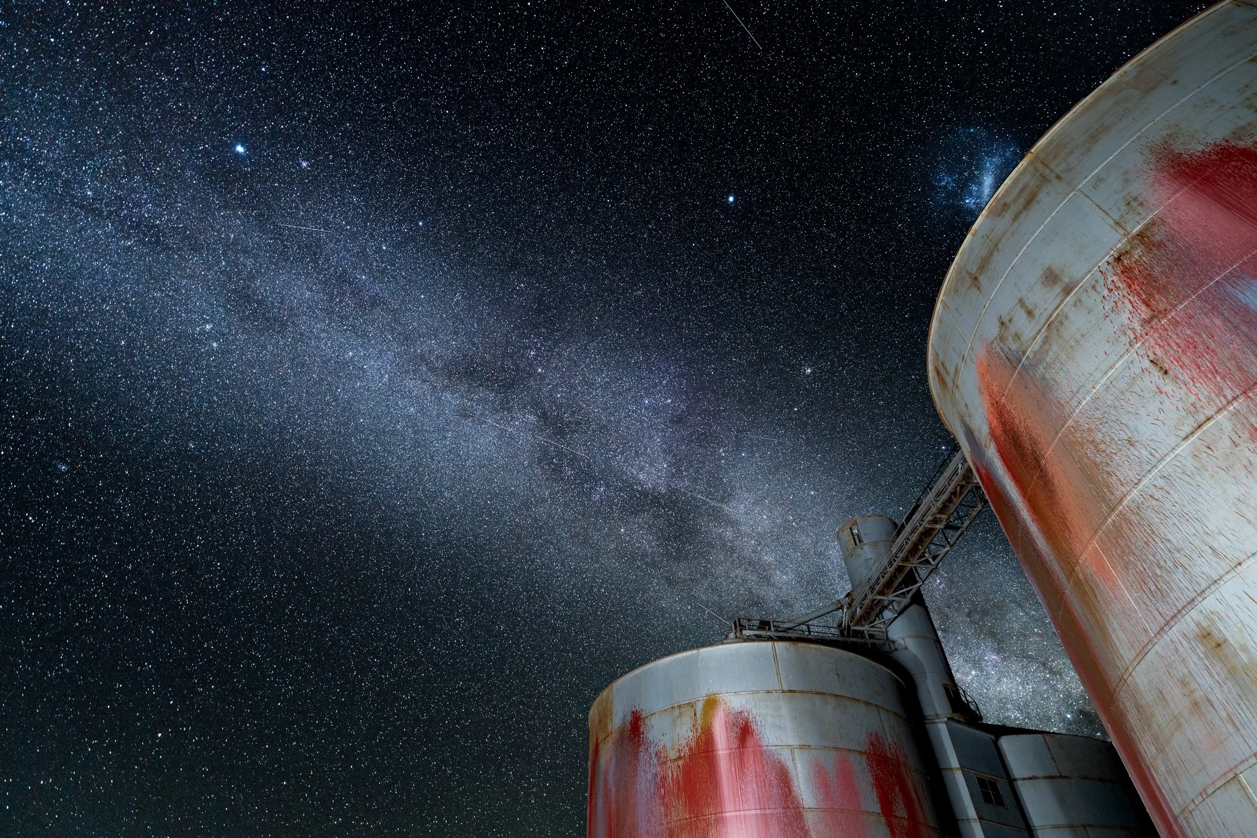
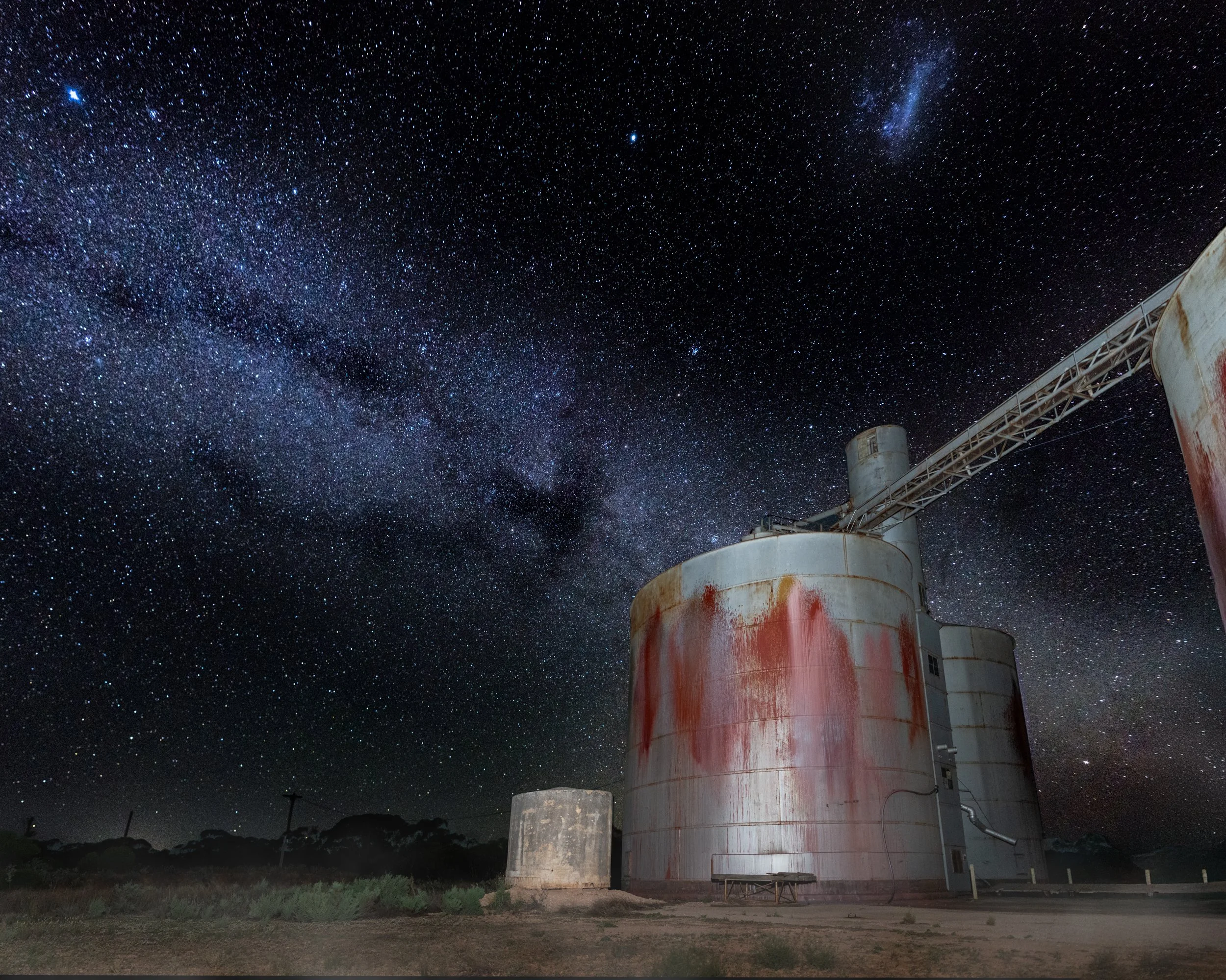
Astro Potography
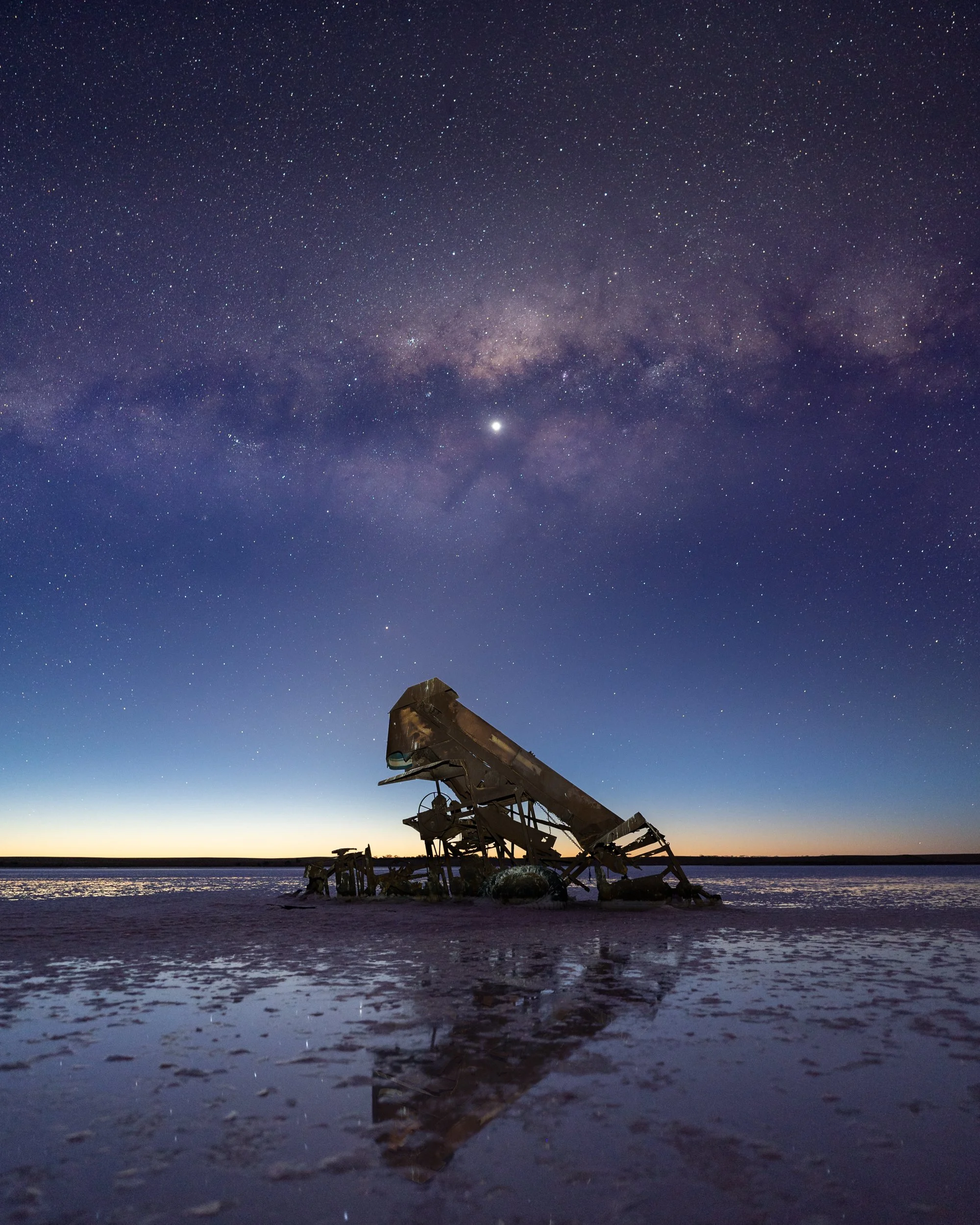
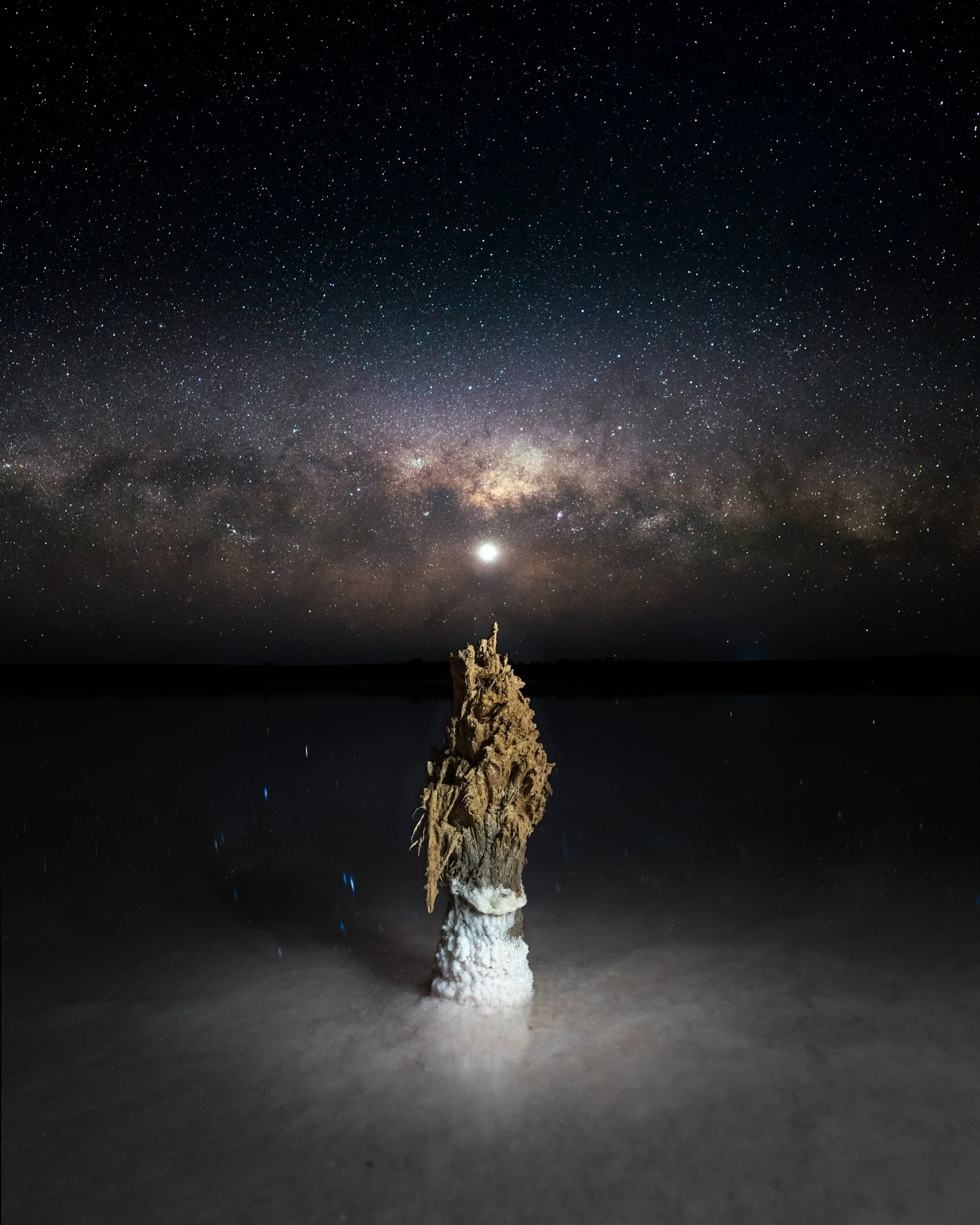
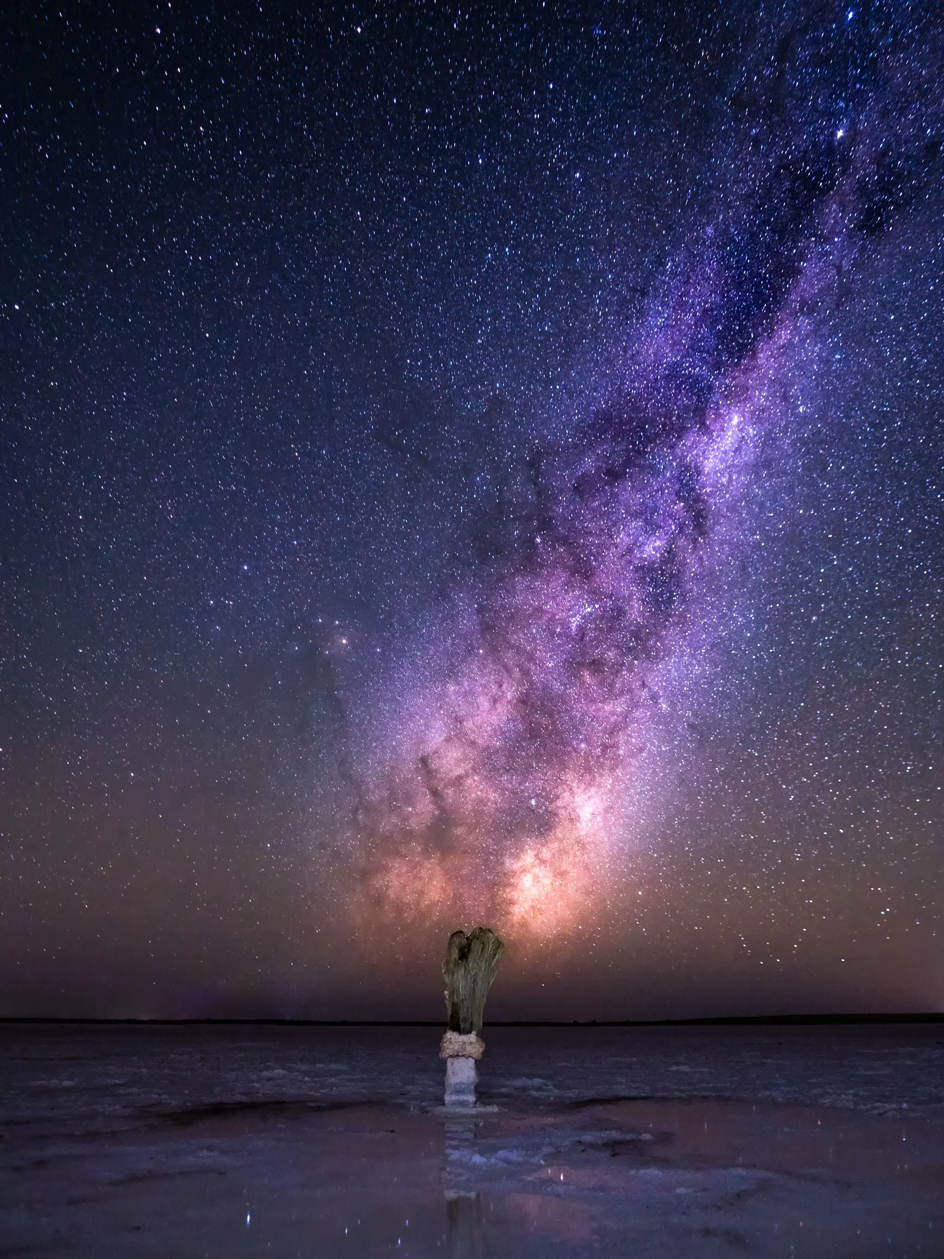
I'm no expert as astro, but I did make time on my last trip to walk out onto the lake as we slipped into true night time. What an extraordinary experience.
It is so incredibly dark with almost no light pollution that the stars and milky way are so distinct that it feels as if you could reach out and touch them. Surrounded on all sides with nothing but pitch black, and the skies ablaze with stars is almost a spiritual experience.
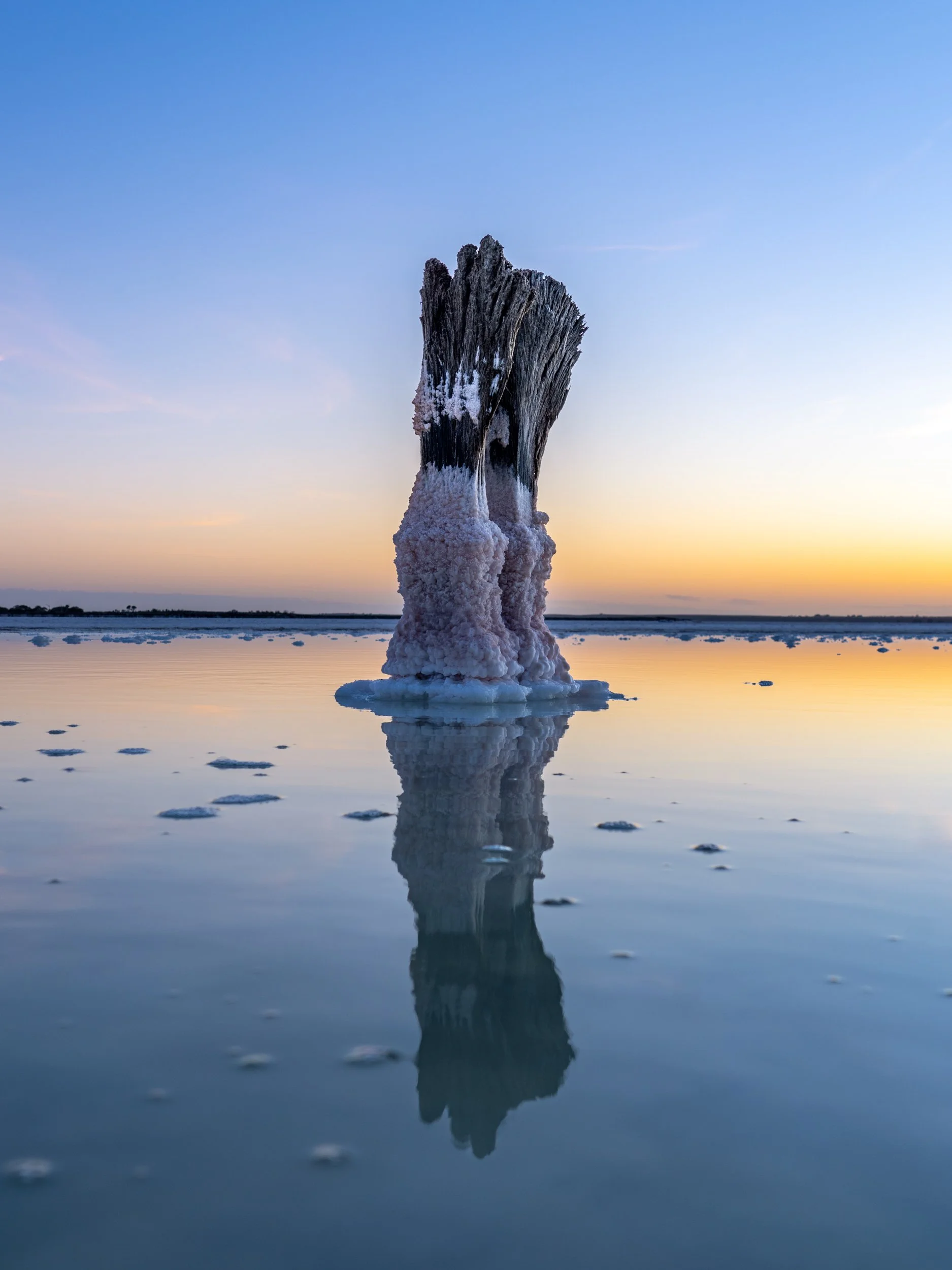
Once I saw the position of the milky way extending up vertically from the horizon, I decided to try to frame it behind that famous salt encrusted fence post. Almost like a matchstick flaring and igniting the nebulae.
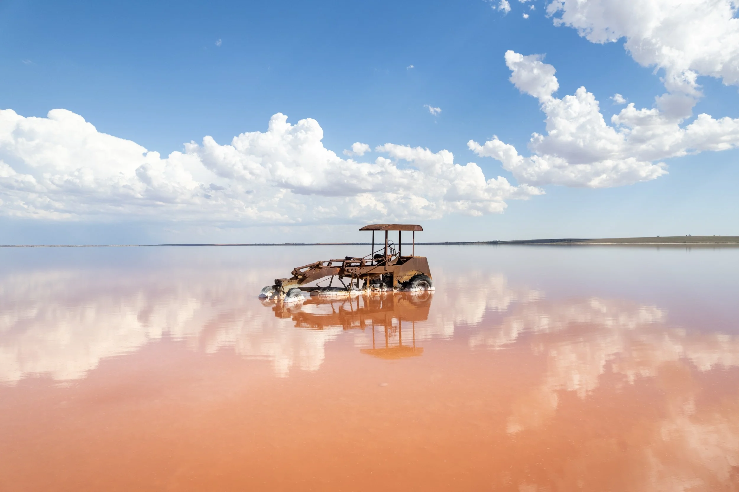
My second trip out the lake was full of water, however I was really wanting to shoot the old abandoned graders (see below), unfortunately the breeze had blown most of the water further west. On this visit the milky way was running almost perfectly horizontal, with the galactic core in the perfect position to place behind my subjects.
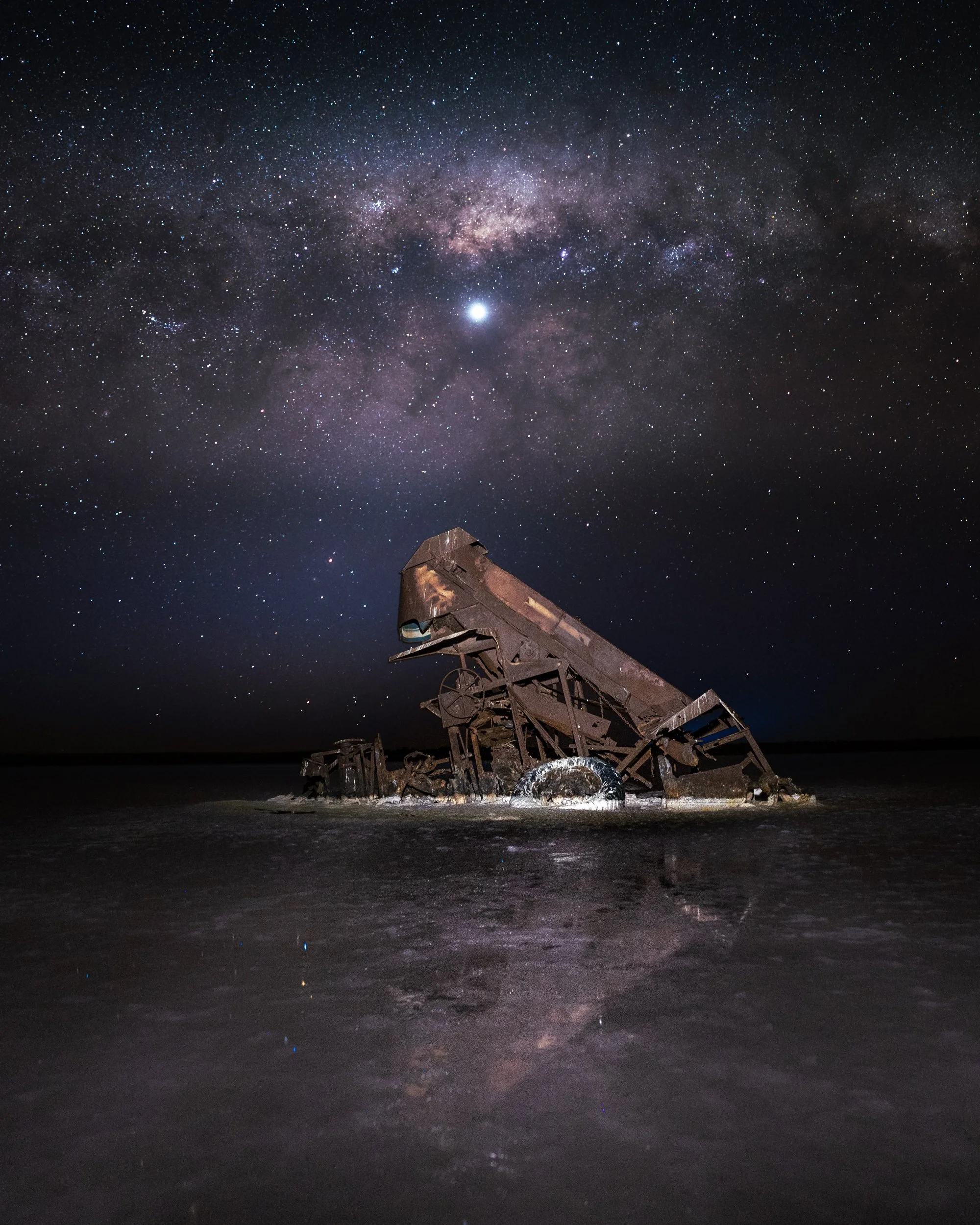
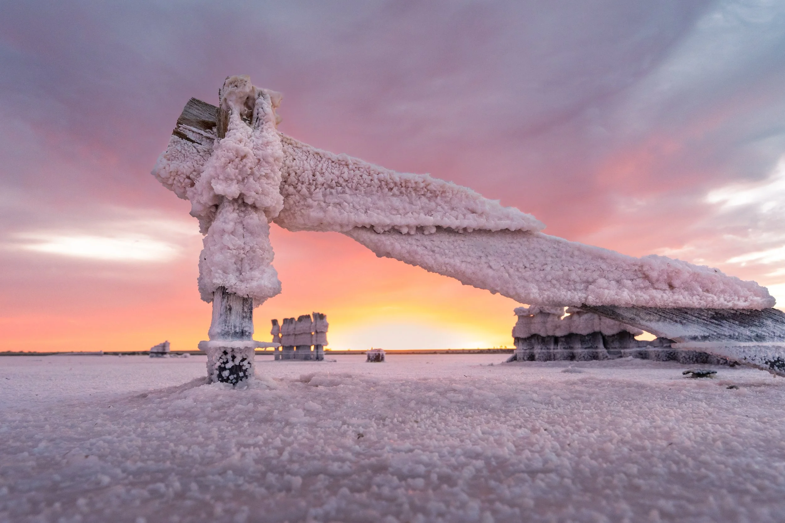
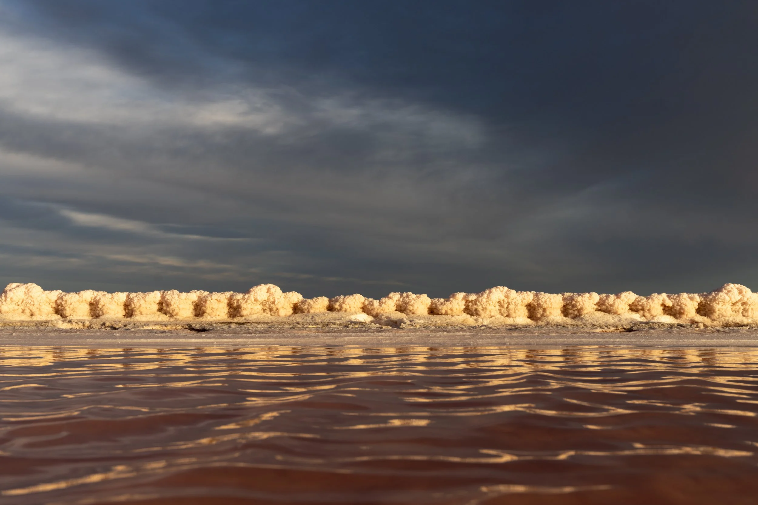
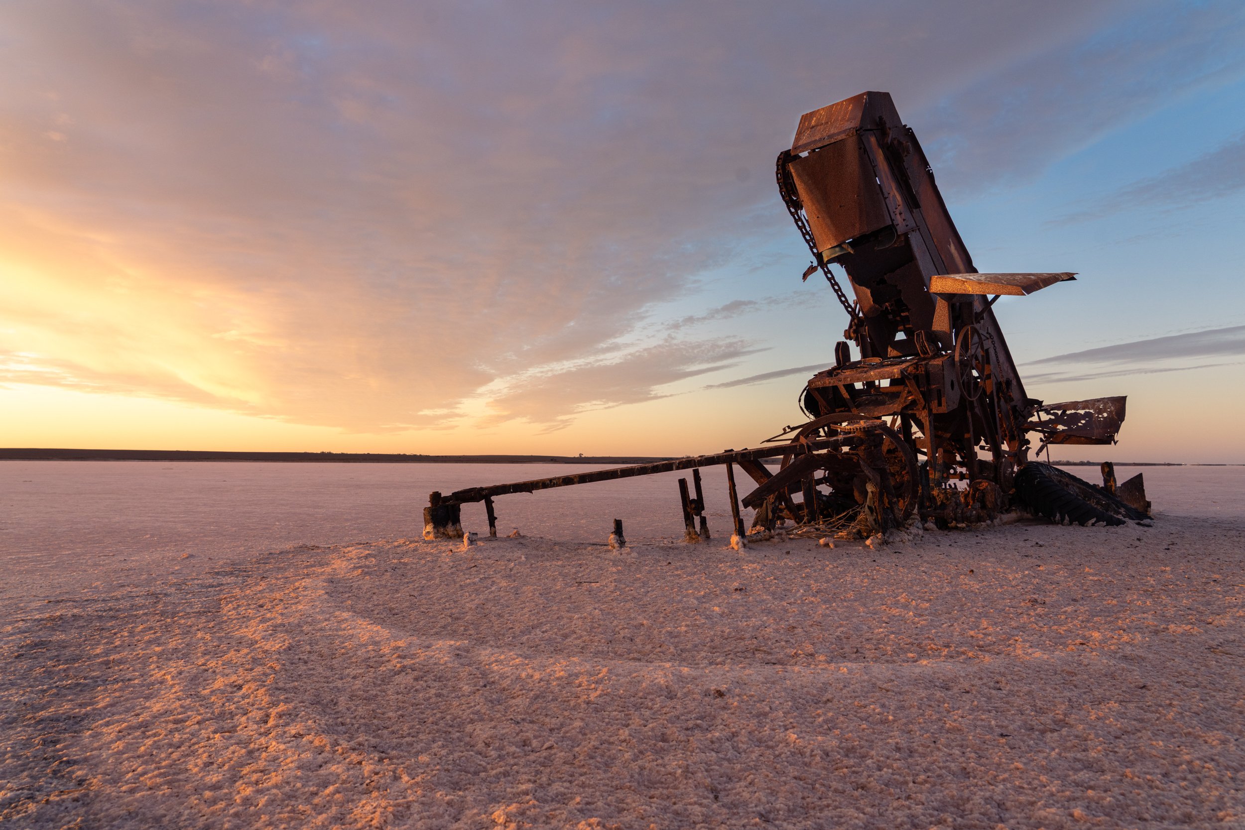
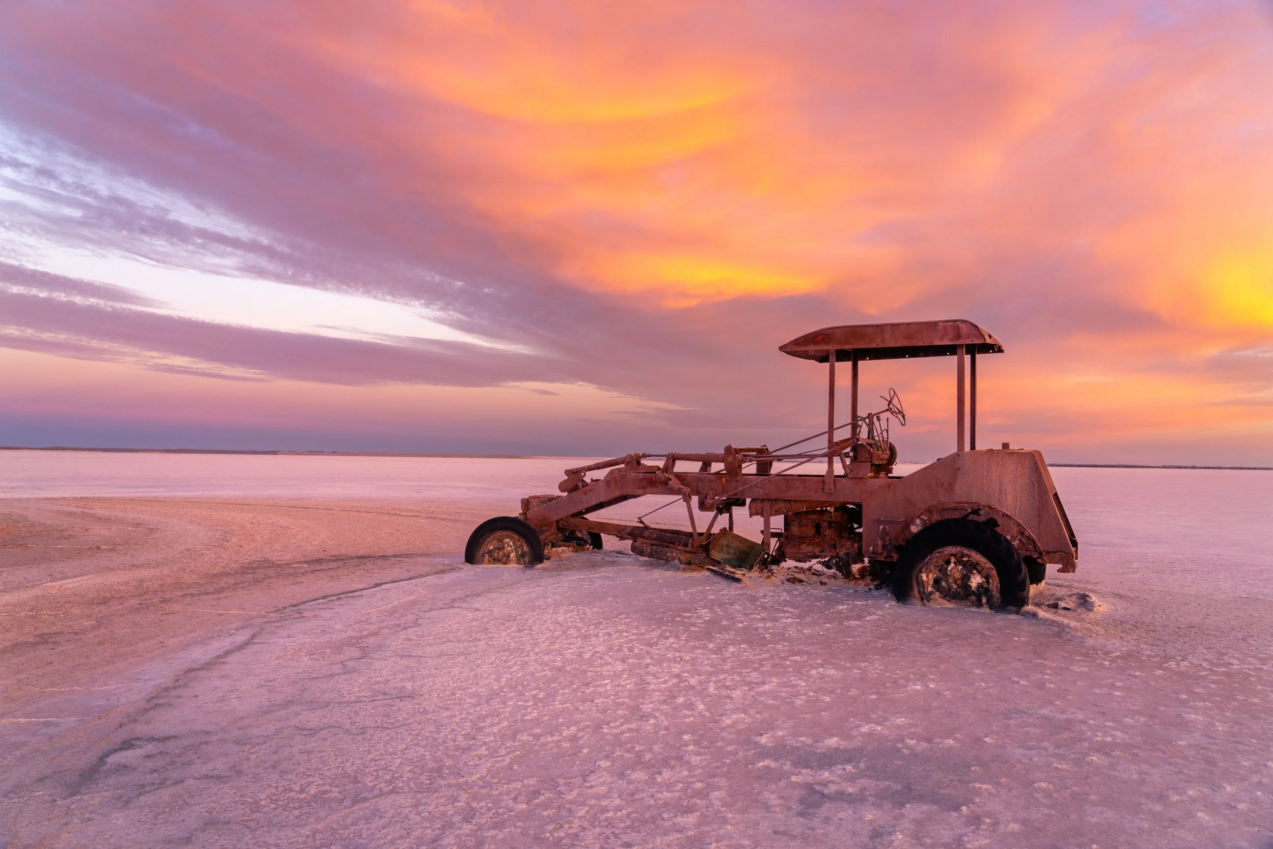
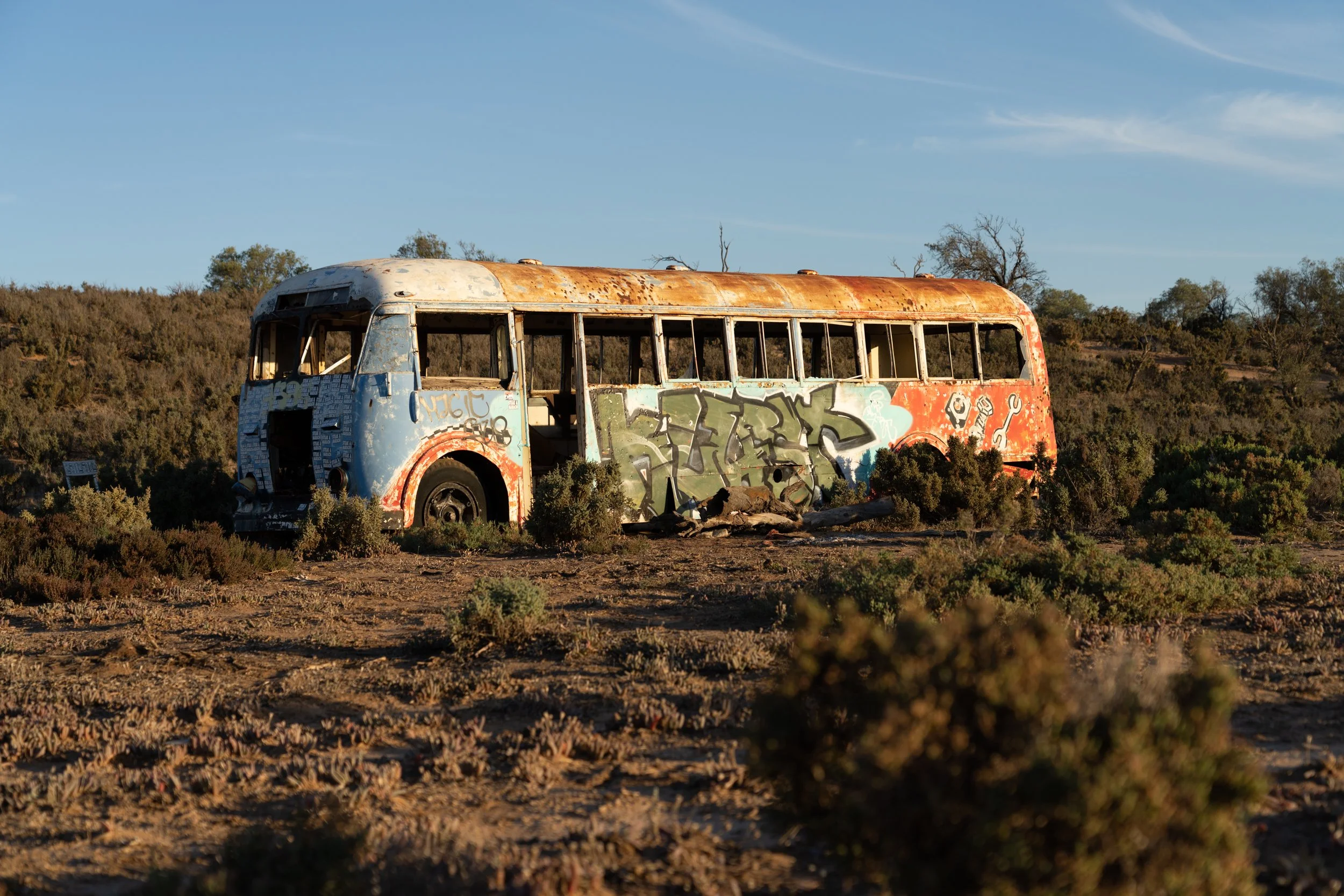
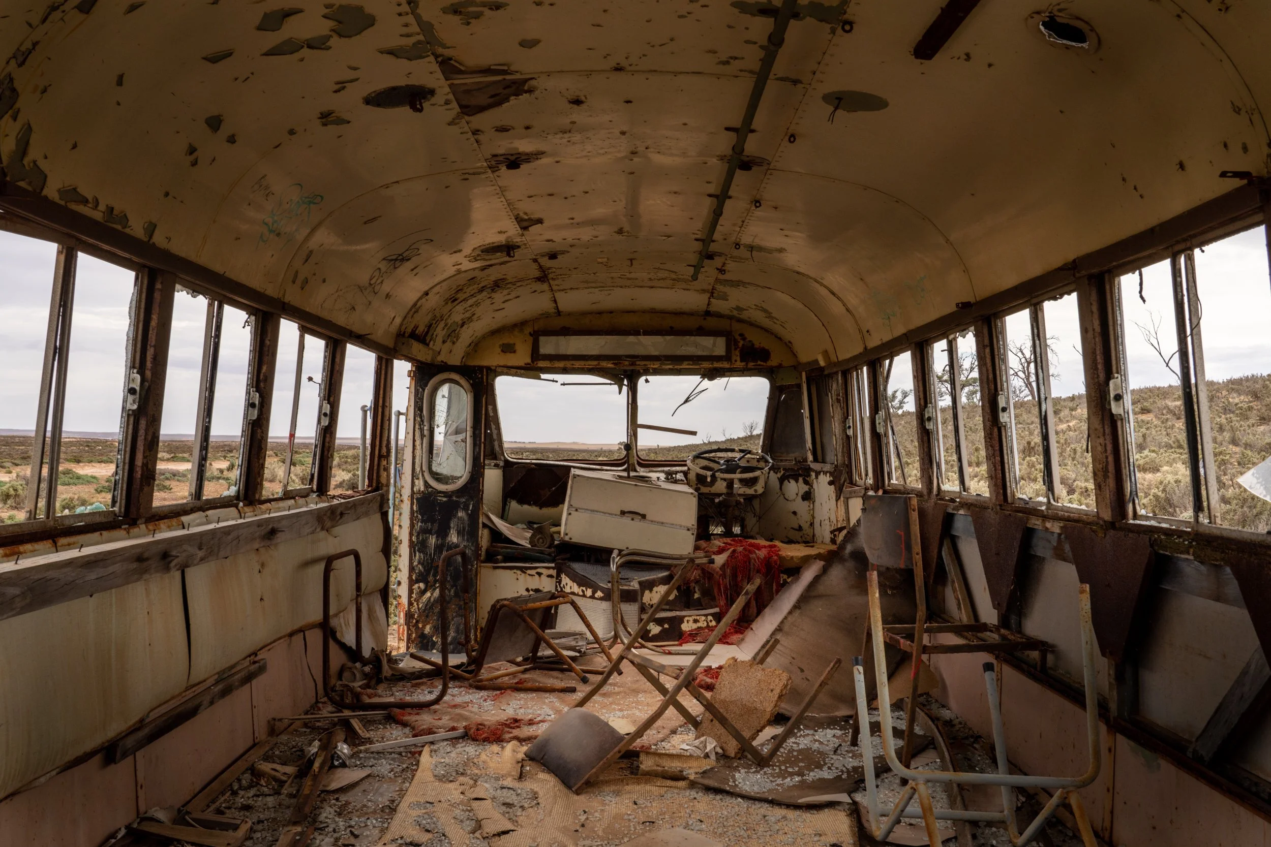
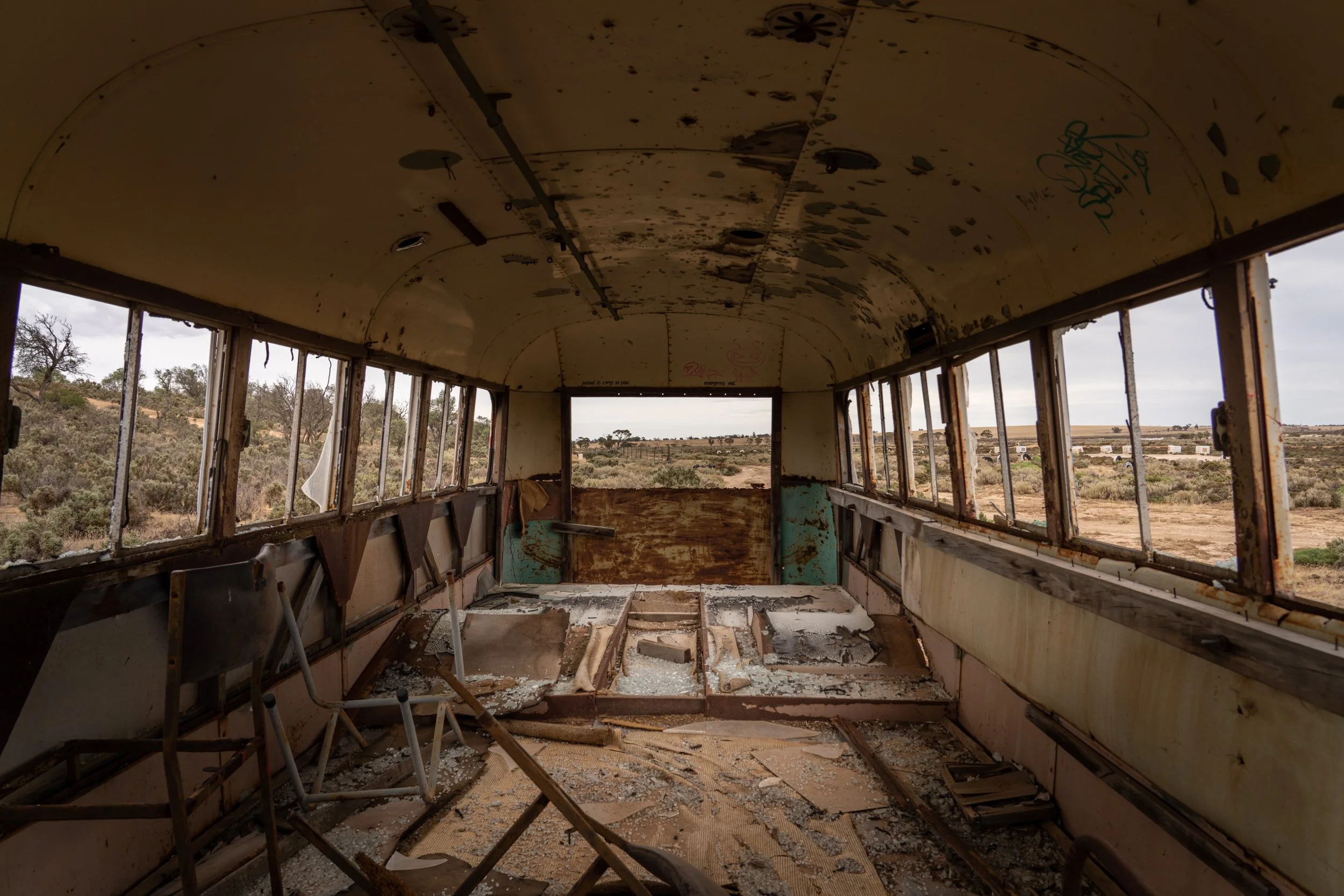
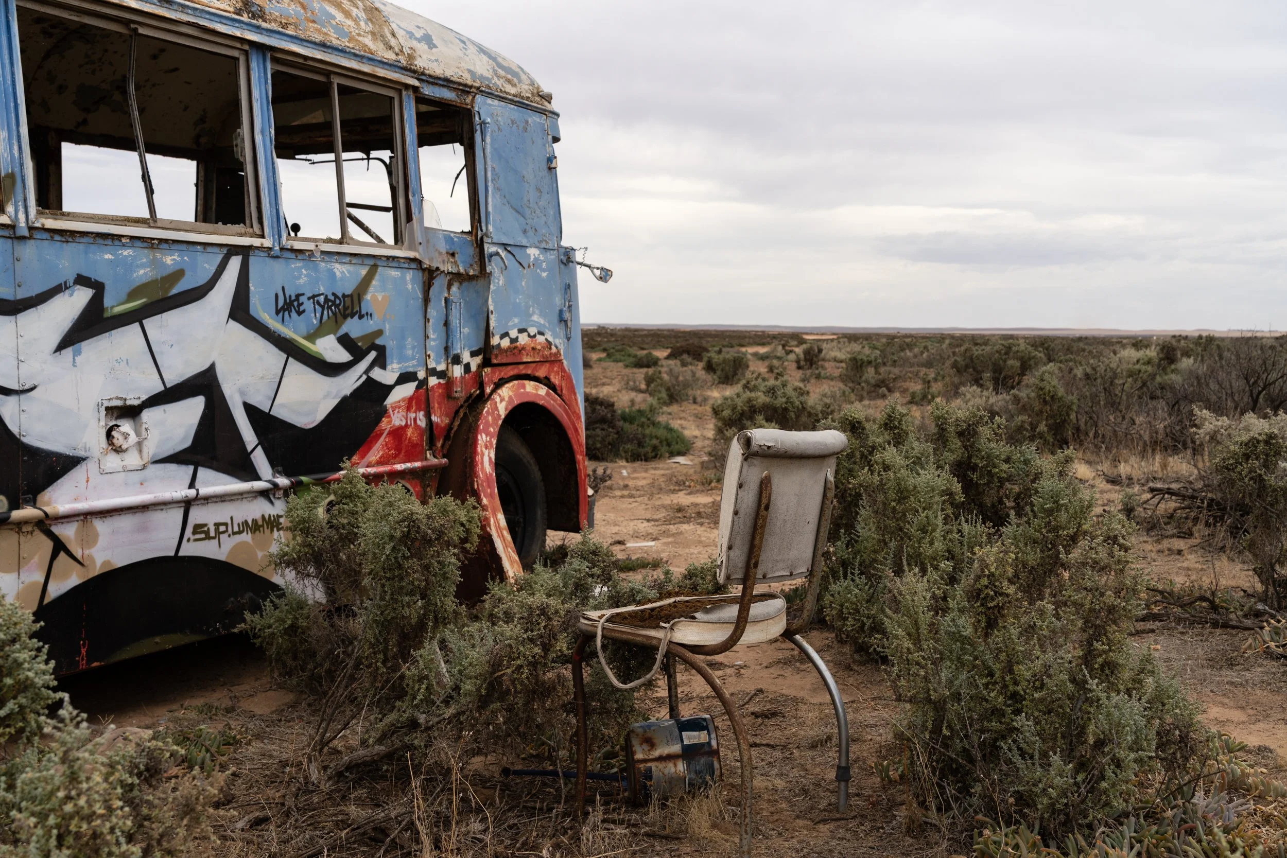
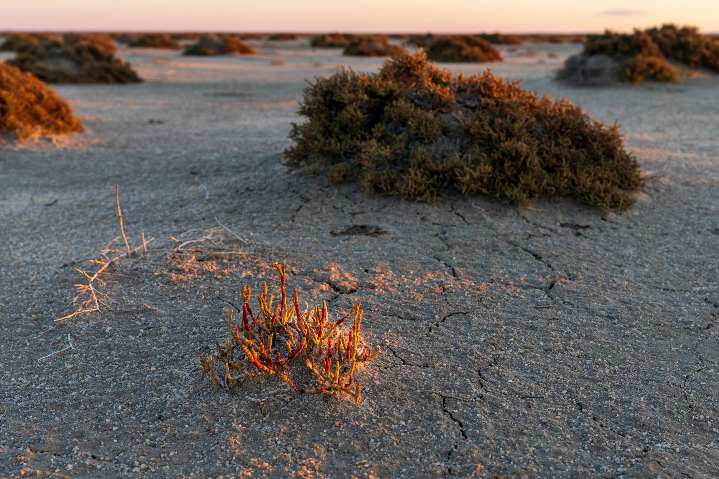
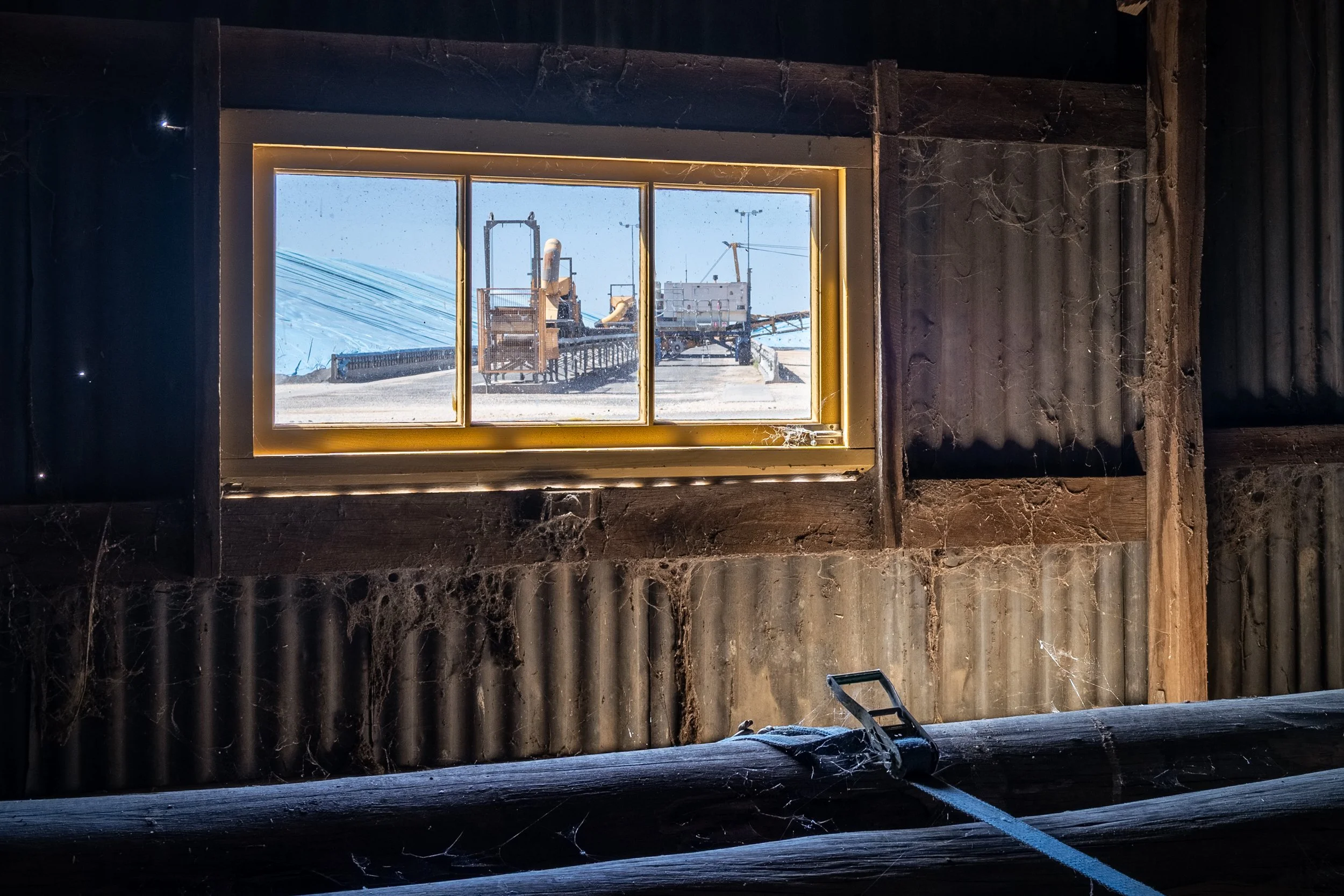
Abandoned Industrial Objects
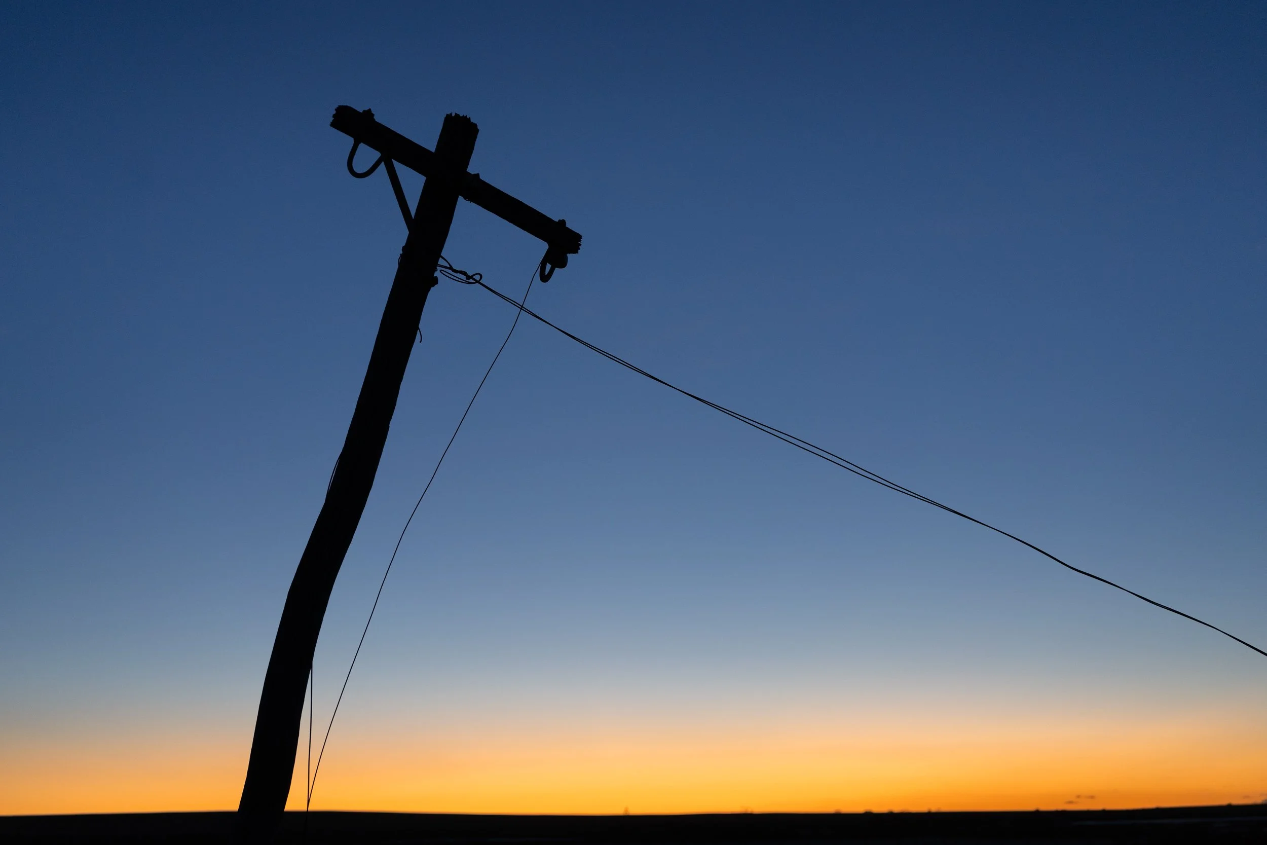
The land around the viewing platform and quite a way into the interior used to be salt works. This is why there are fence lines in the lake for example. There's lots of left over material on the shore line, or further out into the lake left over from earlier times. These make for GREAT compositional elements. The two below are my favourites, a left over dredge and road grader. They are a LONG way out into the lake, and will take hours to get to. In gumboots. Not fun. They are only for the most fearless to attempt. If you have your heart set on them, I really recommend getting in touch with Julie at Sea Lake Tyrrell tours, and booking an individual trip out there. That's the safest way to go. There's also a few old powerlines near the new boardwalk car park that can make for great subjects too.
Be Creative!
This is a spot that will give you new opportunities every time you go there with the change of conditions. No water? Make use of the vast expanse of dry salt plain. Water? Create some amazing mirrored images. Try abstracts, try close ups, try wide shots, try long exposures. This is a perfect place to play.

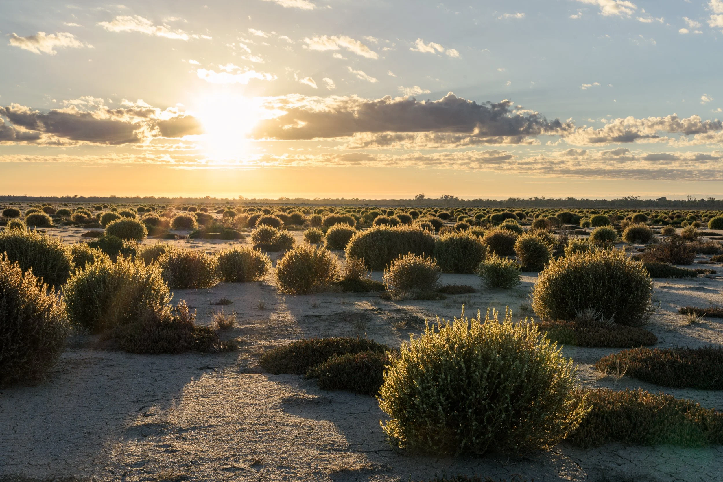
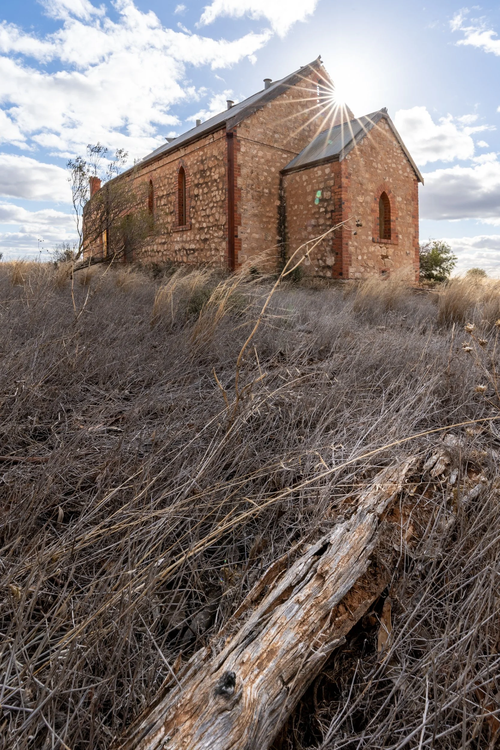
LULLA FLORA & FAUNA RESERVE
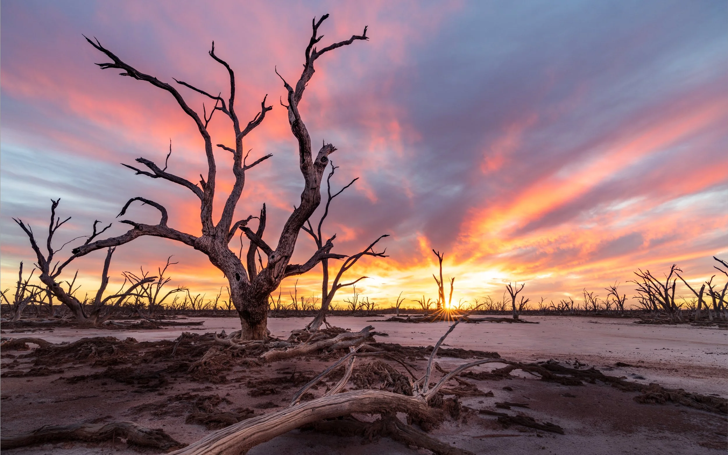
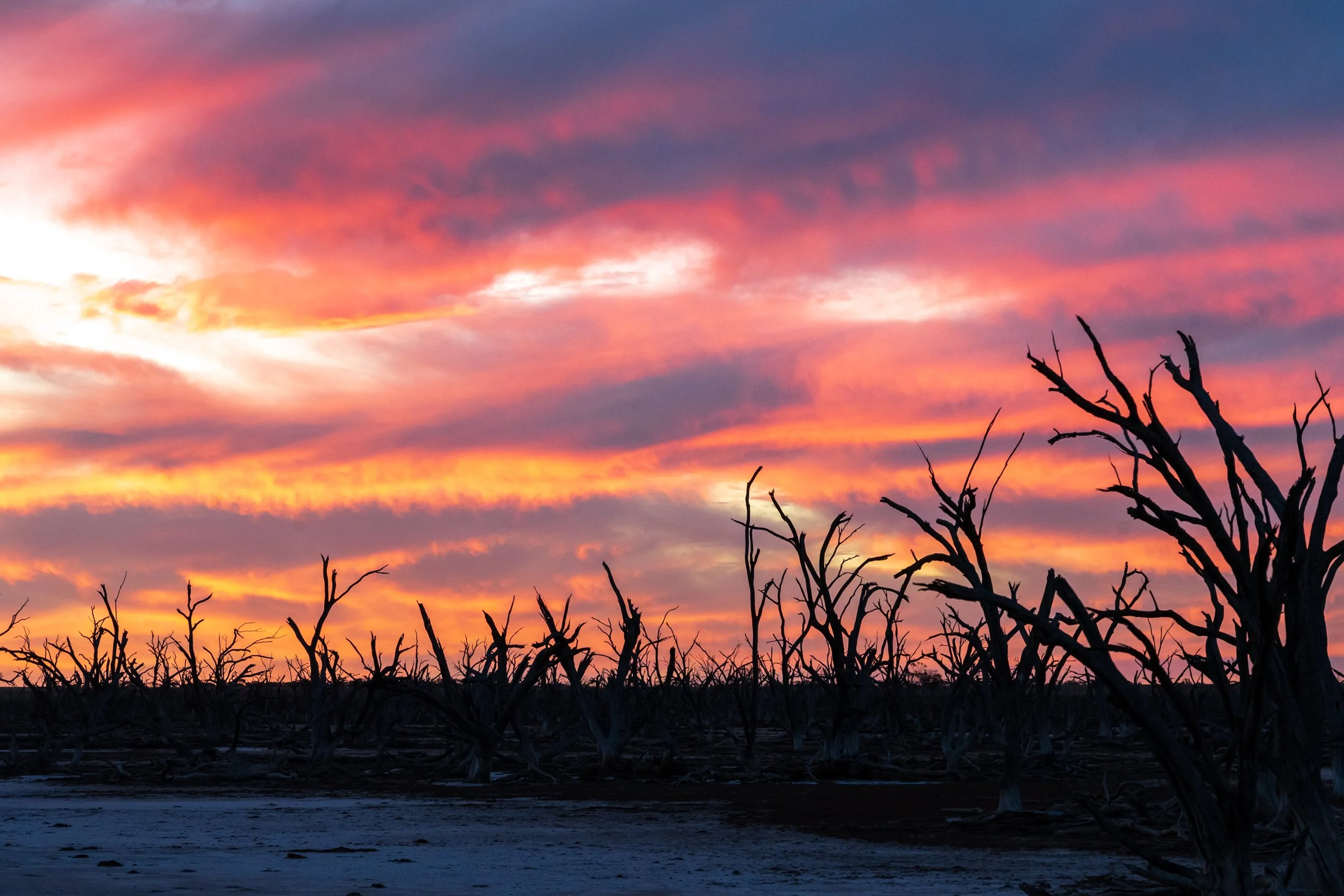
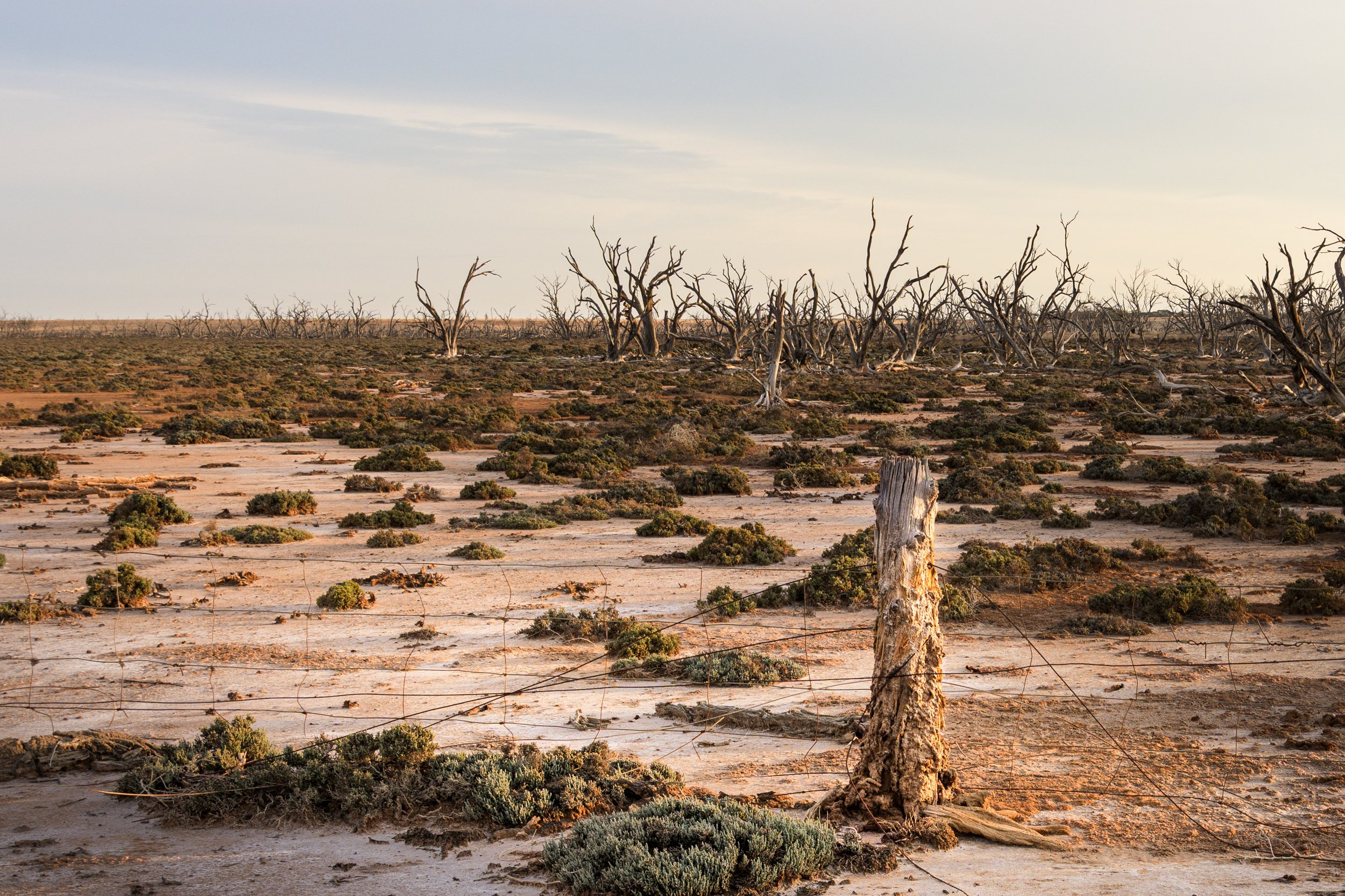
Lulla FFR sits between Manangatang and Ouyen — about 15 minutes from Manangatang and 30 from Ouyen. This 200-hectare reserve features a salt lake and a haunting forest of trees killed by rising salinity.
I first heard about Lulla over a steak sanga at the Manangatang Hotel, where the publican, Aub, urged me to visit at sunset. An endless expanse of dead trees? I was sold — and I’ve returned many times since.
An AWD or 4WD is best to reach the prime spots, though you can also park and walk in. Take care if you’re not experienced: the ground can soften quickly and bog vehicles without warning.
At sunrise and sunset the scene is spectacular — pale sand, twisted silhouettes and huge skies. I love shooting low to let the gnarled trunks cut across the horizon, often leaving one camera running on a tripod while I wander nearby looking for new angles.
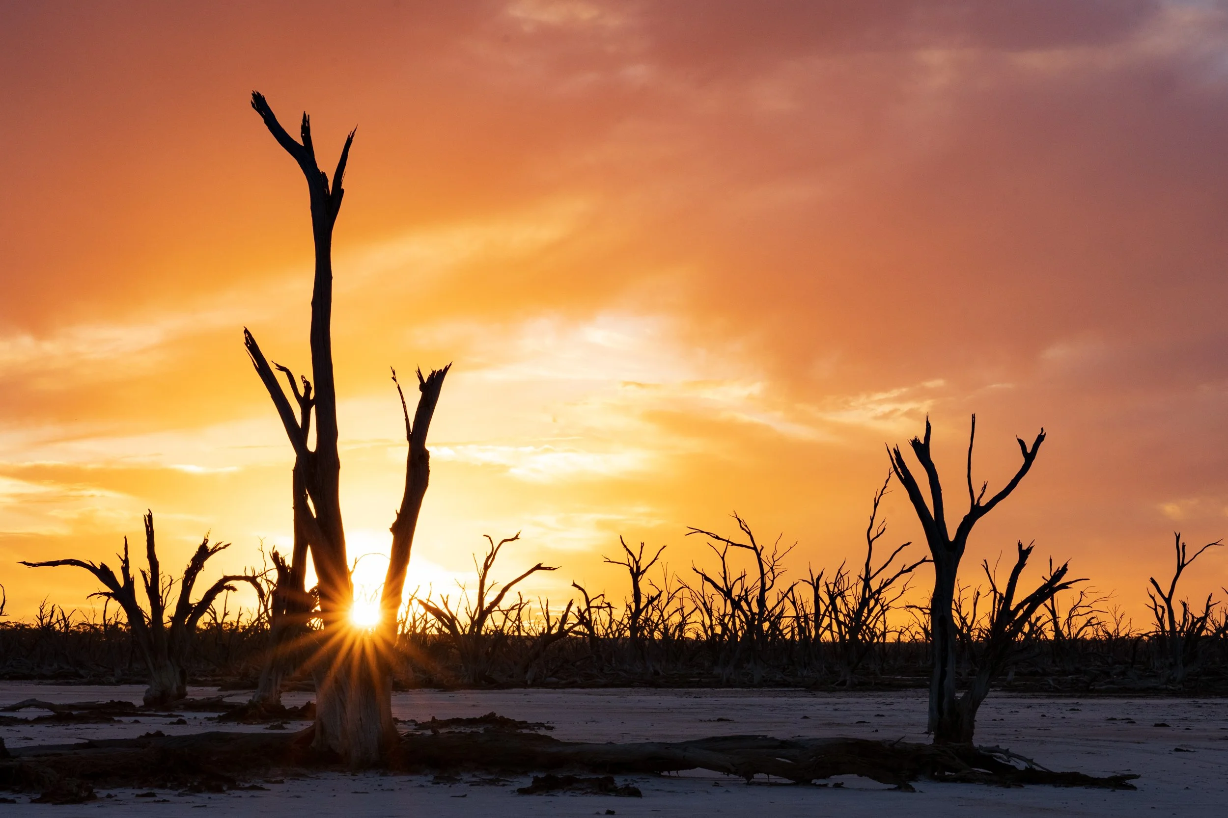
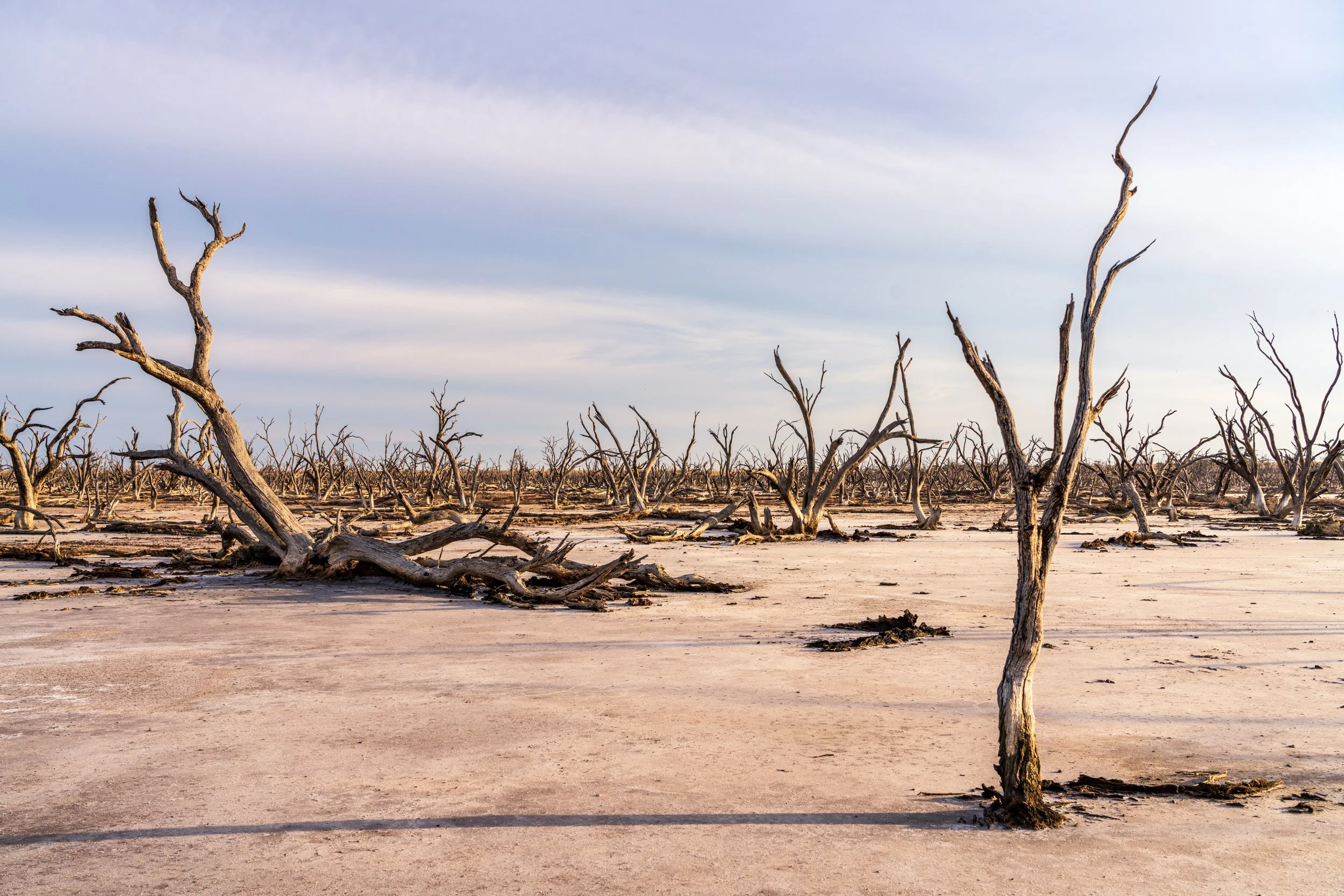
The images below were taken during the day time. The first was taken in mid afternoon after first learning about Lulla, as you can tell by the hardness and direction of the shadows. I used the fence line and fallen tree to add interest into the shot. The second image was taken in the early morning, as you can see from the long shadows. I took a number of shots with the sun behind me shooting into the trees, but although the colour was amazing they felt quite flat. This image is taken with the trees side-lit and it gives them so much more dimension, texture and form.
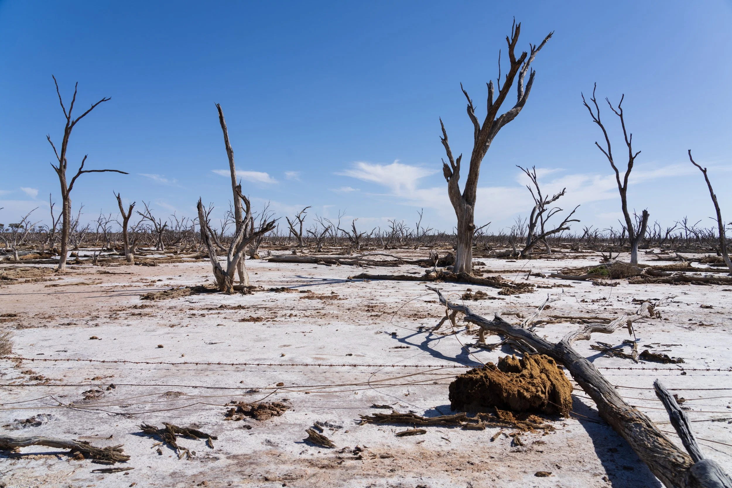
This shot was taken near the edge of the 'dead' part of the reserve, where the bare sand gives way to scrubby vegetation. The old fence post and transition from gnarled trees to scrubby ground cover felt like to me like a story of failed endeavours. This was also taken earlyish in the morning, but with a little more cloud. We still have side light but it's quite soft and muted.
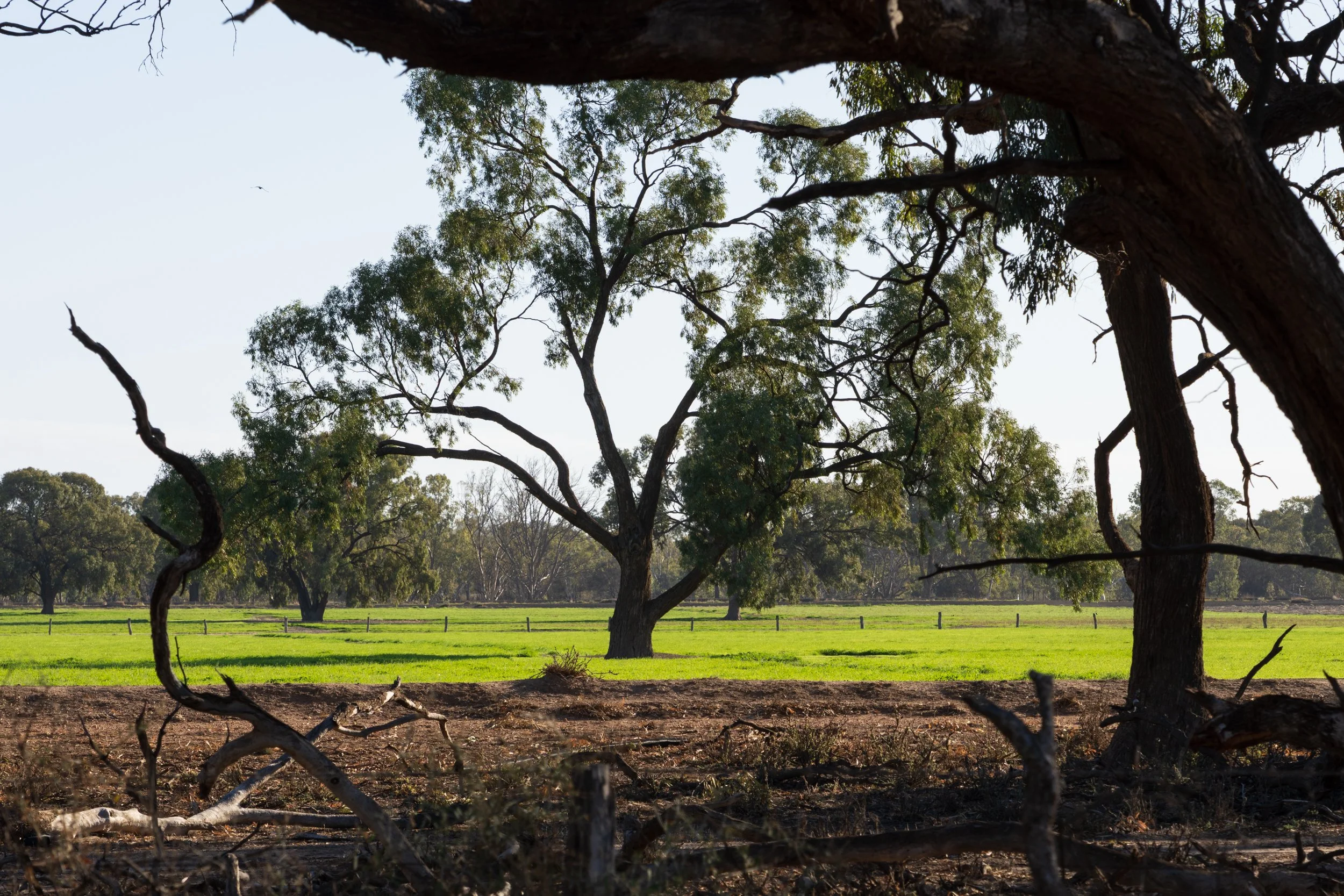
Lake Hindmarsh
Lake Hindmarsh is a huge lake between Jeparit and Rainbow. It's very popular, I've been there a couple of times both when the lake has been completely dry.
From Visit Victoria : Lake Hindmarsh is Victoria's largest freshwater lake an extremely popular spot for holiday makers, teeming with wildlife. Fringed by ancient River Red Gums and fed by the Wimmera River, this huge lake is shared by parrots, pelicans, sea eagles, anglers and water sports enthusiasts alike. The Wimmera River originates on the Great Dividing Range near Beaufort and ends in a series of 'terminal lakes', including Lake Hindmarsh, Lake Albacutya and finally, the Wyperfeld flood plains.
Once was on the eastern side in the afternoon, and there were dirt bikers on the lake, and paddle boards and jet skies in some of the rivers surrounding it. I lost all my images from that trip unfortunately due to door premature memory card formatting!
The second time was at first light, to the south, and no one else was on the lake. There were quite a few caravans in the camping ground and lots of tyre tracks on the ground. After sleeping in Nhill, it was my first stop on the last day of a weekend shooting.
Near the shore was a span of mud covered in tyre tracks where people had been doing doughnuts and skids by the look of things. About a 15-20 minute walk into the lake vegetation came in waves, I assume as there was more moisture towards the centre.
What really struck me were these amazing scrubby bushes scattered across the lake that just caught the early morning sun like magic. Side lit and back lit they looked absolutely gorgeous. I felt like they were little alien creatures lined up saluting the rising sun.
Farm Land
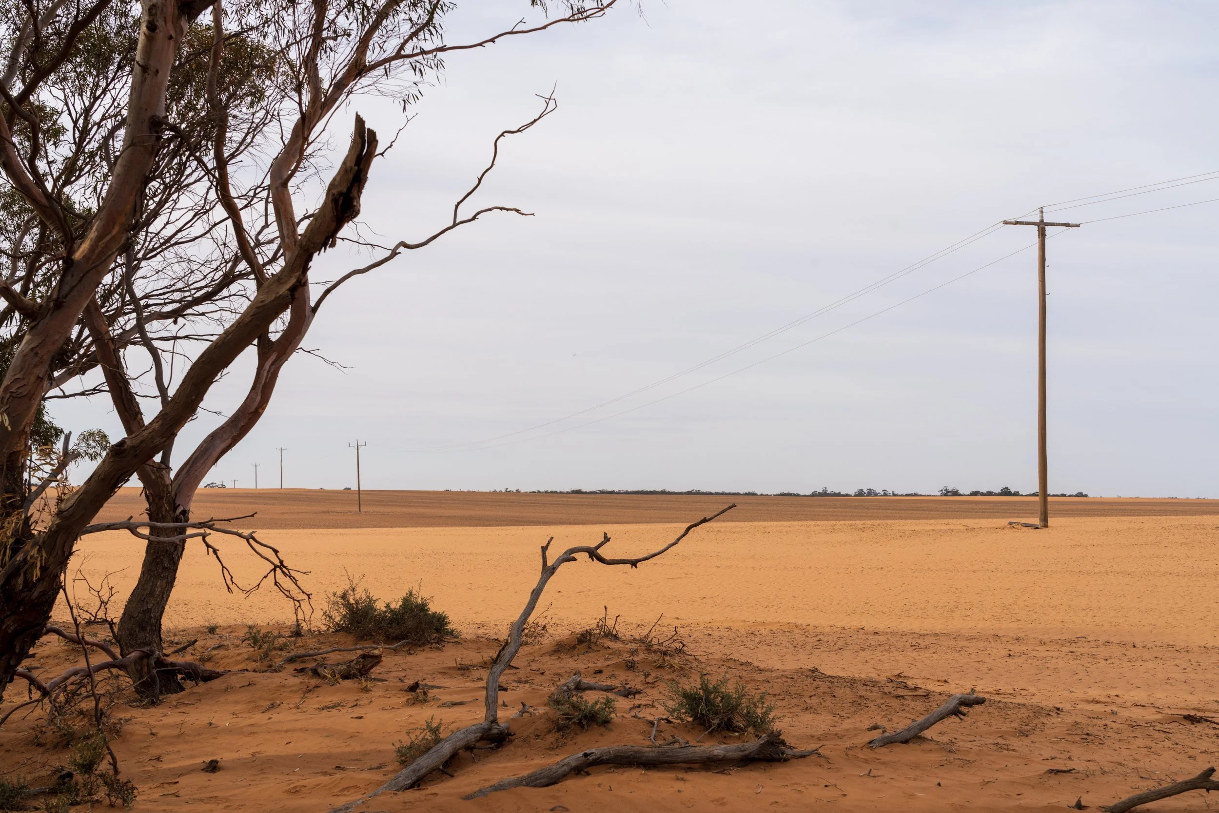
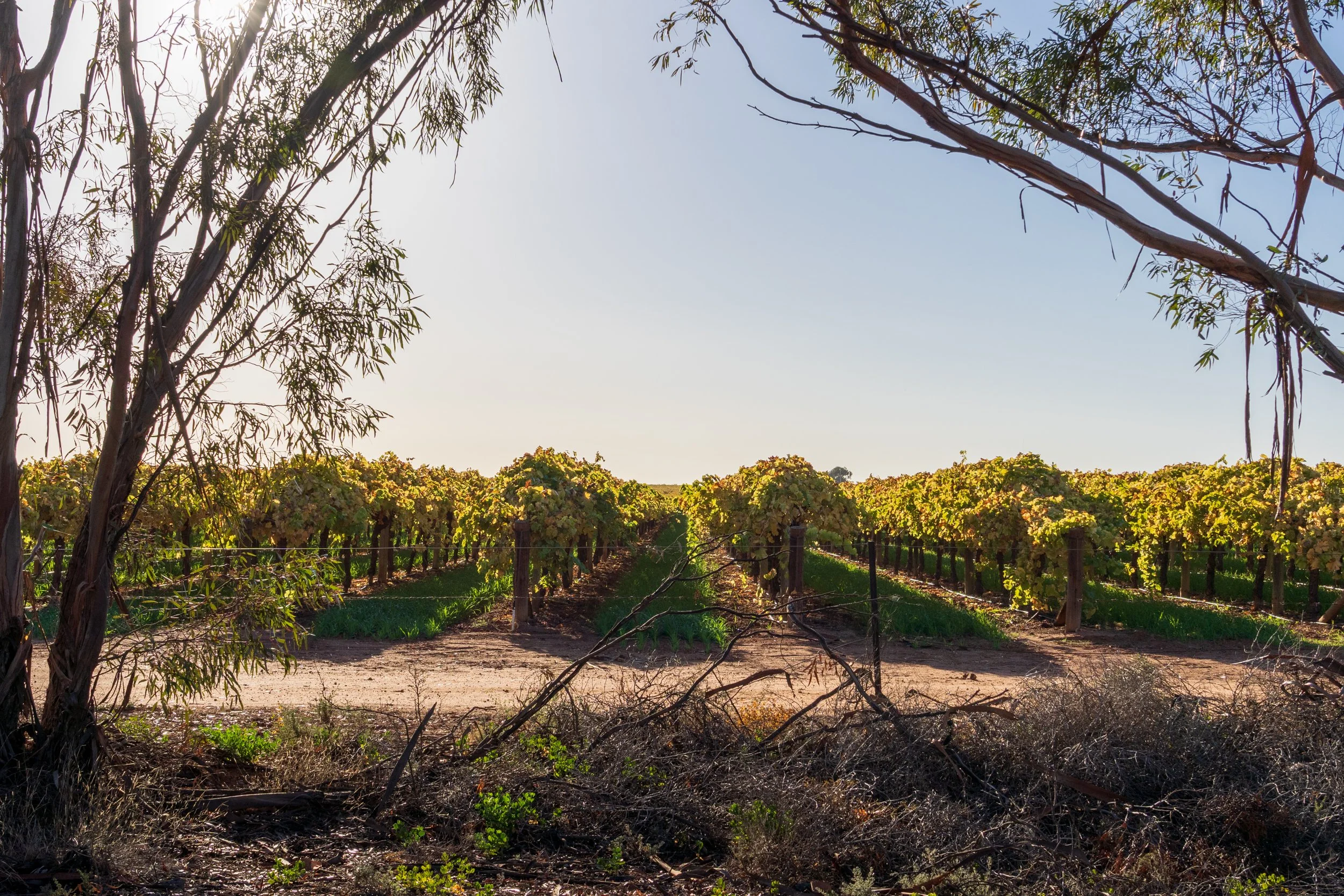
There are few things in the Mallee that are as dominant as the huge expanse of farm land covering the region. The dominant crops are wheat and barley, however alternate crops are developing. The history of farming in the Mallee is fascinating. If you're interested in history, I recommend the book Mallee Country : Land, People, Historyby Richard Broome, Charles Fahey, Andrea Gaynor, Katie Holmes. This book charts the passage of time from pre-white settlement, through colonisation and 'development', waves of settlement driven by failed government policies and poor ecological understanding, the use of fertilisers and chemicals to coax productivity, and into our current era. As you drive north through the region you will notice dark soils give way to red dirt and yellow sand. For the most part you'll see expansive fields of crops, or crop stubble, before you get closer to the border of NSW and vibrant green orchards, vineyards and fields stand in stark contrast to the dry yellow, brown and orange landscape surrounding them. It's incredible to see these little oases nurtured by irrigation and fertilisation in the middle of essentially desert.
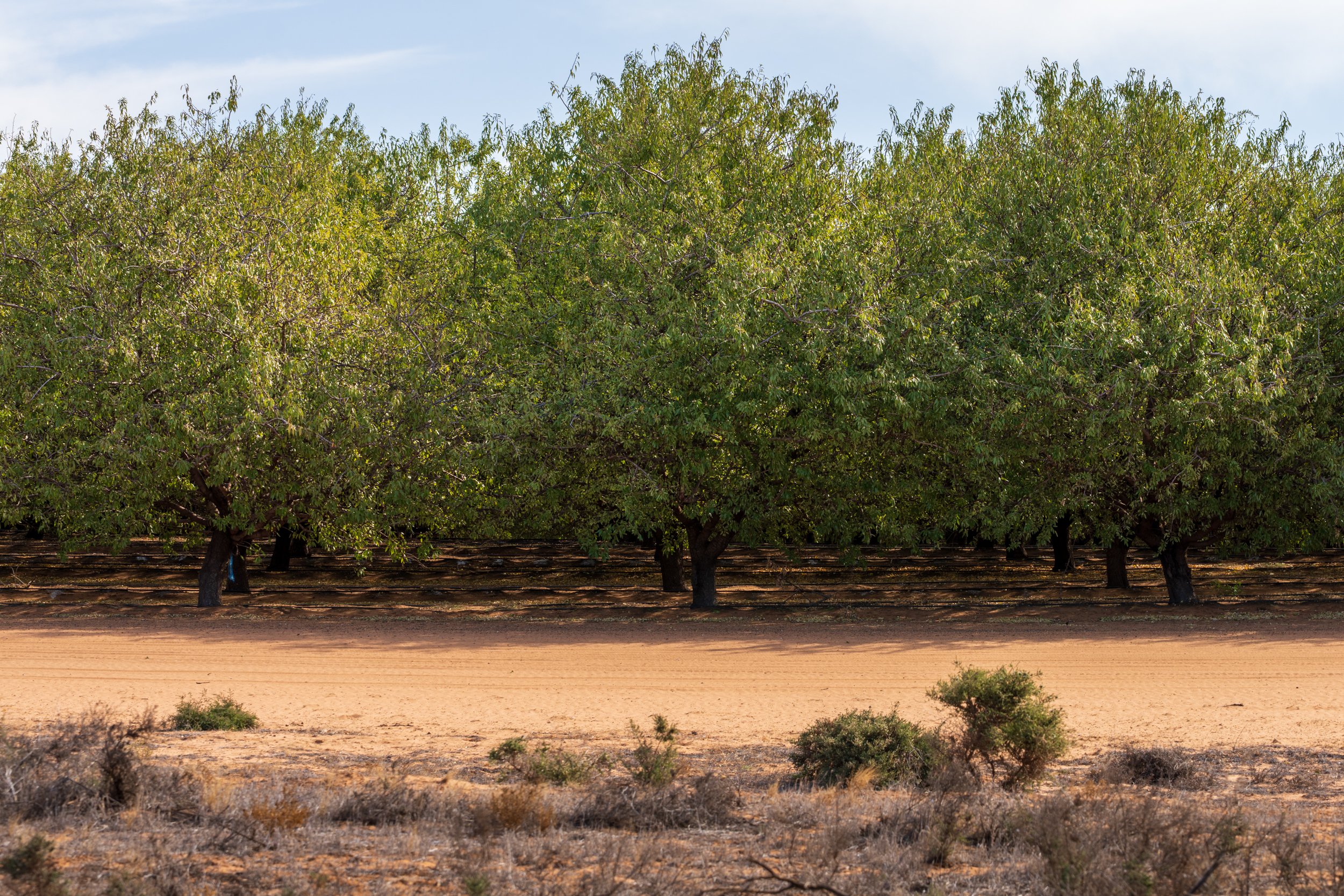
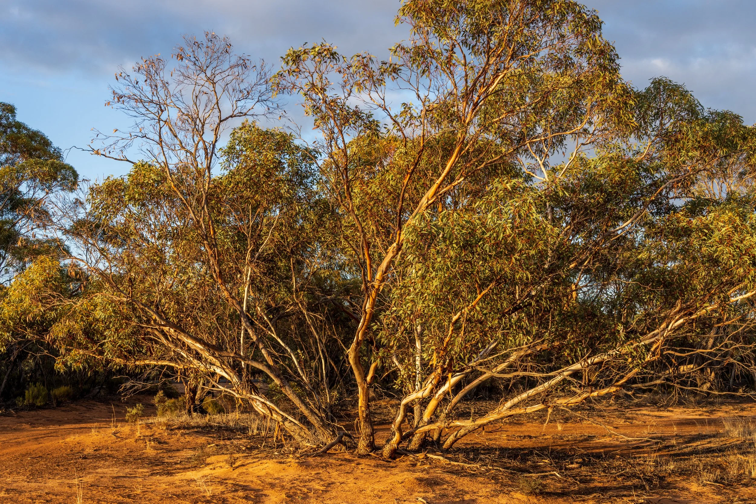
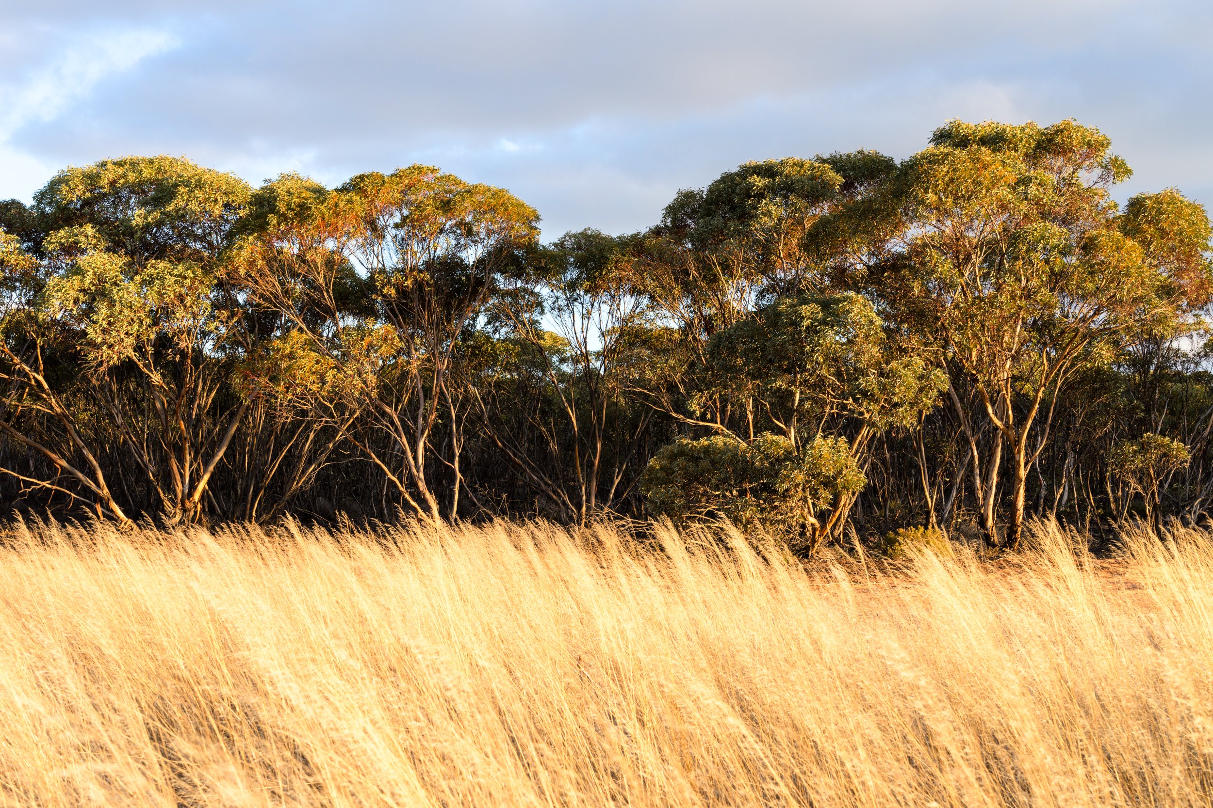
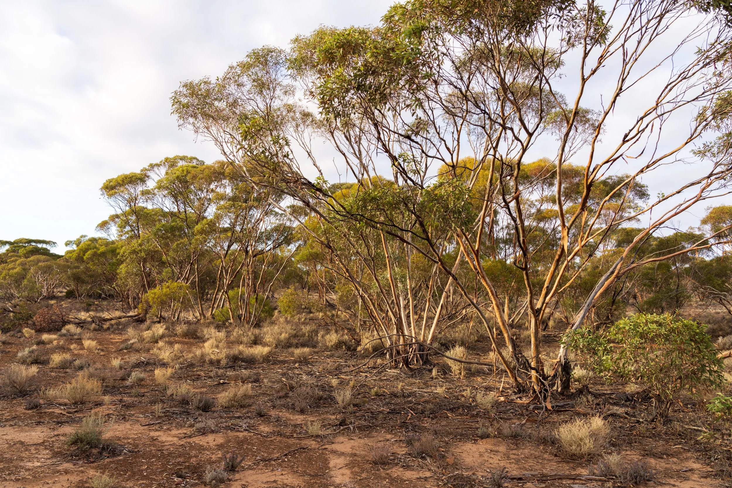
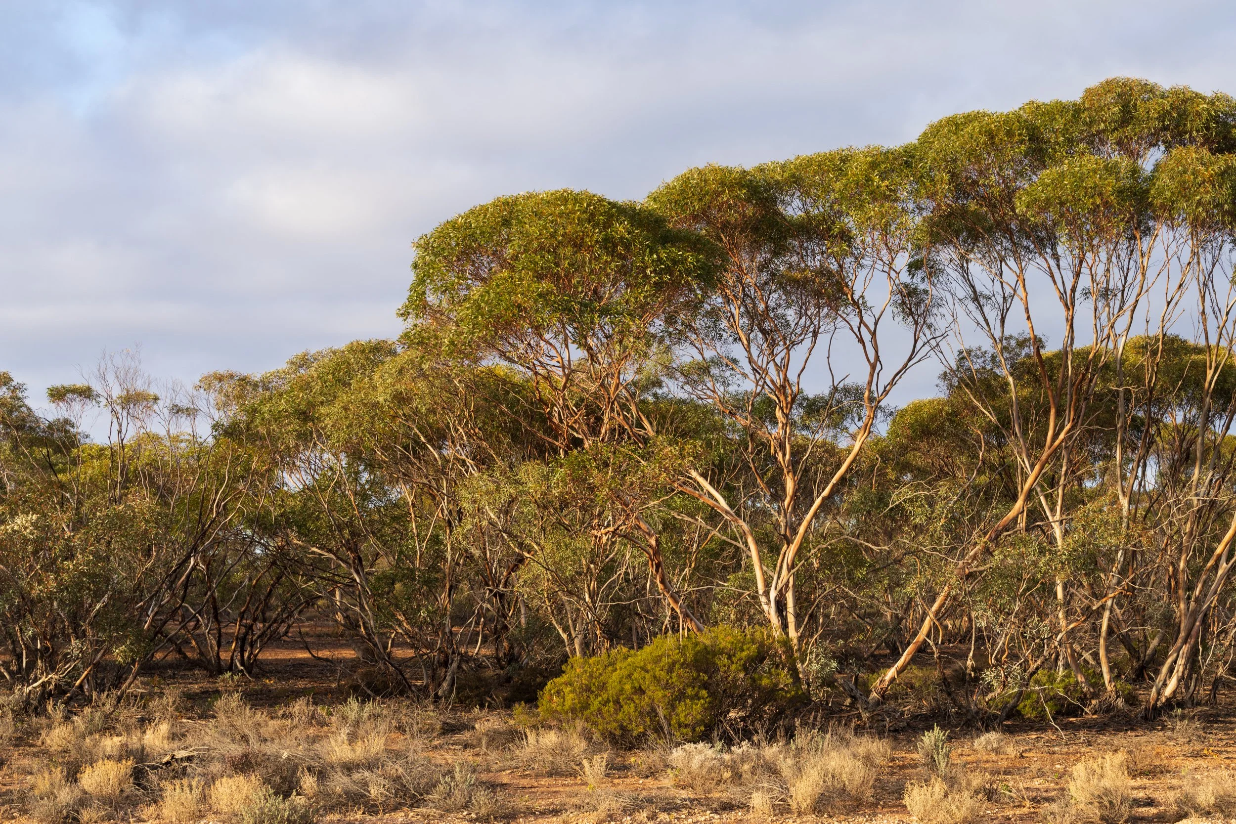
Mallee Eucalypt
This landscape was once dense scrub dominated by Mallee eucalypts, which early settlers cleared along with native fauna and inhabitants. The Mallee stretches across northern Victoria, eastern South Australia and southern New South Wales, with another region in Western Australia.
Mallee trees grow with multiple trunks from a large underground lignotuber, making ploughing extremely difficult. Before mechanisation, removing them was brutal, labour-intensive work. Widespread clearing left light sandy soils unbound, and when the hot Mallee winds blew, massive dust storms followed — sometimes invading homes and coating everything in fine grit. This culminated in the infamous 1983 dust storm that blanketed Melbourne.
Farming practices have since improved. Today you’ll see crop stubble left to stabilise soil, fallow fields protected from erosion, and clover planted to restore fertility.
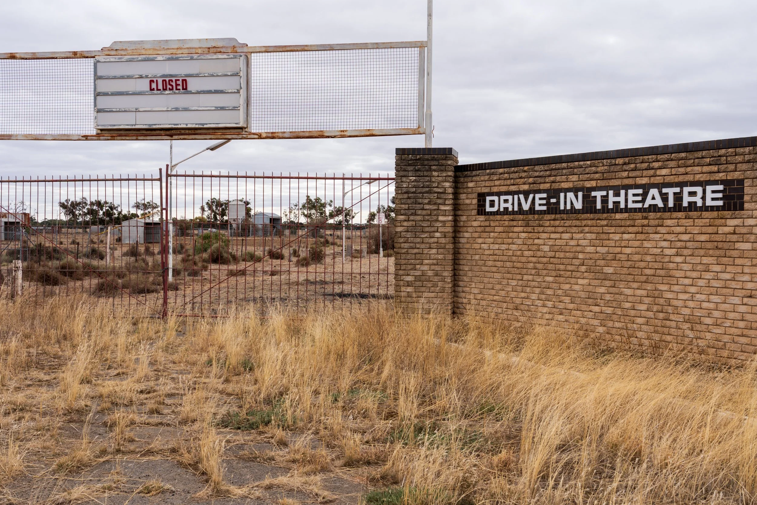
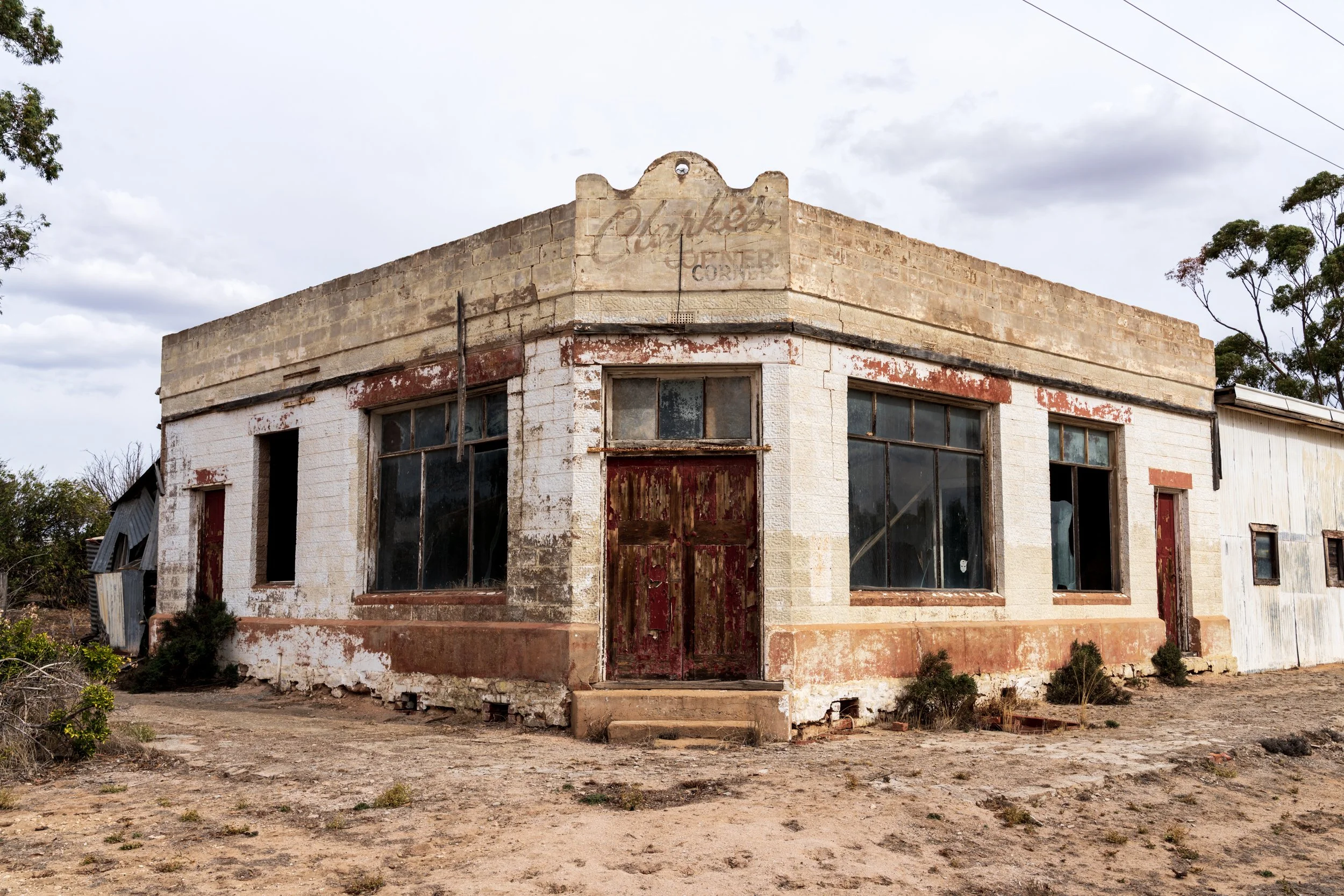
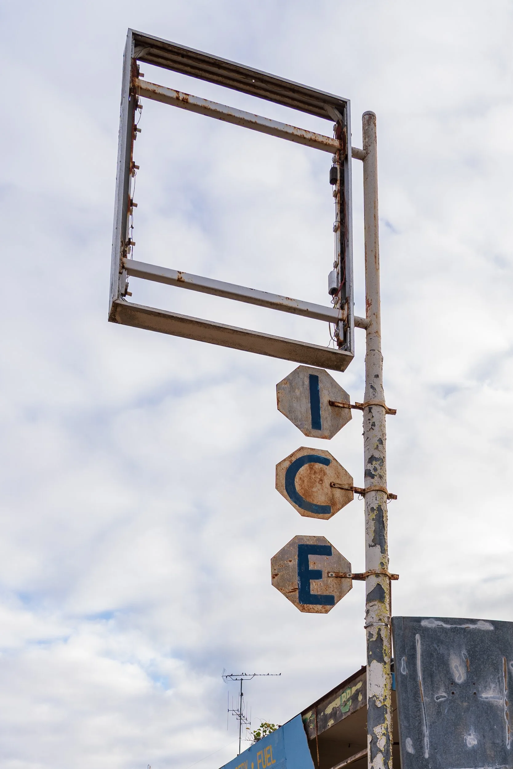
Rural Towns
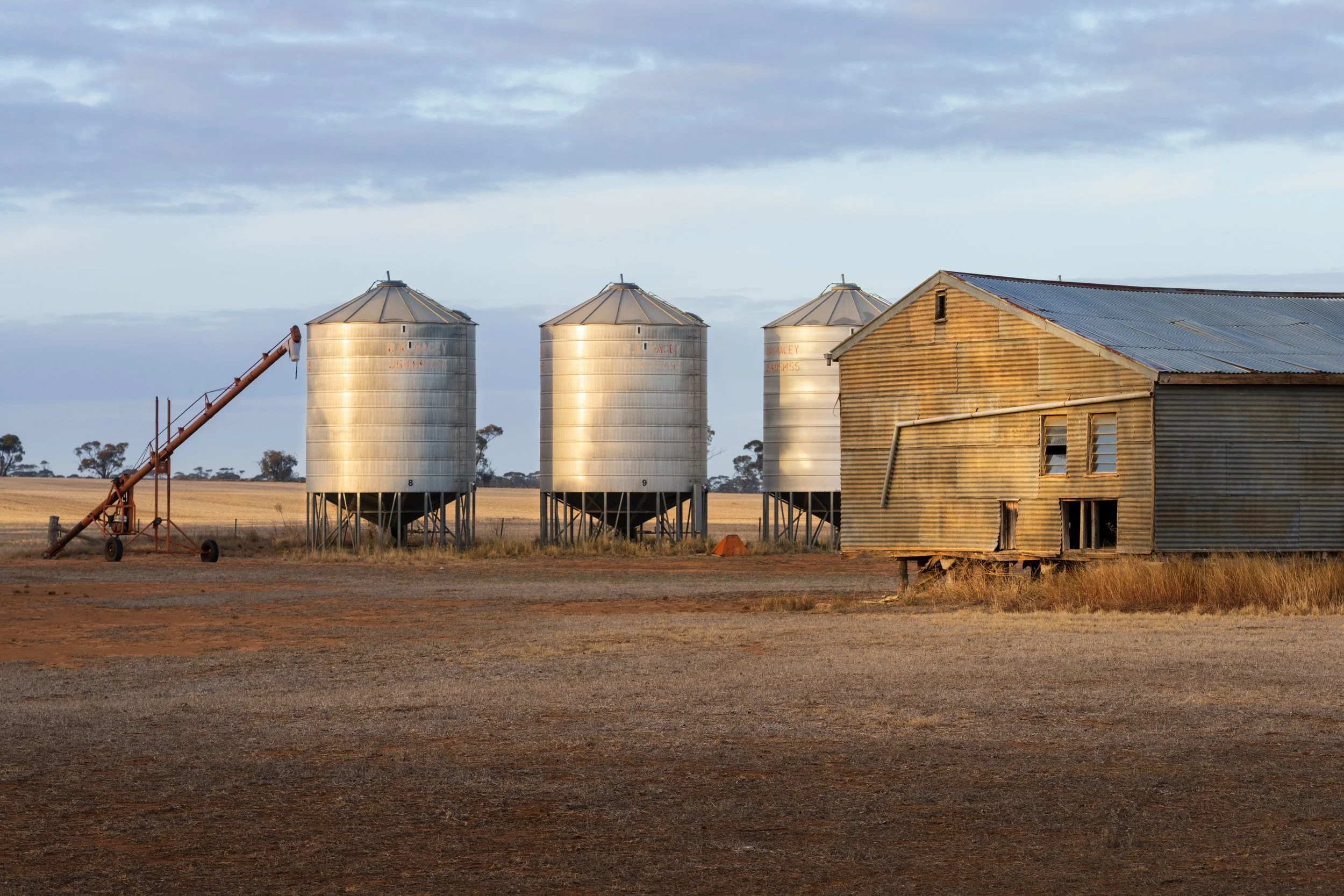
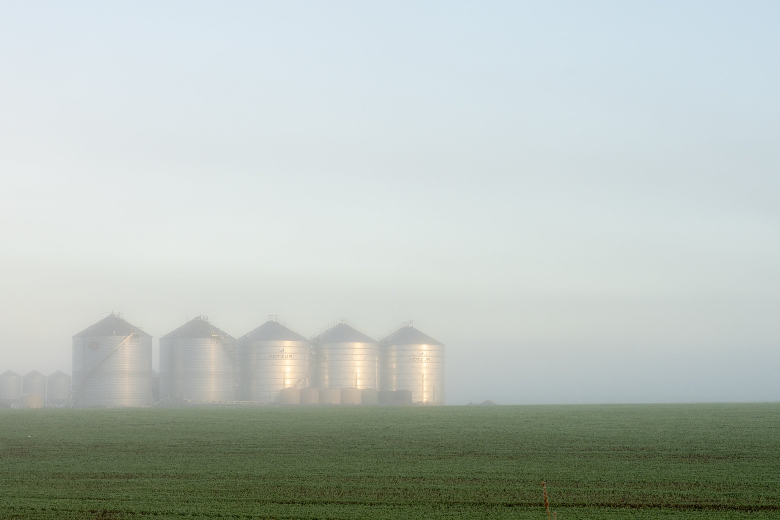
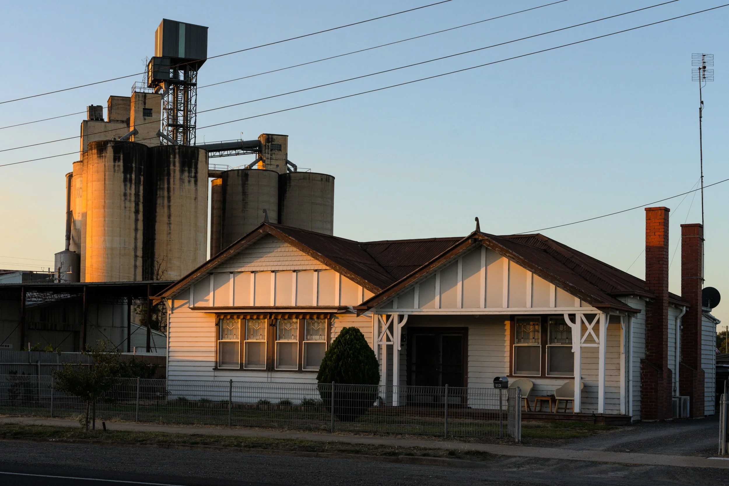
What fascinates me most about the Mallee is how its towns are changing. Small settlements are fading as family farms merge into large agri-businesses, shifting life toward bigger regional centres. I’m drawn to the tension between everyday life lived in the shadow of towering grain silos, and the abandoned buildings left behind as communities move on.
I photograph these places to honour what they once held — the hopes of towns now quiet, while new stories are written elsewhere. It’s a personal lens, and only one side of the story. The Mallee is also full of strong, vibrant towns, beautifully kept historic buildings, rich hospitality and pride. I encourage you to go visit some of these towns to discover them for yourself.
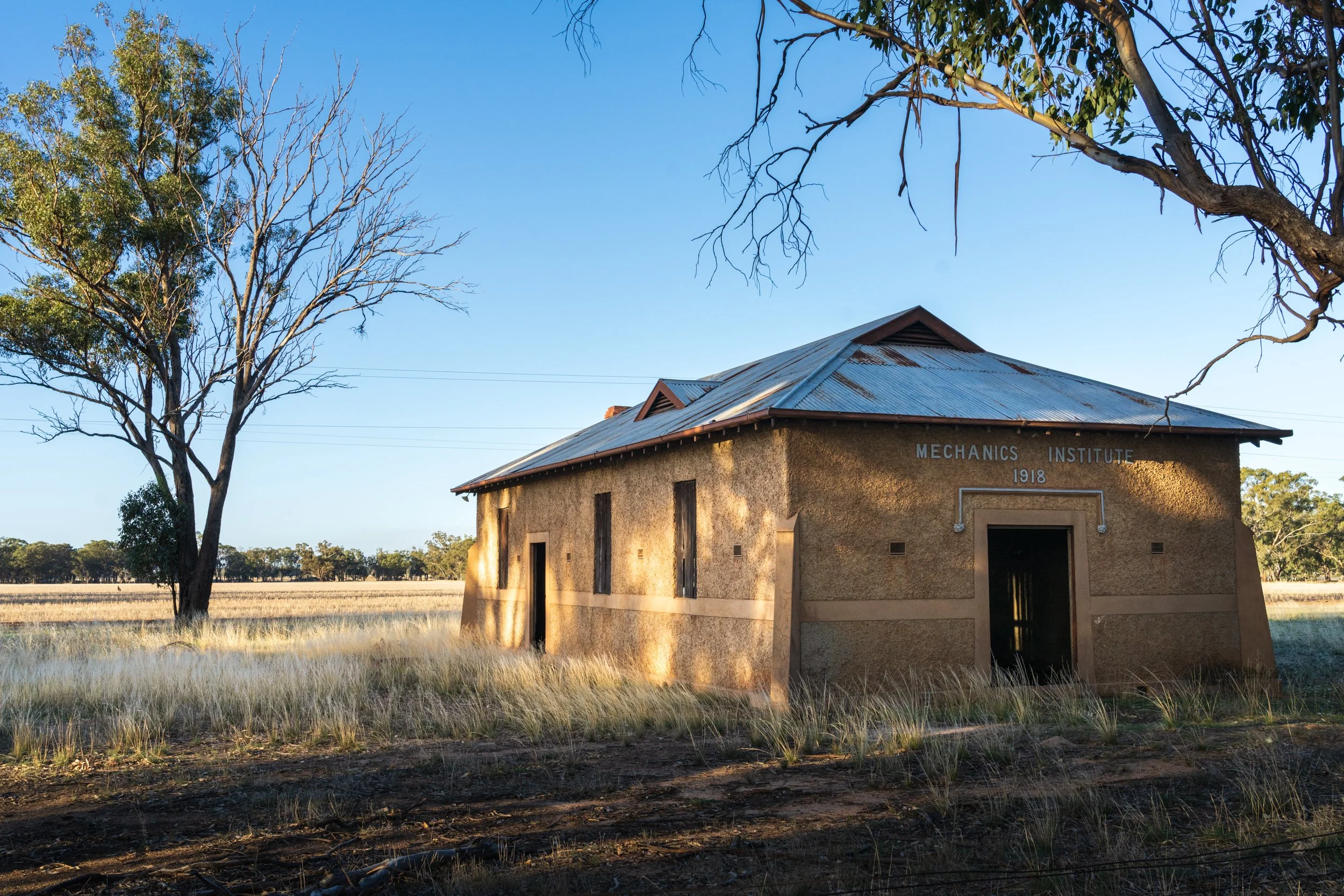
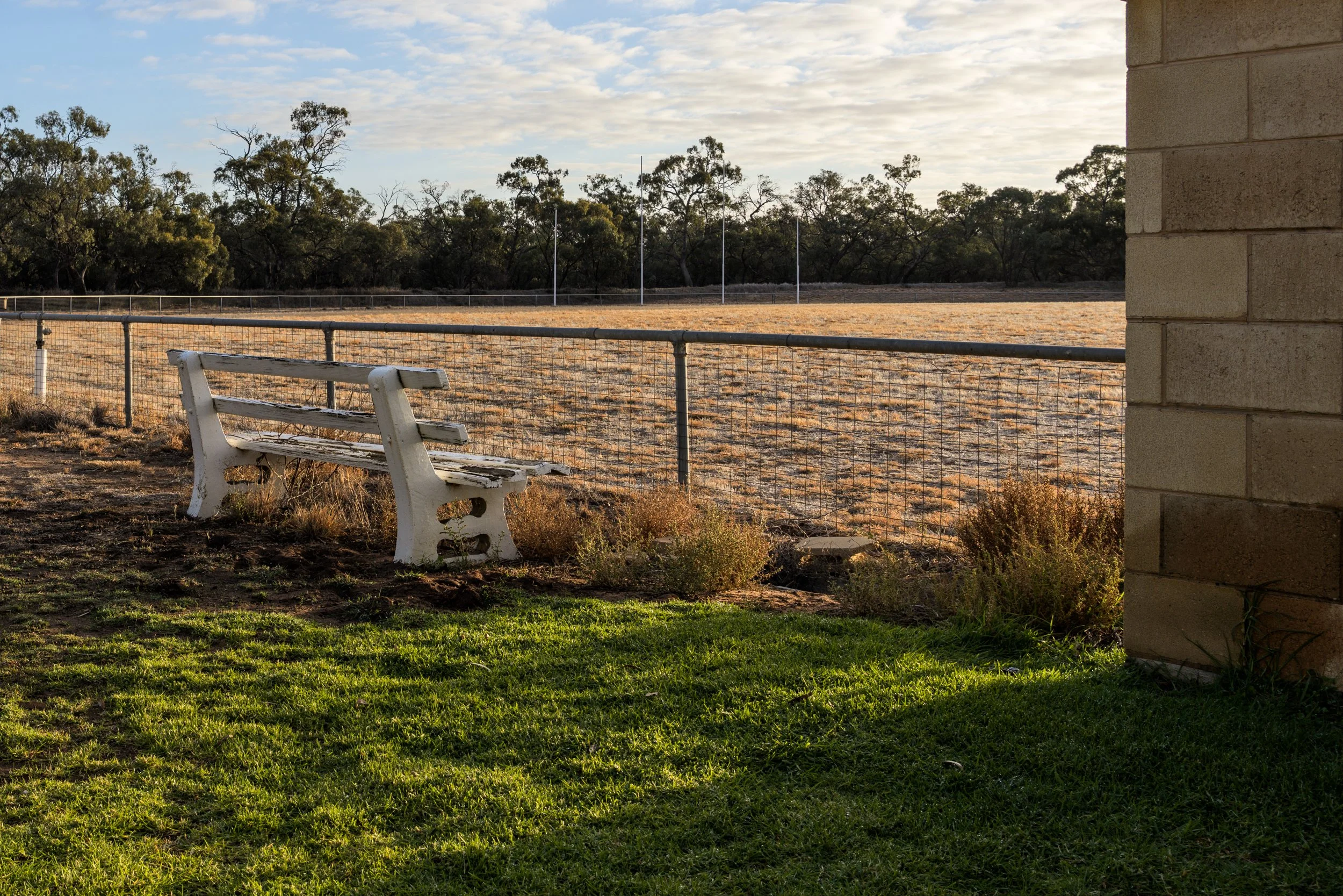
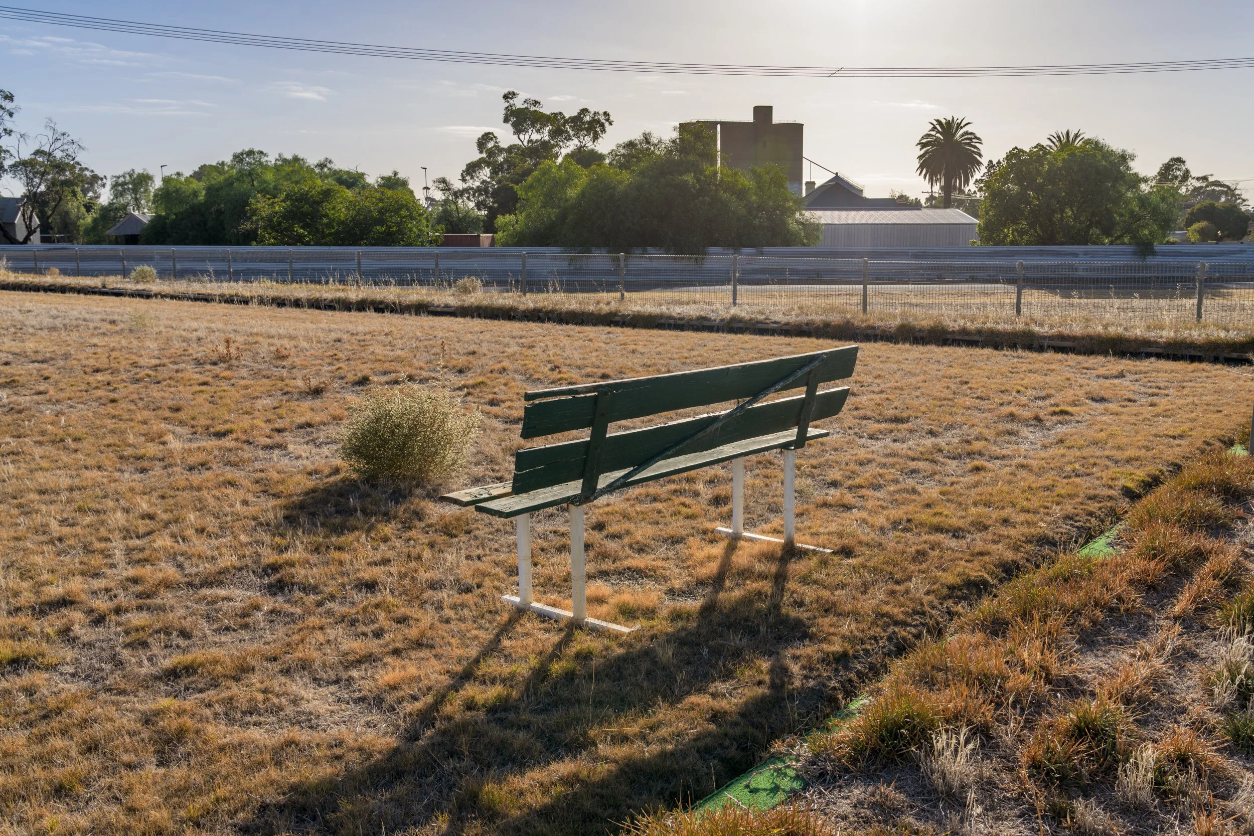
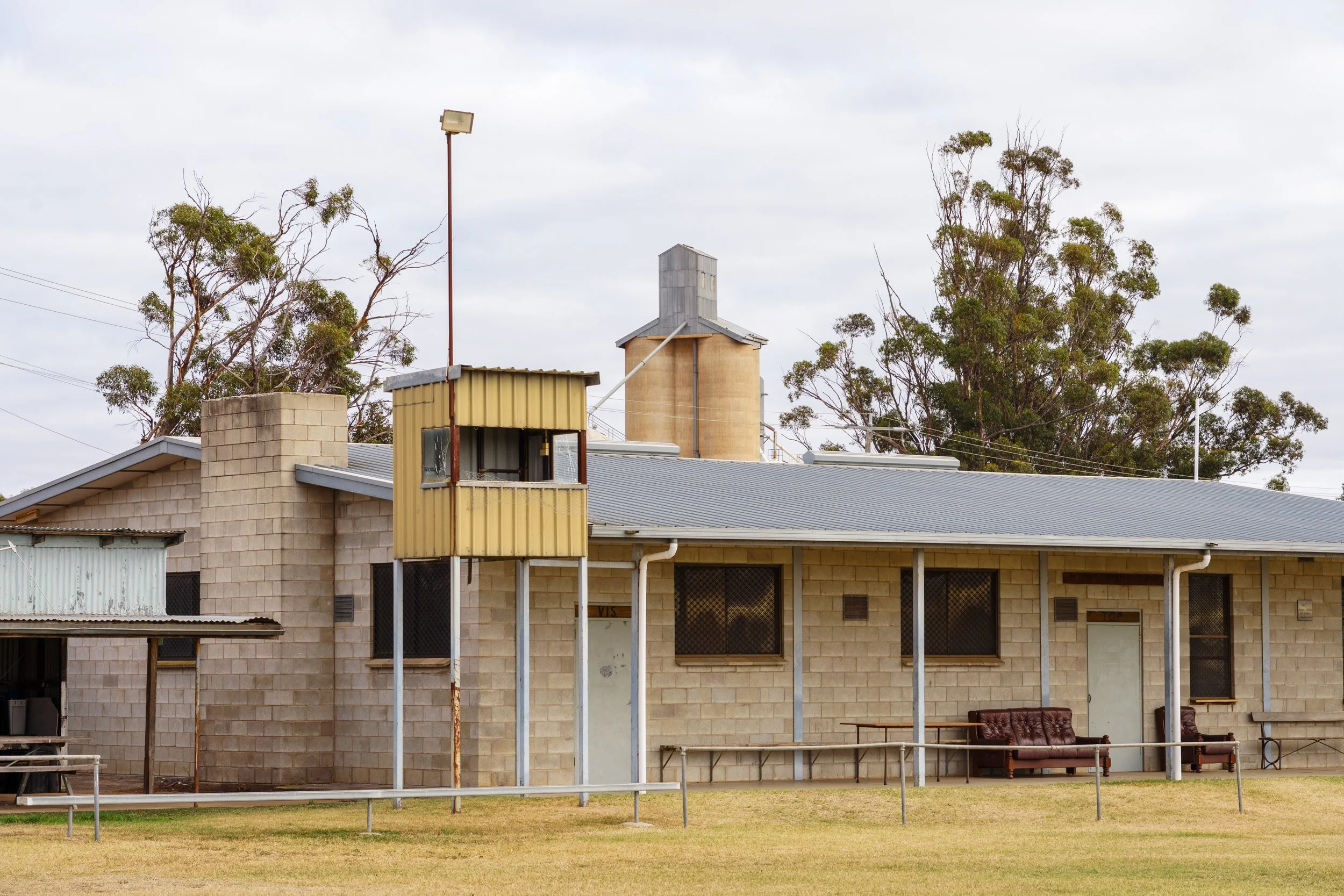
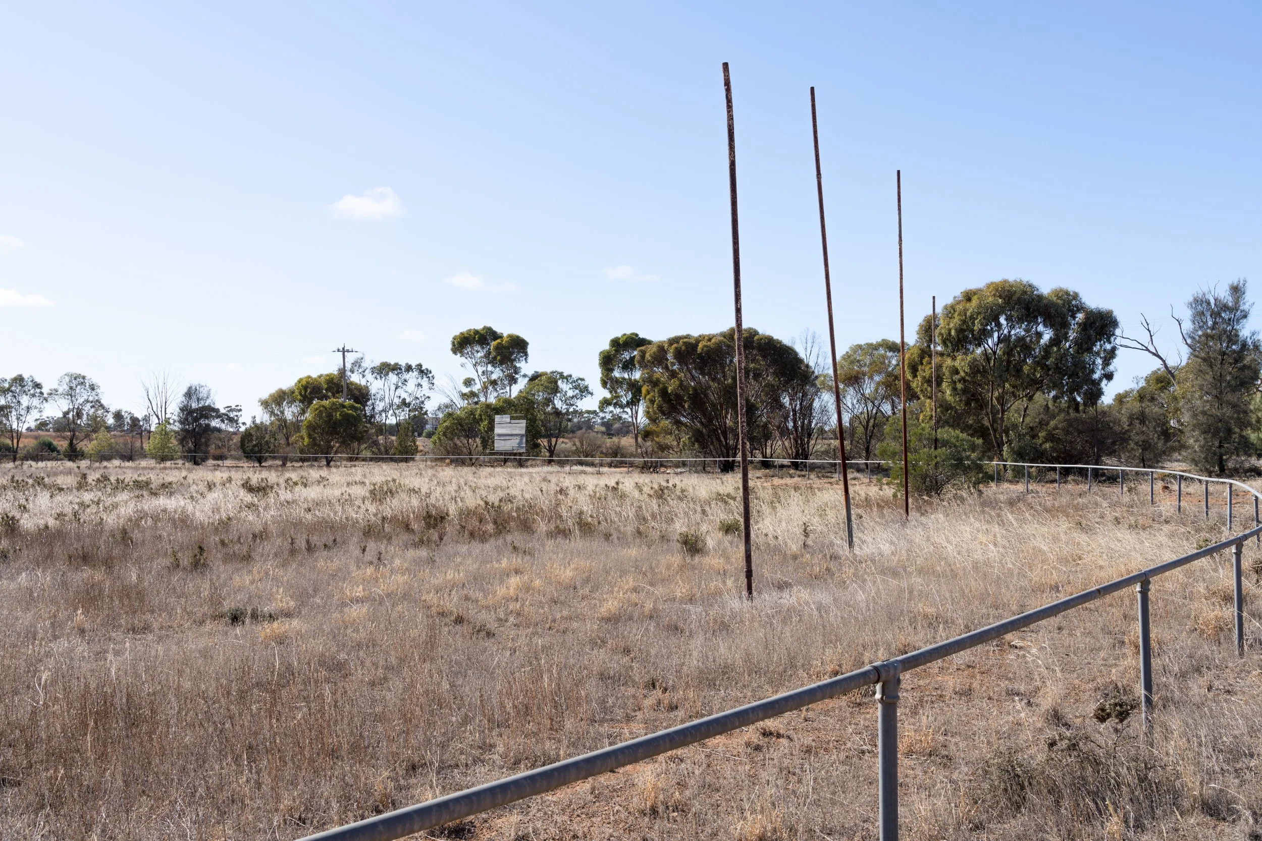
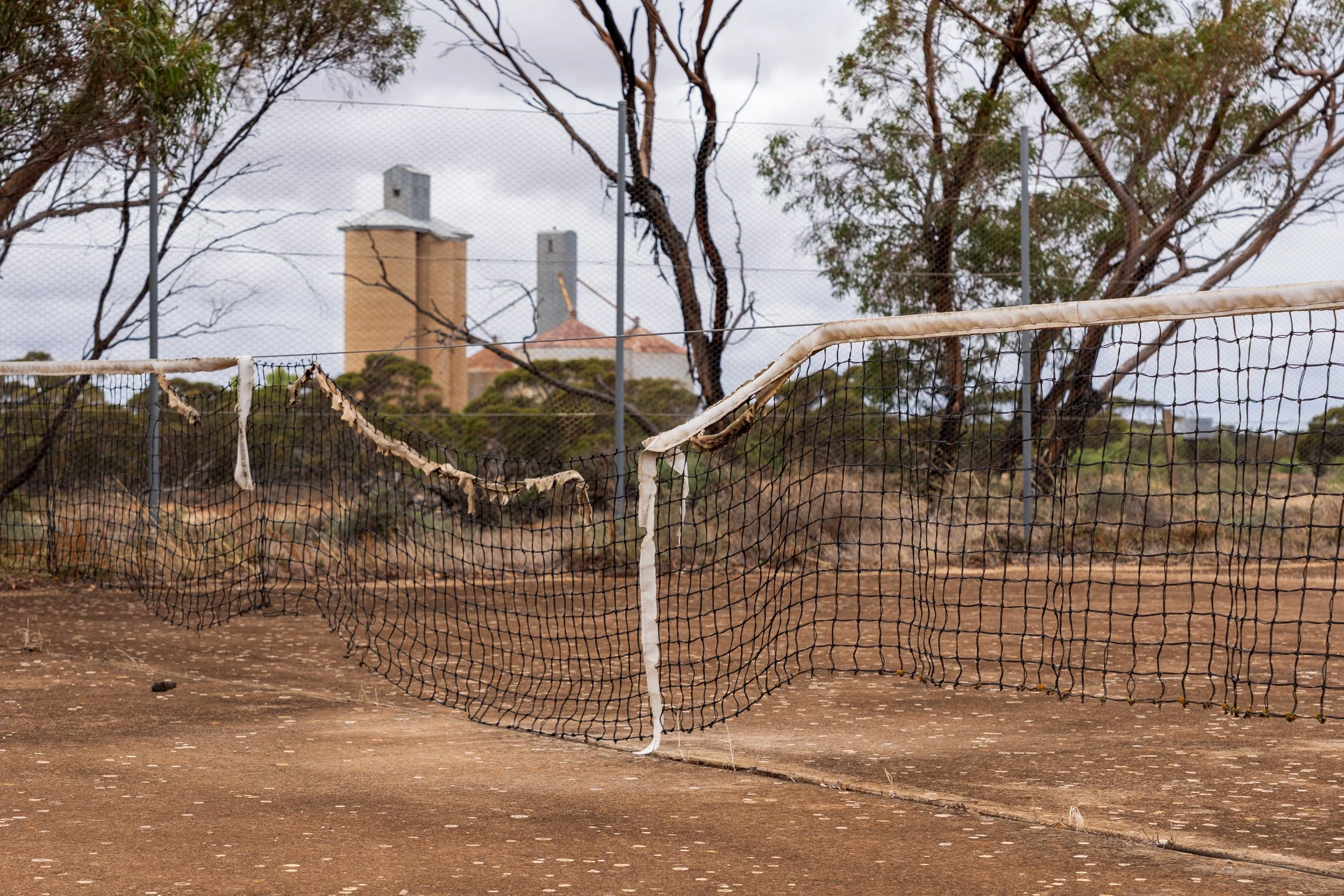
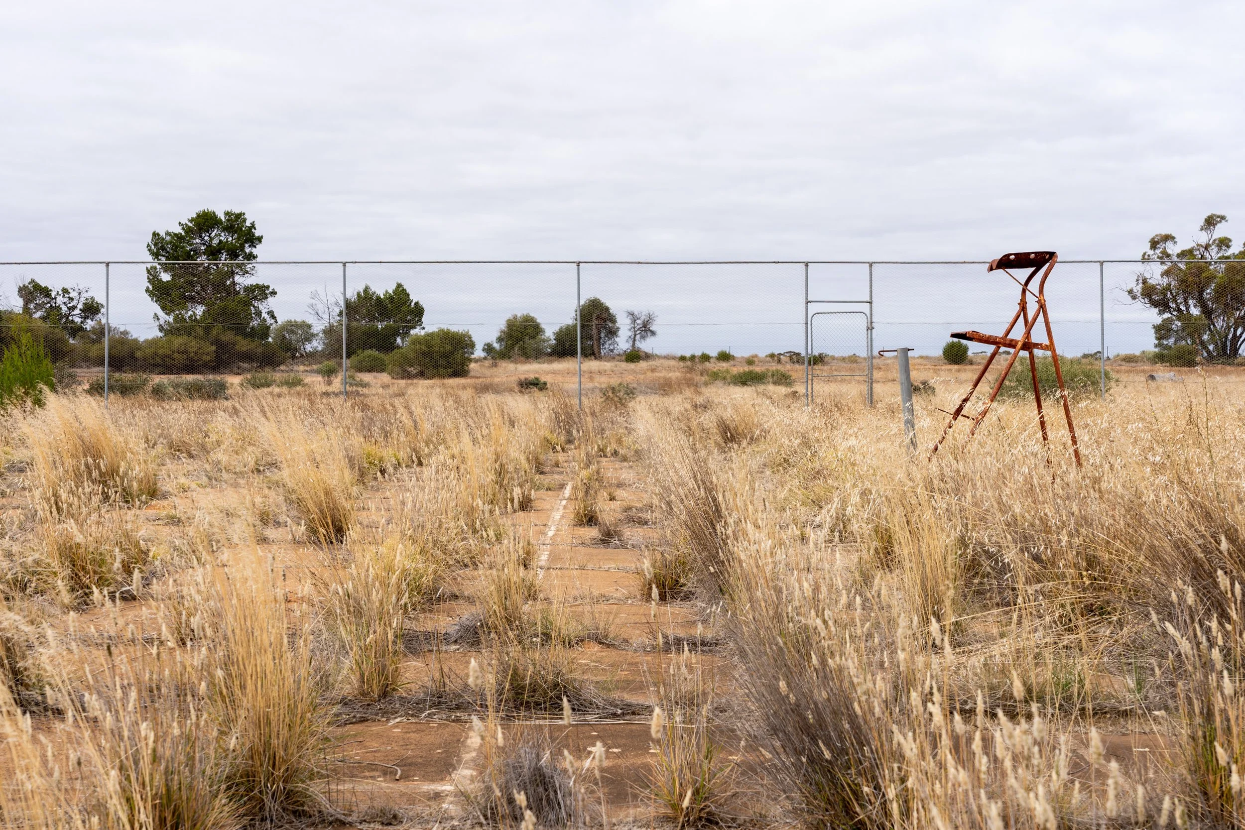
RECREATION GROUNDS
Like I've been drawn to capture the buildings that have been left to fallow, I've also found myself drawn to recreational spaces for the same reasons. The ubiquitous footy oval, tennis court and bowls clubs are hallmarks of a town that has the population, community and commercial success necessary to support them. I find those that have been left to nature to be strangely beautiful. Now empty and being reclaimed, or still being maintained, but again in the shadow of the grain silo. Again this is the view that appeals to me, in larger towns you'll find shining new bowling greens with modern facilities, bright green ovals, netball courts and tennis courts that are spotless and covered with the latest high tech surfaces. I'm drawn to the older places.
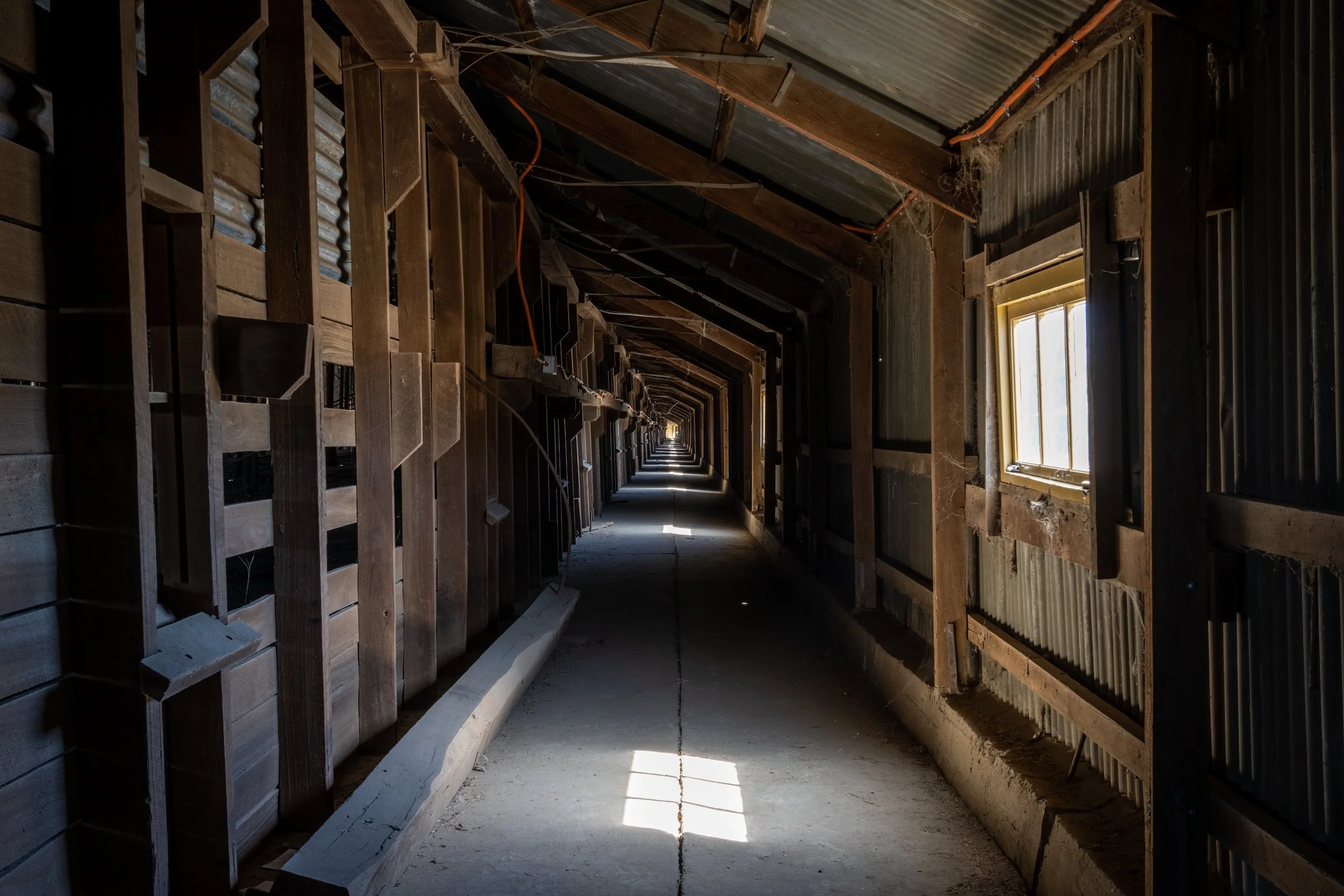
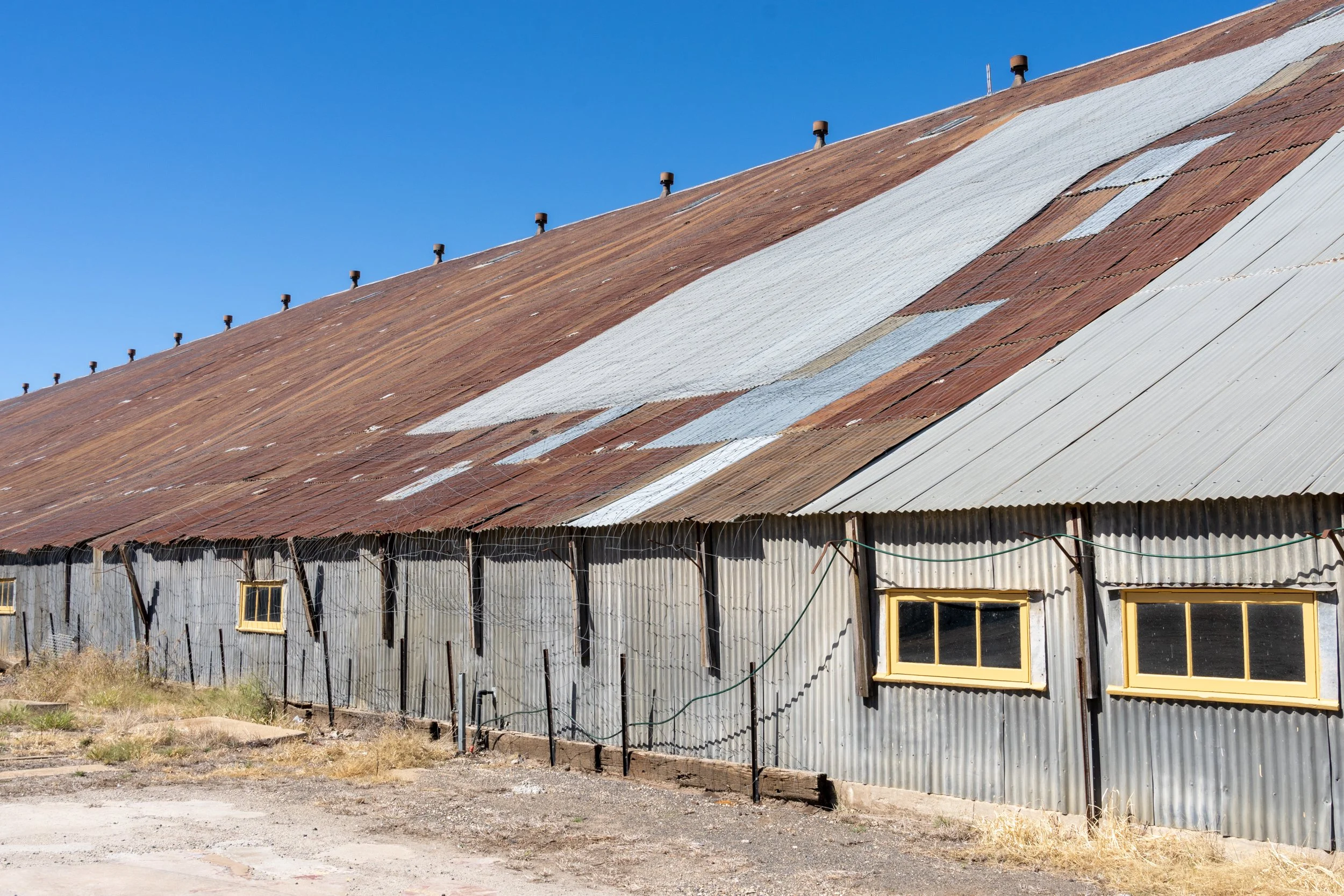
The Murtoa Stick Shed
The Murtoa Stick Shed is pretty amazing. From thestickshed.com.au :
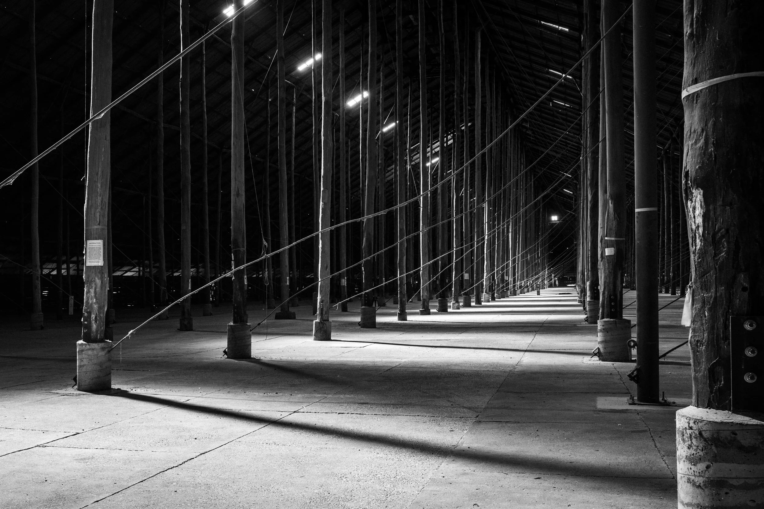
The Stick Shed (previously known as the Murtoa No. 1 Grain Store) is the only remaining emergency grain store built during World War Two. This structure is an enduring testament to iconic Australian bush ingenuity and a symbol of the growth and strength of the Australian wheat industry. The Stick Shed is the 101st place included in the National Heritage List. Completed in 1942, the unique and dramatic structure of The Stick Shed has captured the imagination of everyone who has seen its serene and evocative cathedral-like interior. Referred to by some as the ‘Cathedral of the Wimmera’. The Murtoa Stick Shed’s ghostly unmilled tall timber poles and central aisle draw the eye upward towards the roof as light spills into the space through skylights as if through a stained-glass window.
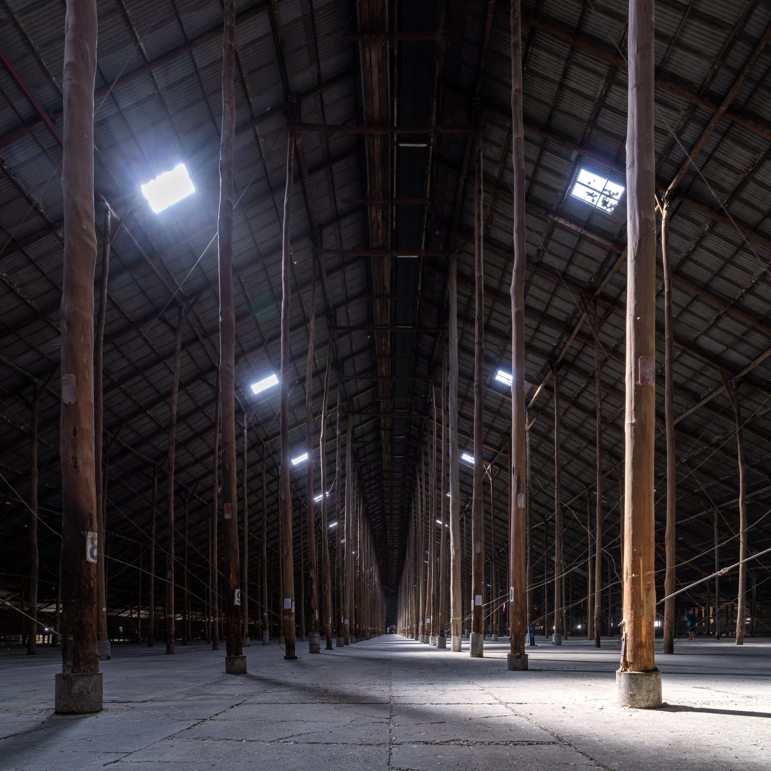
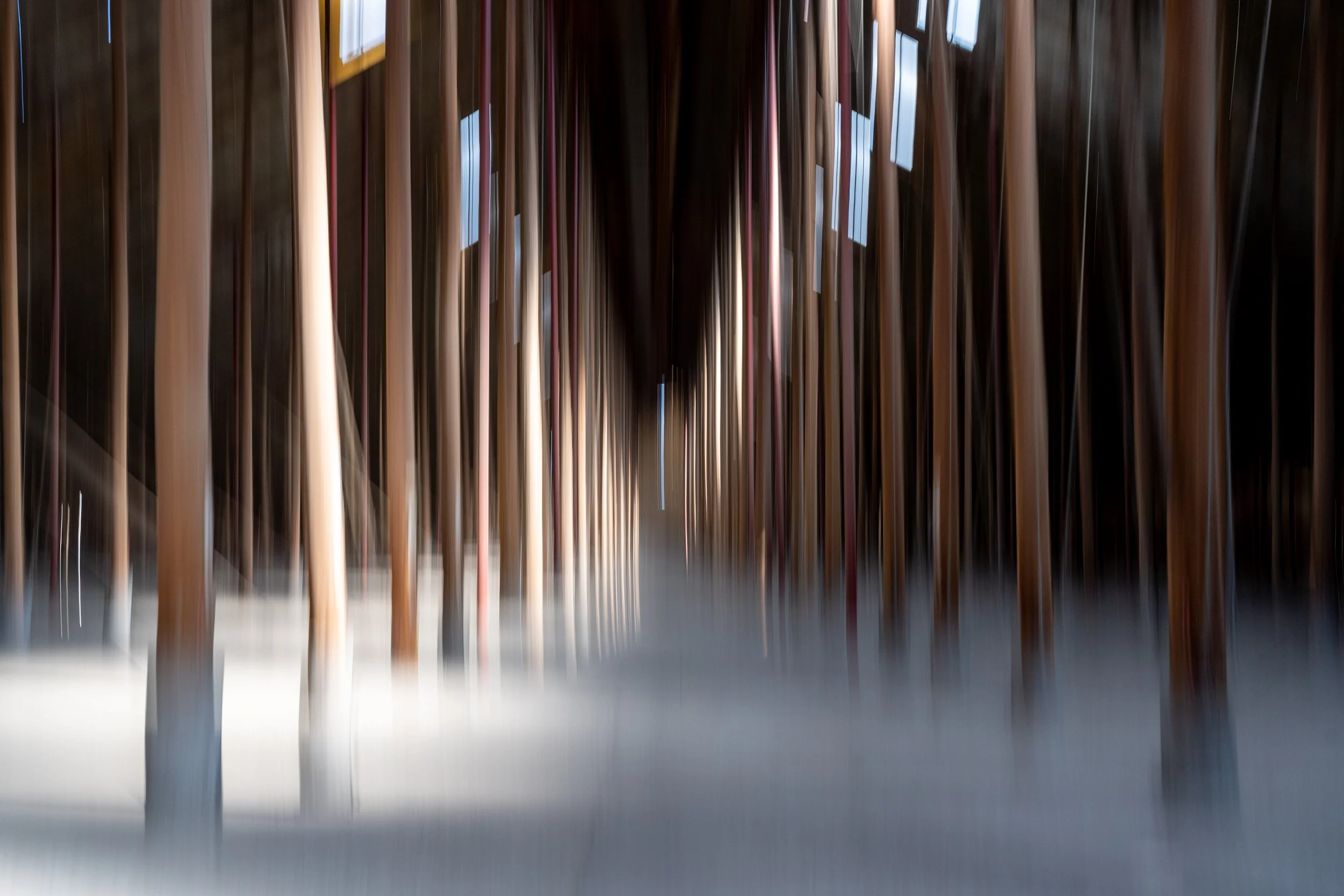
Inside it's a pretty incredible structure, and it's massive. The logs used inside come from the Dandenongs, and tower overhead, disappearing into the darkness. The images below were taken mid-afternoon, I'd like to visit again and spend a little more time, as I think there are some really interesting compositions and details that I could capture next time. This space is very dark, so a tripod and slow shutter speed is your friend here. Otherwise you may need to crank up your ISO to avoid an unmanageably slow shutter speed.
Black and white would be pretty amazing here with such strong contrasts between light and dark. As there are such strong geometric forms, playing with intentional camera movement could yield some interesting results.
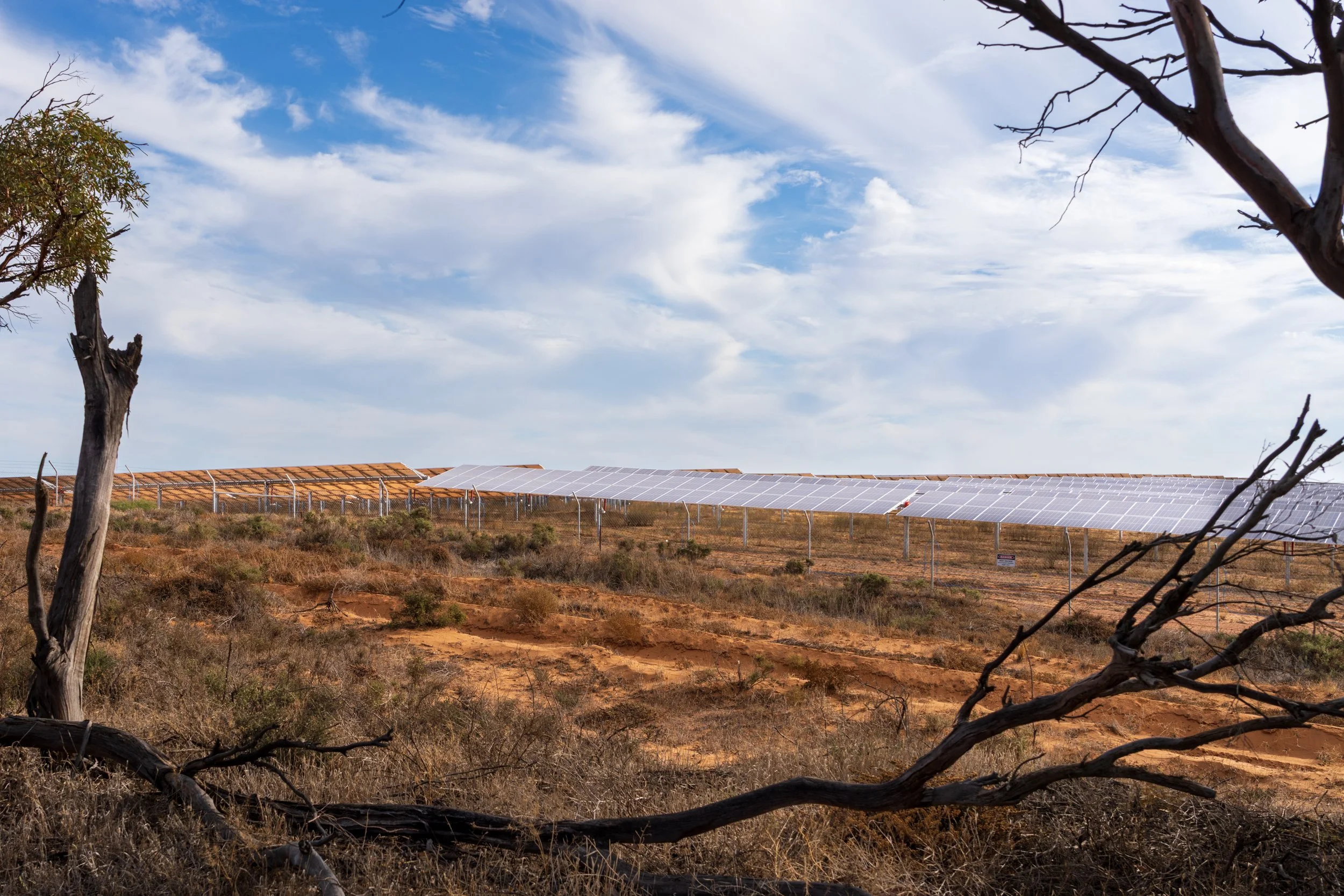
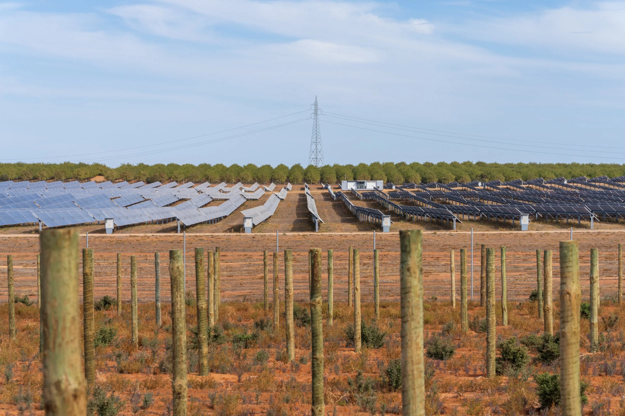
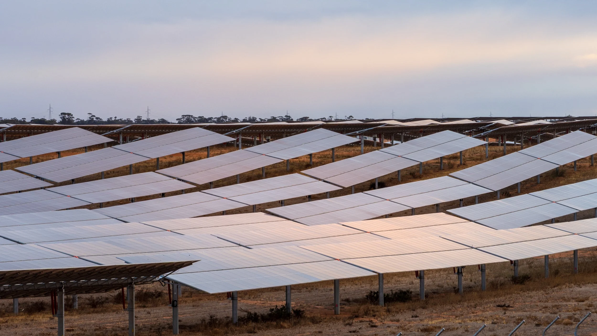
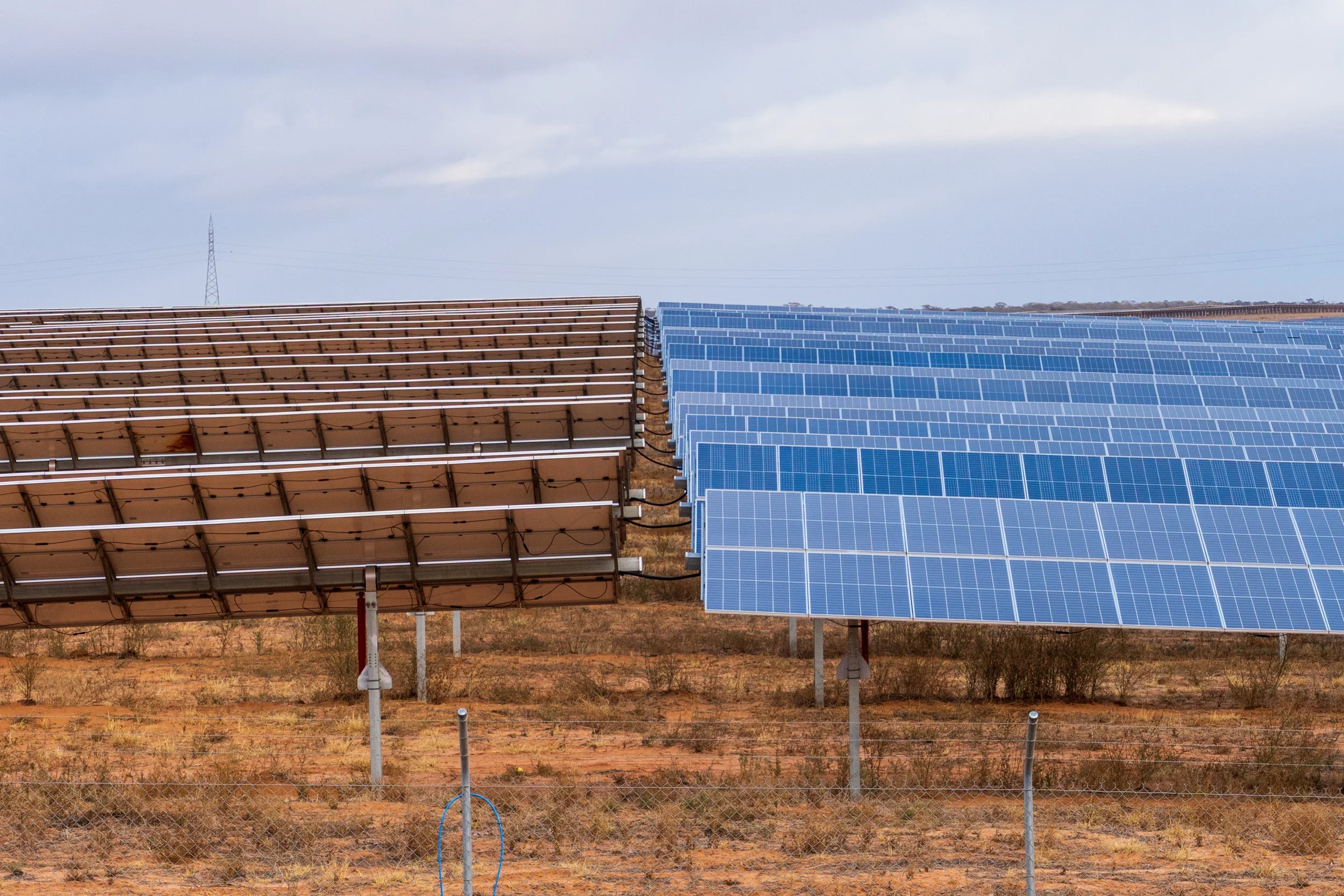
SOLAR FARMS
I'm quite taken by by concept of energy generation in the landscape. Whether this is a coal fired power station, a wind farm or a solar farm, I find these places absolutely irresistible. These vast spaces standing out in the landscape, the ingenuity of man and our ability to wrest power from nature. When I see older power plants I see invasive, dominant and massive structures dominating the landscape. When I see wind turbines and solar farms I see our push to use what is freely available to us, an effort to apply technology in concert with nature. In this landscape, rows and rows of solar panels alone in the red dirt, or alternating between vineyards and orchards. I feel like we are starting to live in a brighter future.
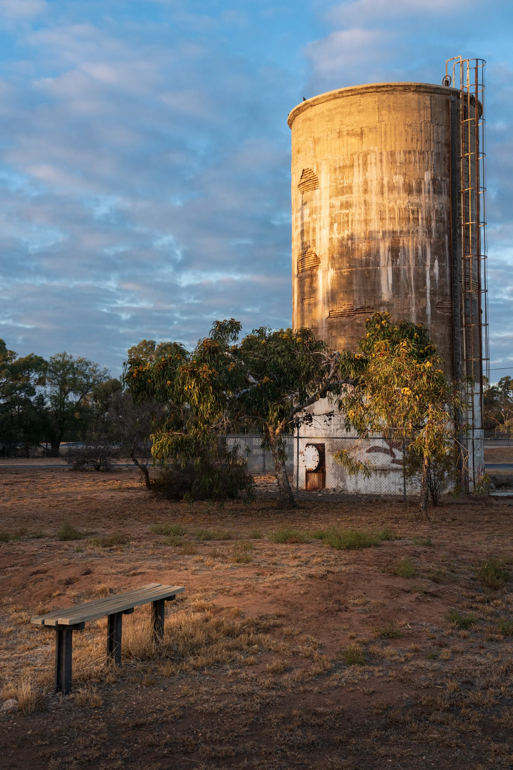
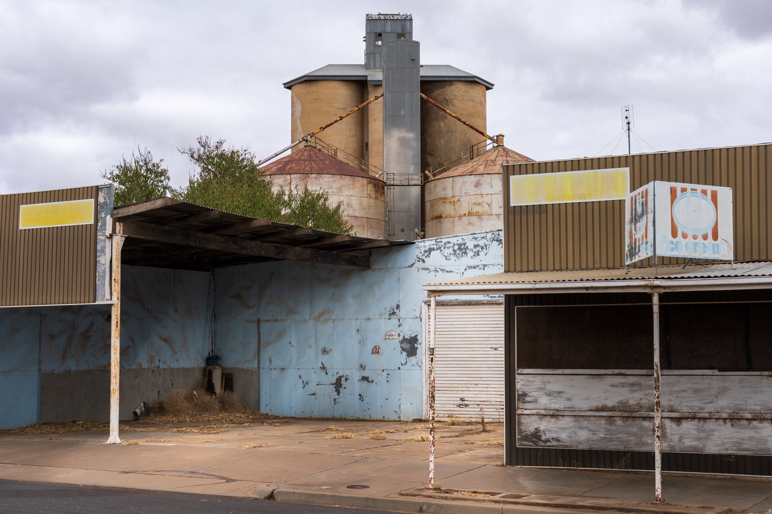
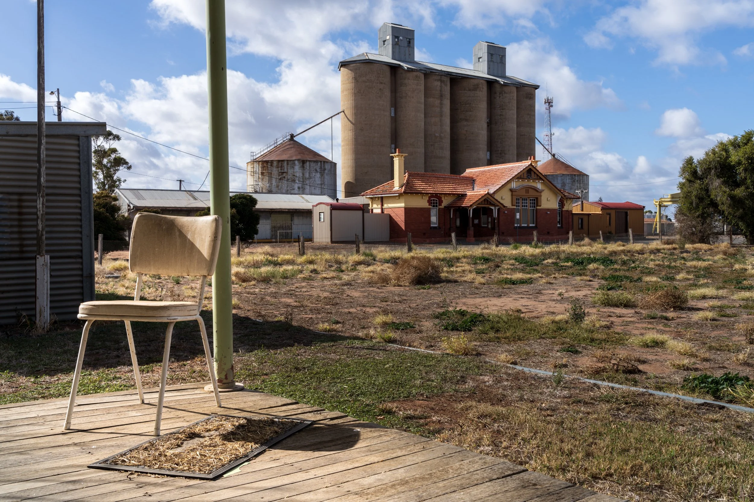
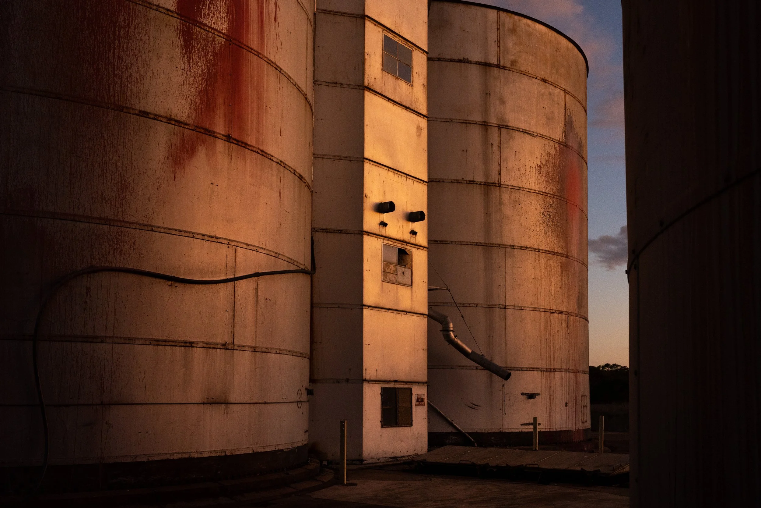
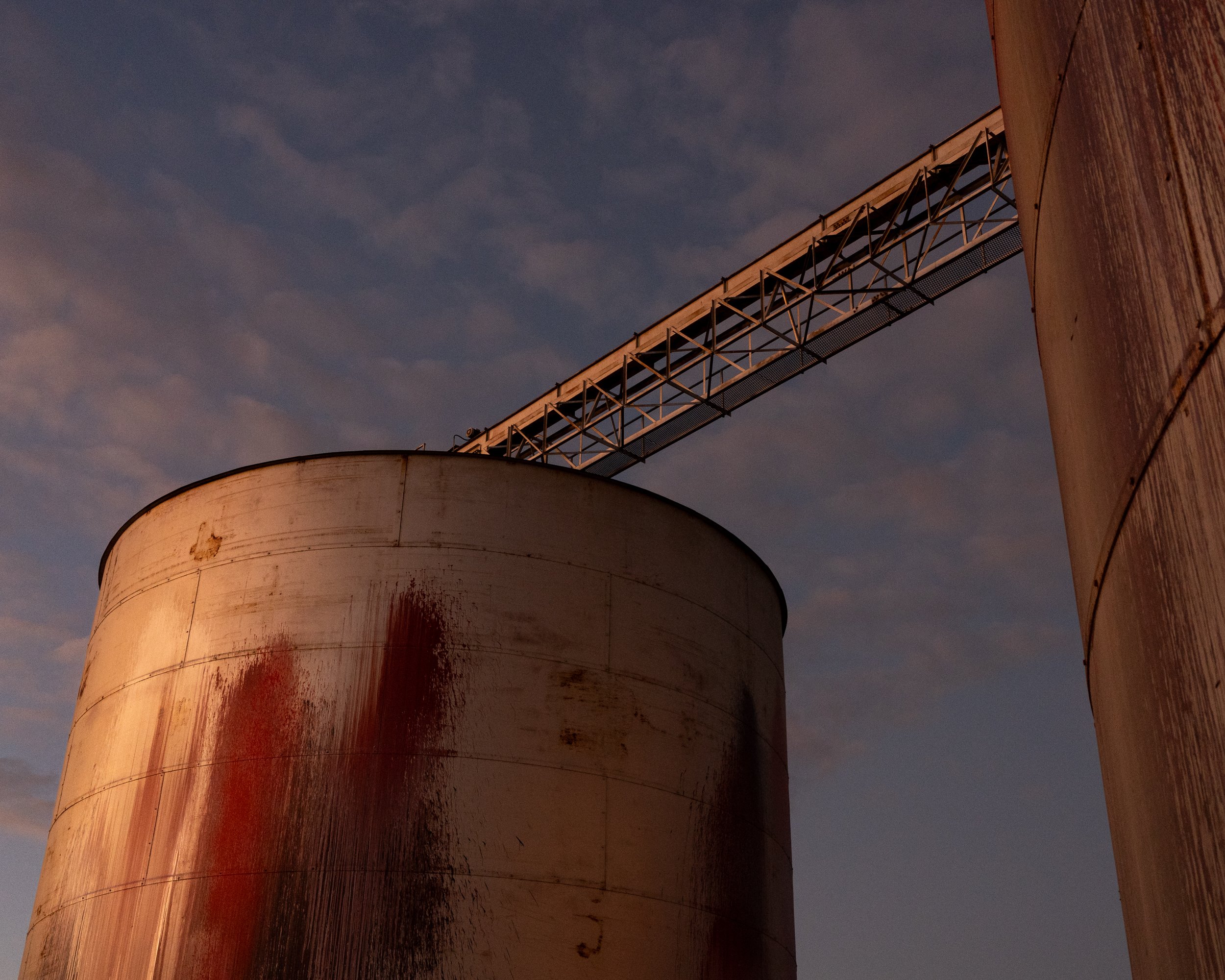
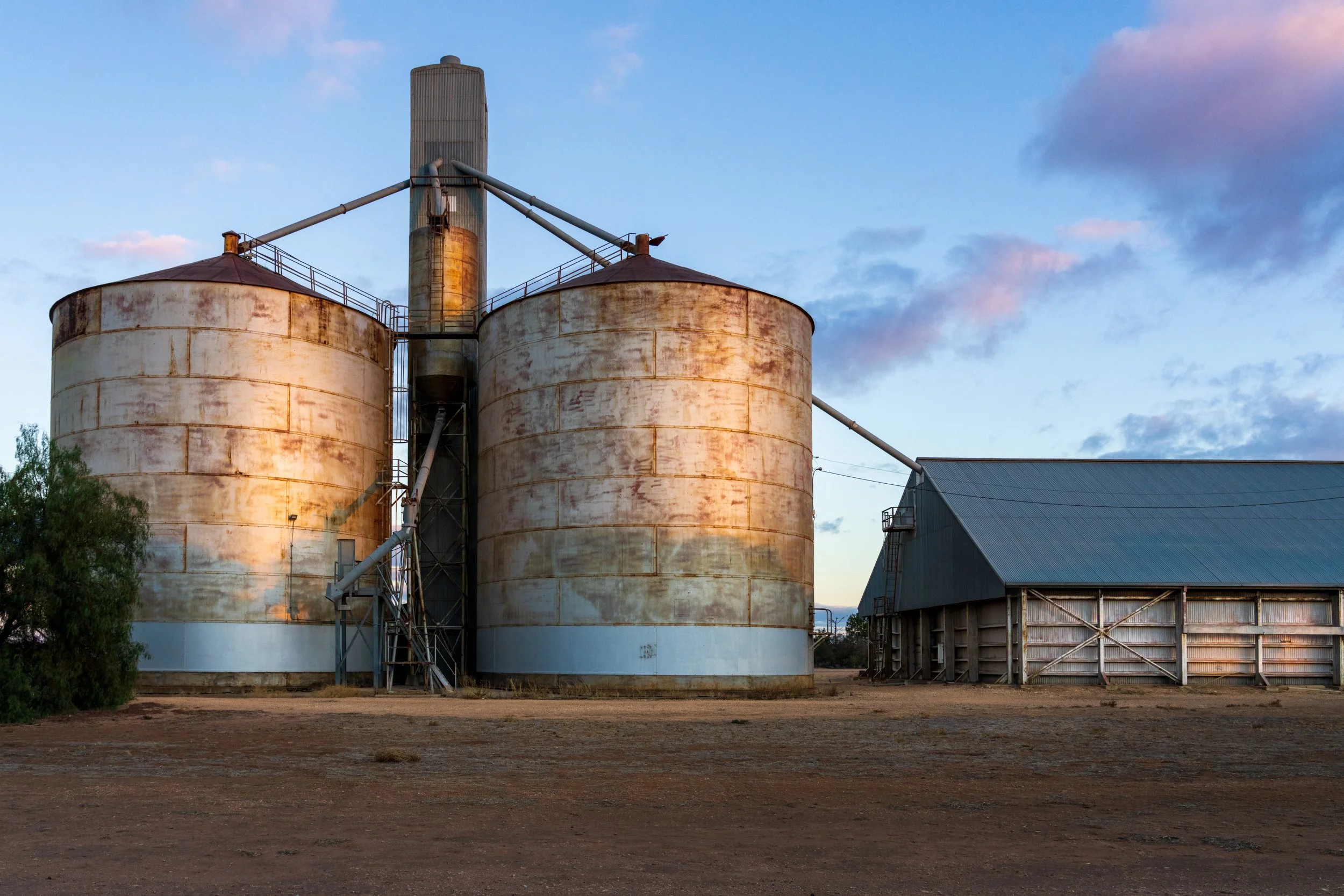
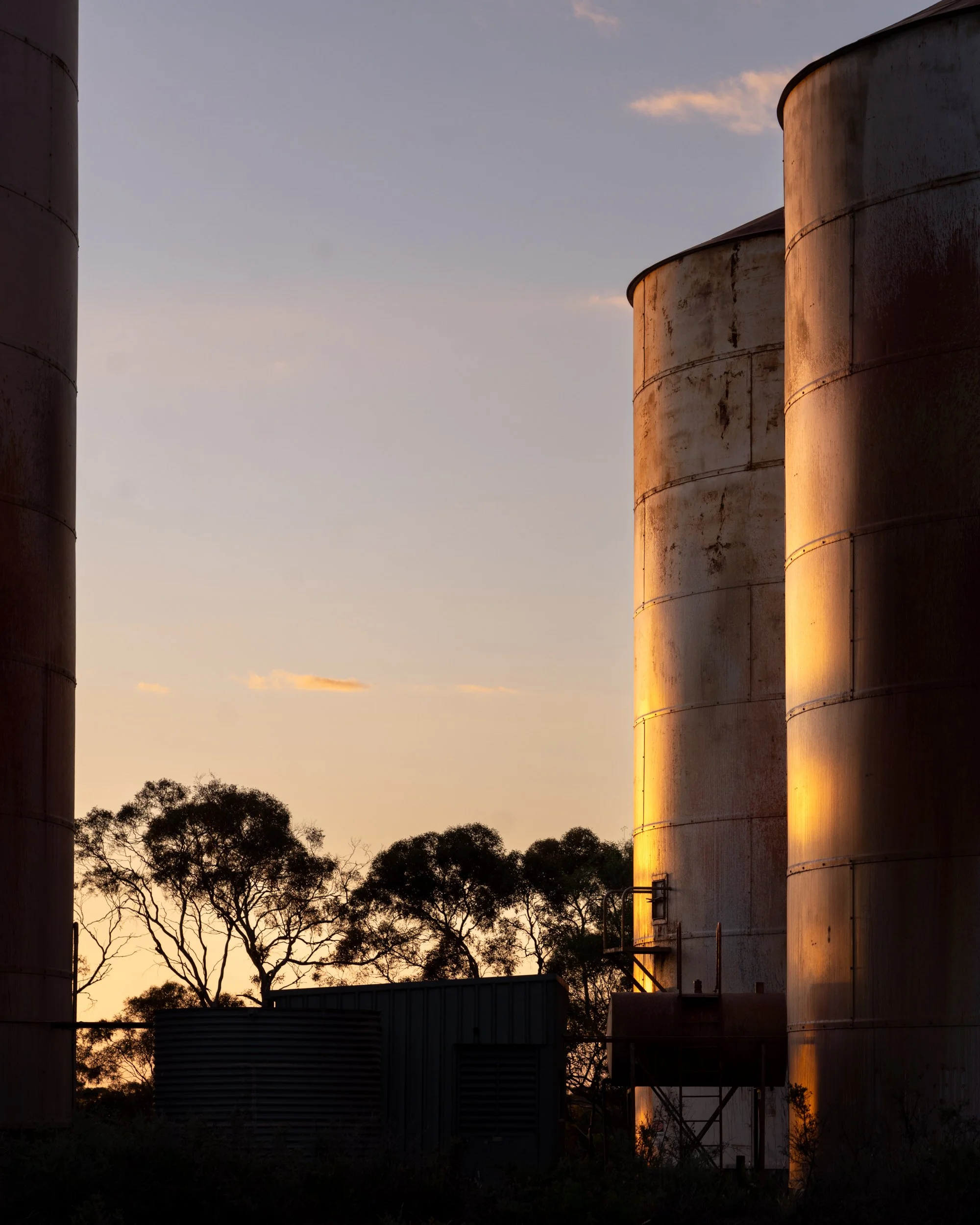
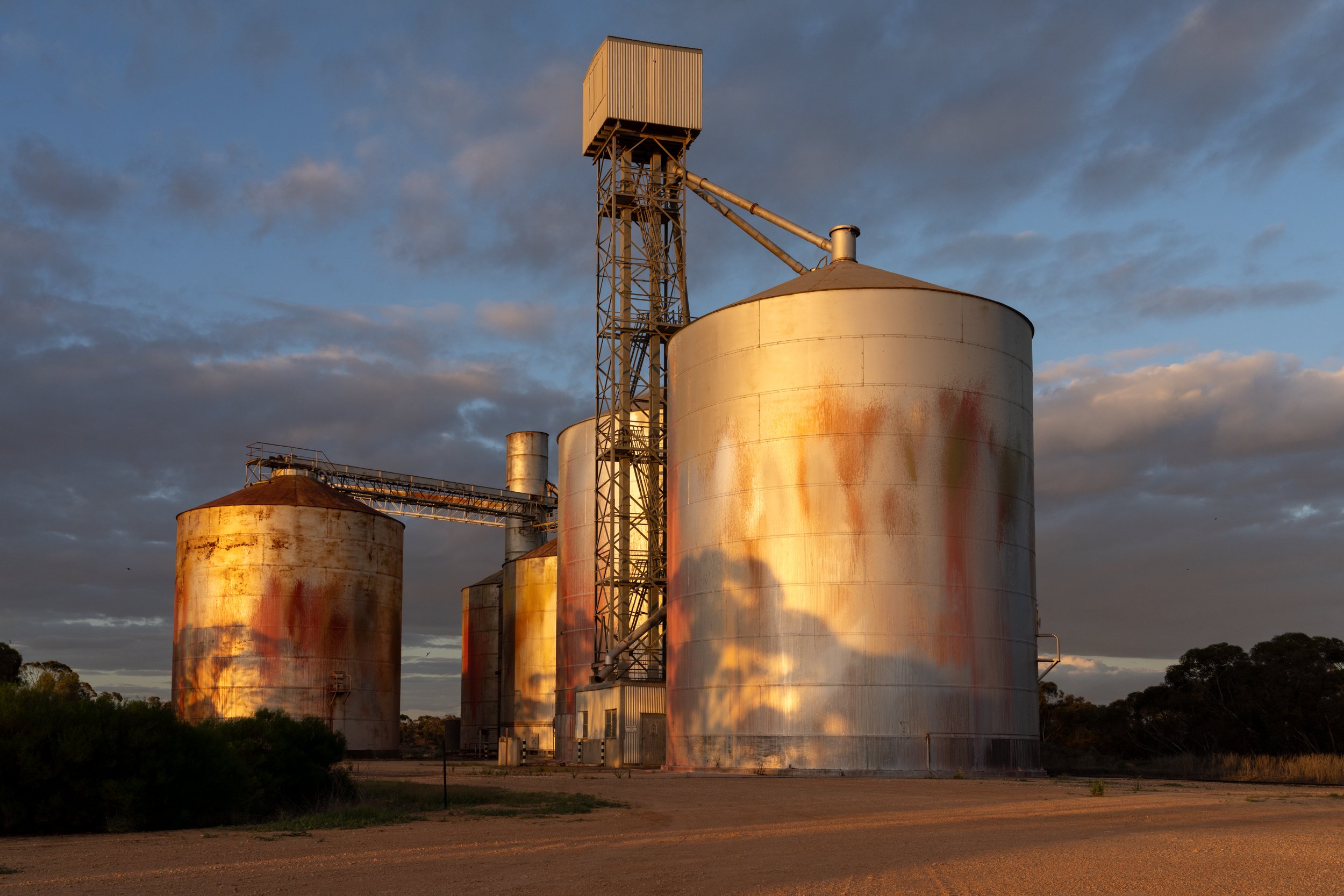
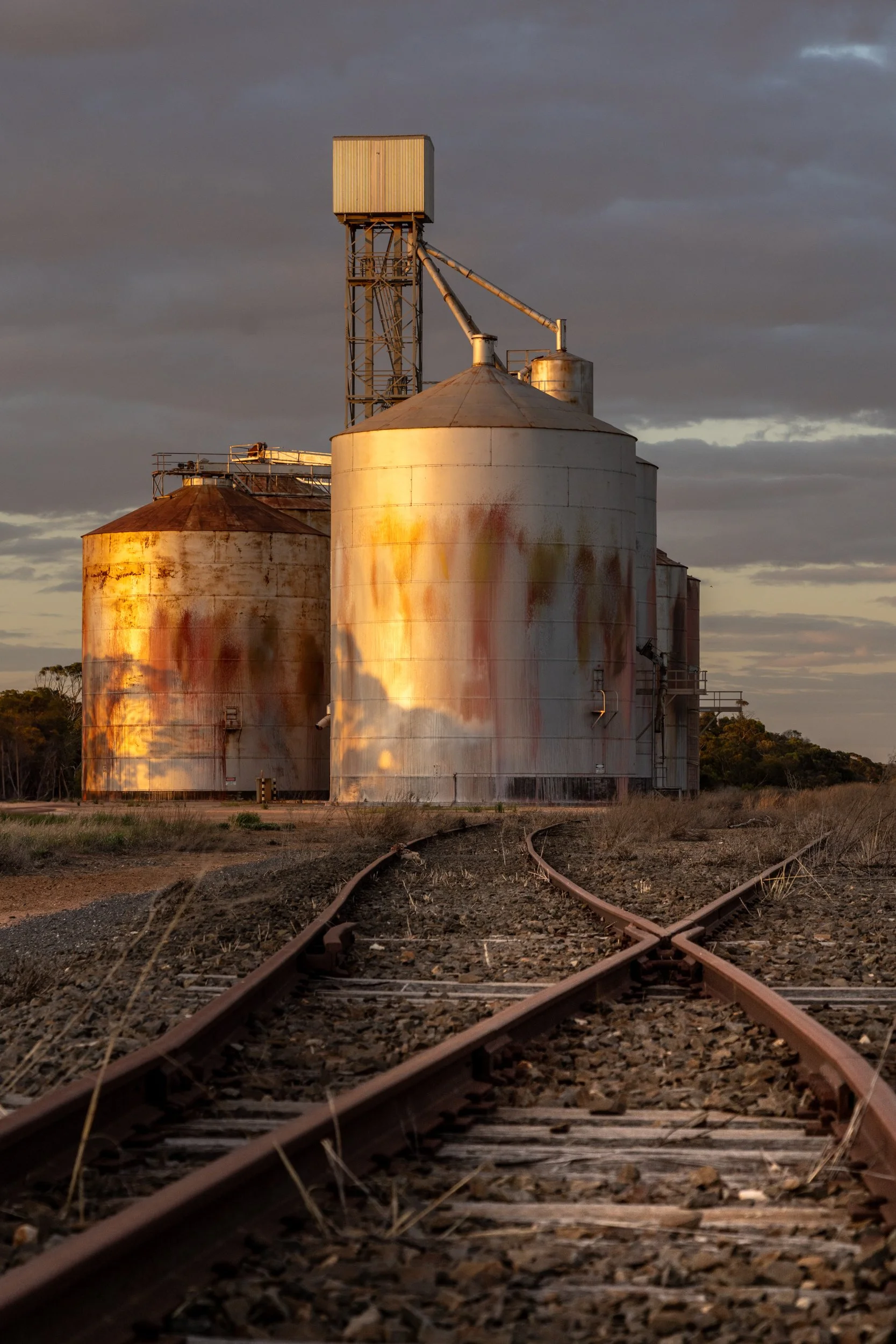
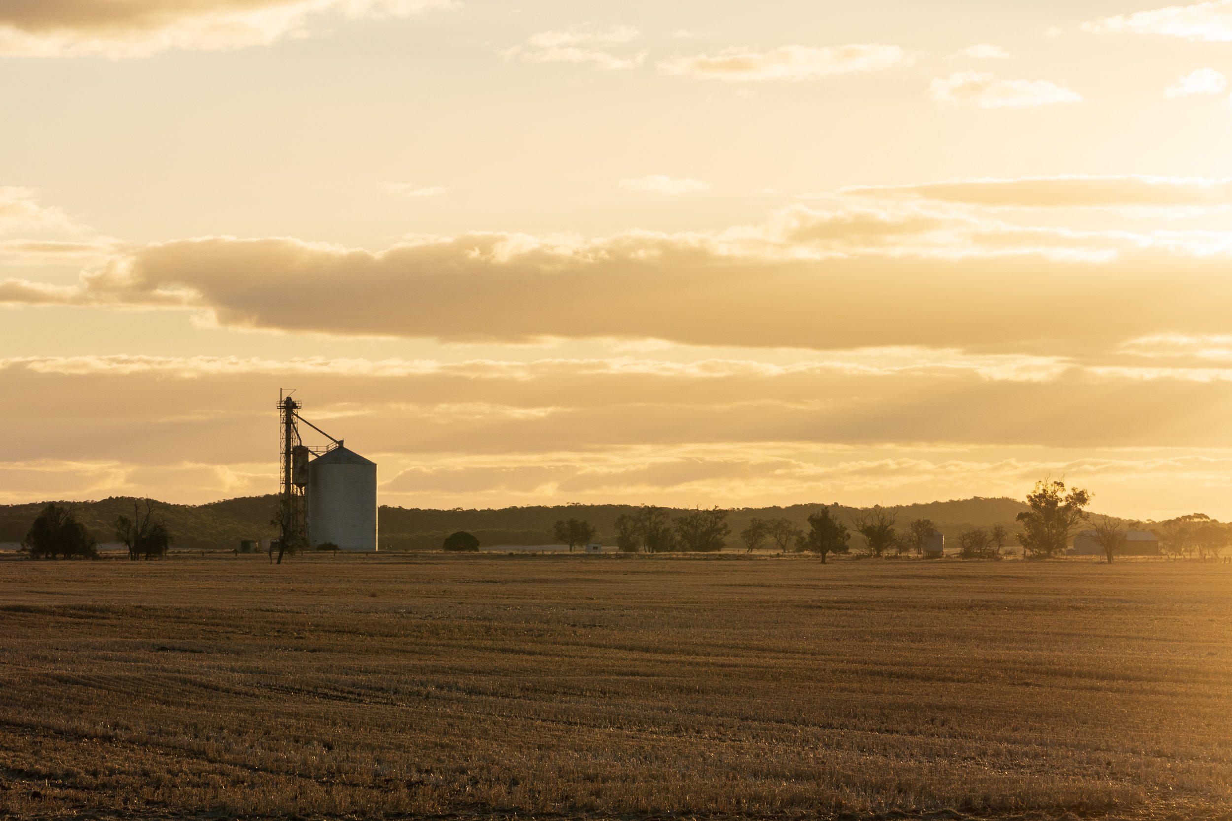
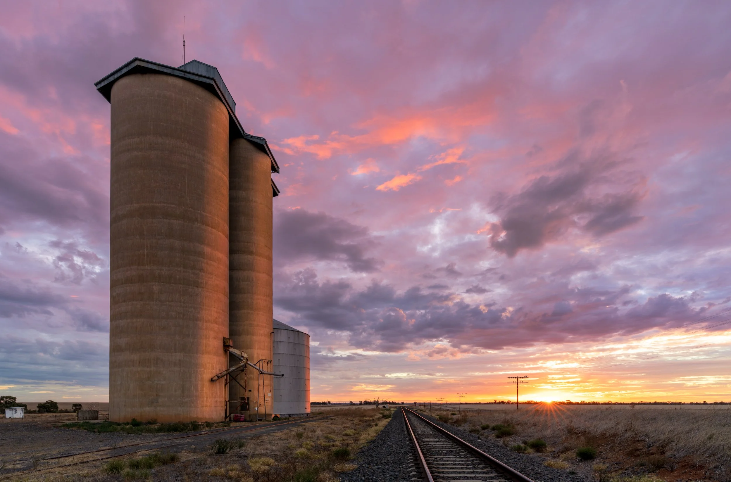
Silos
What would any trip to the Mallee be without paying homage to these huge grain silos dotting the landscape. These are such a visual symbol for the agricultural nature of the landscape in it's current form. Even when not painted with incredible artworks, they are fantastic to photograph over such a wide, flat landscape.
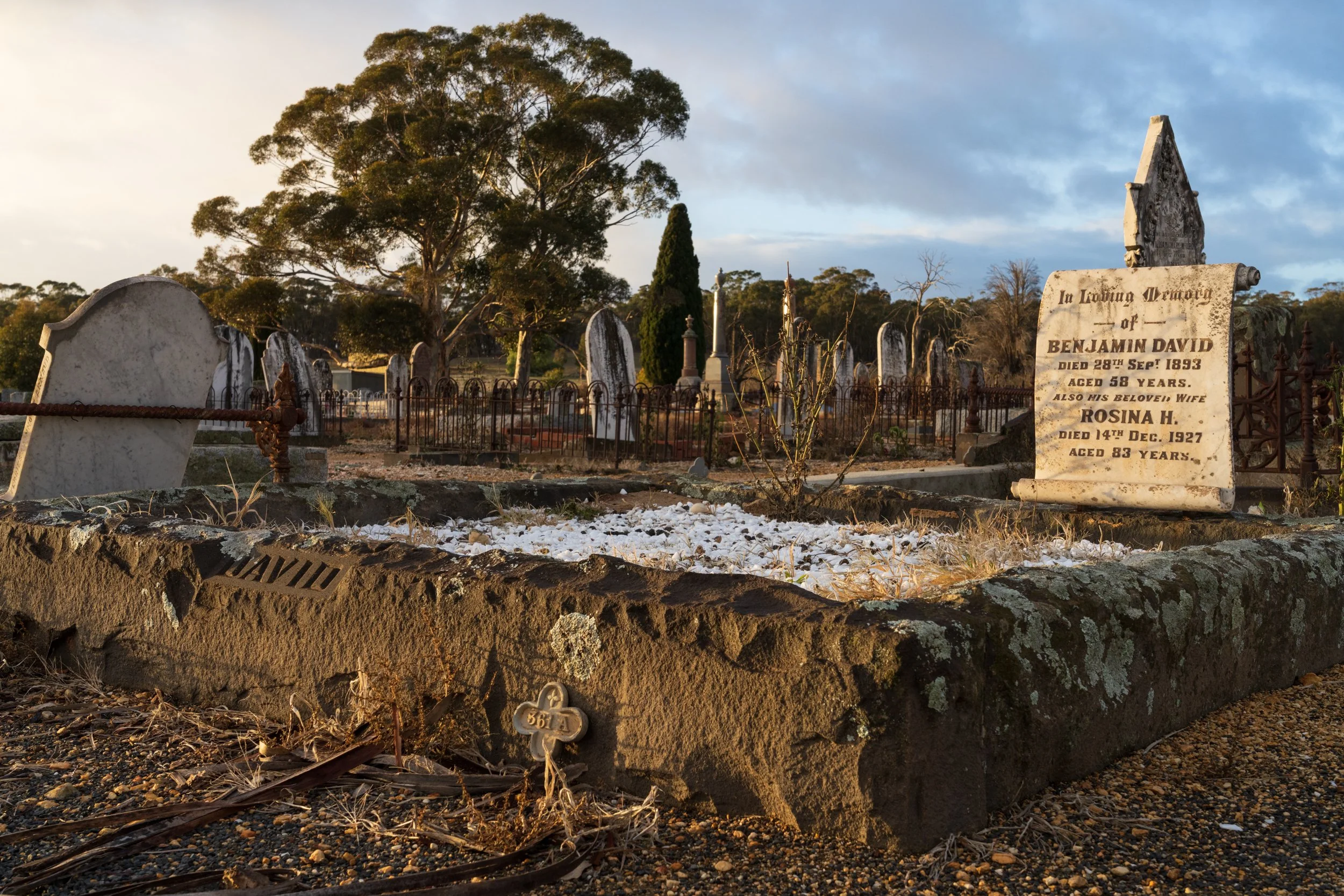
I've felt some strange connection to this landscape, then on one of my trips talking to my Dad over the phone, I found out that some of my ancestors settled here after travelling from Wales as coal miners to mine for gold. They ended up starting retail businesses in St Arnaud, and are buried there today.
On one of my trips I stopped to find the grave of my great grandfather and grandmother and left some flowers for them. I considered the chains of action and fate that led them to this land, and then the chains that led down the generations to me standing there commemorating them 128 years later. Will someone visit my grave 128 years after my death?